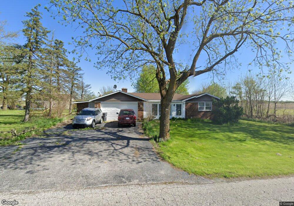
645 W 450 N Hobart, IN 46342
Estimated Value: $288,000 - $359,000
3
Beds
2
Baths
1,748
Sq Ft
$179/Sq Ft
Est. Value
About This Home
This home is located at 645 W 450 N, Hobart, IN 46342 and is currently estimated at $312,375, approximately $178 per square foot. 645 W 450 N is a home located in Porter County with nearby schools including Union Township Middle School and Wheeler High School.
Ownership History
Date
Name
Owned For
Owner Type
Purchase Details
Closed on
Jul 15, 2022
Sold by
Ashley Cotton
Bought by
Cotton Ashley and Cotton Brandon
Current Estimated Value
Home Financials for this Owner
Home Financials are based on the most recent Mortgage that was taken out on this home.
Original Mortgage
$184,100
Outstanding Balance
$176,151
Interest Rate
5.78%
Mortgage Type
New Conventional
Estimated Equity
$136,224
Purchase Details
Closed on
Oct 27, 2021
Sold by
Null Teresa Rainford and Null Robert T
Bought by
Cotton Ashley and Null Teresa
Purchase Details
Closed on
Sep 18, 2007
Sold by
Rainford Shirley A
Bought by
Rainford Teresa and Rainford Robert T
Create a Home Valuation Report for This Property
The Home Valuation Report is an in-depth analysis detailing your home's value as well as a comparison with similar homes in the area
Home Values in the Area
Average Home Value in this Area
Purchase History
| Date | Buyer | Sale Price | Title Company |
|---|---|---|---|
| Cotton Ashley | -- | None Listed On Document | |
| Cotton Ashley | -- | None Available | |
| Rainford Teresa | -- | None Available |
Source: Public Records
Mortgage History
| Date | Status | Borrower | Loan Amount |
|---|---|---|---|
| Open | Cotton Ashley | $184,100 |
Source: Public Records
Tax History Compared to Growth
Tax History
| Year | Tax Paid | Tax Assessment Tax Assessment Total Assessment is a certain percentage of the fair market value that is determined by local assessors to be the total taxable value of land and additions on the property. | Land | Improvement |
|---|---|---|---|---|
| 2024 | $1,751 | $255,700 | $39,300 | $216,400 |
| 2023 | $1,631 | $227,900 | $34,100 | $193,800 |
| 2022 | $1,643 | $222,800 | $34,100 | $188,700 |
| 2021 | $1,508 | $191,200 | $34,100 | $157,100 |
| 2020 | $1,440 | $179,100 | $29,900 | $149,200 |
| 2019 | $1,302 | $163,200 | $29,900 | $133,300 |
| 2018 | $1,356 | $157,400 | $29,900 | $127,500 |
| 2017 | $1,493 | $185,300 | $29,900 | $155,400 |
| 2016 | $1,452 | $181,400 | $30,500 | $150,900 |
| 2014 | $1,379 | $172,600 | $28,500 | $144,100 |
| 2013 | -- | $176,800 | $31,600 | $145,200 |
Source: Public Records
Map
Nearby Homes
- 631 W 350 N
- 633 W 600 N
- 6490 County Line Rd
- 736 Cinnamon Teal Ct
- 606 Merganser Dr
- 745 Pintail Ln
- 242 N 600 W
- N/a County Line Sr 130
- 4175 Viceroy St
- 4164 Viceroy St
- 4163 Viceroy St
- 272 White Tail Ct
- 4146 Viceroy St
- 679 N 700 W
- 4118 Viceroy St
- 542 Robyn Rd
- 536 W Us Highway 30
- BELLAMY Plan at Bauer Farm
- HENLEY Plan at Bauer Farm
- HARMONY Plan at Bauer Farm