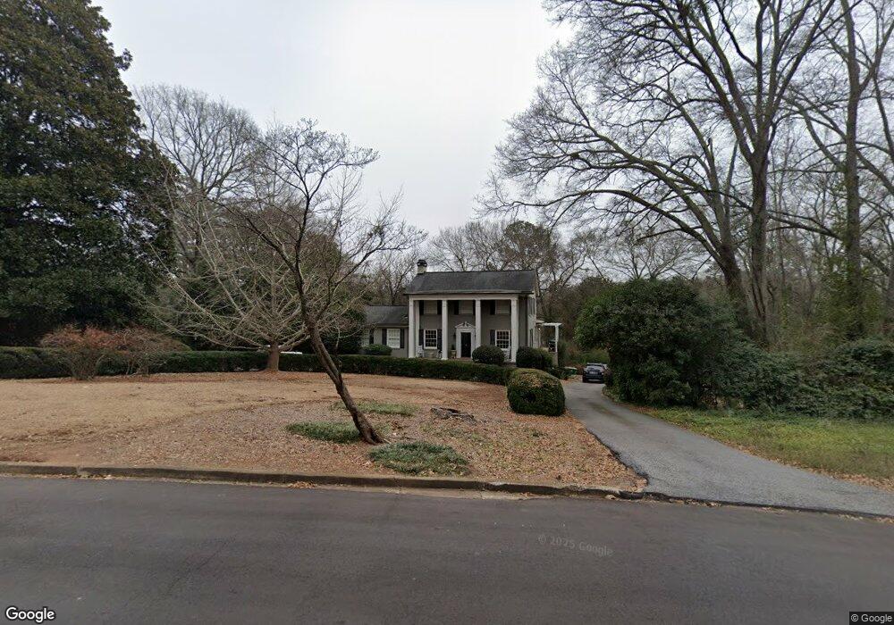
645 W Cloverhurst Ave Athens, GA 30606
Five Points NeighborhoodEstimated Value: $1,495,000 - $1,674,000
3
Beds
5
Baths
3,794
Sq Ft
$415/Sq Ft
Est. Value
About This Home
This home is located at 645 W Cloverhurst Ave, Athens, GA 30606 and is currently estimated at $1,575,960, approximately $415 per square foot. 645 W Cloverhurst Ave is a home located in Clarke County with nearby schools including Barrow Elementary School, Clarke Middle School, and Clarke Central High School.
Ownership History
Date
Name
Owned For
Owner Type
Purchase Details
Closed on
Jun 29, 2010
Sold by
Morang Laura B
Bought by
Brown Clark D
Current Estimated Value
Home Financials for this Owner
Home Financials are based on the most recent Mortgage that was taken out on this home.
Original Mortgage
$417,000
Outstanding Balance
$275,915
Interest Rate
4.79%
Mortgage Type
New Conventional
Estimated Equity
$1,300,045
Purchase Details
Closed on
Sep 17, 2002
Sold by
Morang James E and Morang Laura B
Bought by
Morang Laura B
Purchase Details
Closed on
Sep 7, 2002
Sold by
Morang Laura B
Bought by
Morang James E and Morang Laura B
Purchase Details
Closed on
Jan 5, 1989
Sold by
Bryson Ann M
Bought by
Morang James E and Morang Laura B
Create a Home Valuation Report for This Property
The Home Valuation Report is an in-depth analysis detailing your home's value as well as a comparison with similar homes in the area
Home Values in the Area
Average Home Value in this Area
Purchase History
| Date | Buyer | Sale Price | Title Company |
|---|---|---|---|
| Brown Clark D | $559,000 | -- | |
| Morang Laura B | -- | -- | |
| Morang James E | -- | -- | |
| Morang James E | $220,000 | -- |
Source: Public Records
Mortgage History
| Date | Status | Borrower | Loan Amount |
|---|---|---|---|
| Open | Brown Clark D | $417,000 | |
| Closed | Brown Clark D | $58,000 |
Source: Public Records
Tax History Compared to Growth
Tax History
| Year | Tax Paid | Tax Assessment Tax Assessment Total Assessment is a certain percentage of the fair market value that is determined by local assessors to be the total taxable value of land and additions on the property. | Land | Improvement |
|---|---|---|---|---|
| 2025 | $17,579 | $619,357 | $111,000 | $508,357 |
| 2024 | $17,579 | $524,853 | $111,000 | $413,853 |
| 2023 | $15,902 | $477,612 | $111,000 | $366,612 |
| 2022 | $13,645 | $437,737 | $108,000 | $329,737 |
| 2021 | $12,283 | $374,483 | $108,000 | $266,483 |
| 2020 | $11,864 | $362,033 | $108,000 | $254,033 |
| 2019 | $11,254 | $341,490 | $108,000 | $233,490 |
| 2018 | $8,952 | $273,691 | $90,000 | $183,691 |
| 2017 | $8,846 | $270,555 | $90,000 | $180,555 |
| 2016 | $8,529 | $261,217 | $90,000 | $171,217 |
| 2015 | $8,338 | $255,217 | $84,000 | $171,217 |
| 2014 | $8,350 | $255,217 | $84,000 | $171,217 |
Source: Public Records
Map
Nearby Homes
- 577 W Cloverhurst Ave
- 169 Fortson Cir
- 495 Woodlawn Ave
- 490 Mcwhorter Dr
- 1055 Baxter St Unit 504
- 206 Fortson Dr
- 224 Fortson Dr
- 590 Highland Ave
- 338 Springdale St
- 265 Springdale St
- 997 S Milledge Ave Unit 2
- 997 S Milledge Ave Unit 3
- 997 S Milledge Ave Unit 1
- 997 S Milledge Ave Unit 4
- 175 Tillman Ln
- 589 W Lake Dr
- 255 Bloomfield St
- 104 W Lake Ct
- 275 Westview Dr
- 50 Springdale St
- 150 Mcwhorter Dr
- 180 Mcwhorter Dr
- 635 W Cloverhurst Ave
- 725 Bobbin Mill Rd
- 190 Mcwhorter Dr
- 625 W Cloverhurst Ave
- 105 Cloverhurst Cir
- 0 Cloverhurst Cir Unit 7372153
- 0 Cloverhurst Cir Unit 8465718
- 0 Cloverhurst Cir Unit 7023862
- 220 Mcwhorter Dr
- 610 Springdale St
- 125 Cloverhurst Cir
- 102 Cloverhurst Cir
- 195 Mcwhorter Dr
- 250 Mcwhorter Dr
- 585 W Cloverhurst Ave
- 211 Mcwhorter Dr
- 219 Mcwhorter Dr
- 590 Springdale St