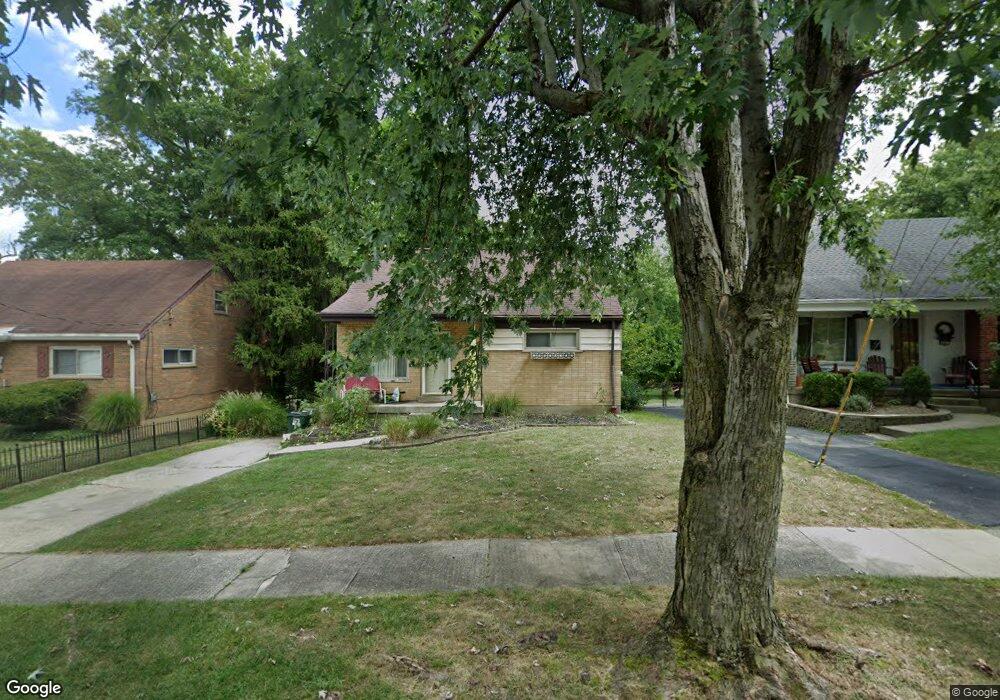
6450 Monalisa Ct Cincinnati, OH 45239
Estimated Value: $192,610 - $220,000
2
Beds
1
Bath
841
Sq Ft
$241/Sq Ft
Est. Value
About This Home
This home is located at 6450 Monalisa Ct, Cincinnati, OH 45239 and is currently estimated at $202,403, approximately $240 per square foot. 6450 Monalisa Ct is a home located in Hamilton County with nearby schools including North College Hill Elementary School, North College Hill Middle School, and North College Hill High School.
Ownership History
Date
Name
Owned For
Owner Type
Purchase Details
Closed on
Jan 4, 2017
Sold by
Meiser Aopril L and Cohen Barry L
Bought by
Teddy Bear Properties Llc
Current Estimated Value
Purchase Details
Closed on
Sep 27, 2003
Sold by
Meiser Richard P and Meiser Ida E
Bought by
Meiser April L
Home Financials for this Owner
Home Financials are based on the most recent Mortgage that was taken out on this home.
Original Mortgage
$90,000
Interest Rate
6.4%
Mortgage Type
Unknown
Create a Home Valuation Report for This Property
The Home Valuation Report is an in-depth analysis detailing your home's value as well as a comparison with similar homes in the area
Home Values in the Area
Average Home Value in this Area
Purchase History
| Date | Buyer | Sale Price | Title Company |
|---|---|---|---|
| Teddy Bear Properties Llc | -- | -- | |
| Meiser April L | $115,000 | -- |
Source: Public Records
Mortgage History
| Date | Status | Borrower | Loan Amount |
|---|---|---|---|
| Previous Owner | Meiser April L | $90,000 |
Source: Public Records
Tax History Compared to Growth
Tax History
| Year | Tax Paid | Tax Assessment Tax Assessment Total Assessment is a certain percentage of the fair market value that is determined by local assessors to be the total taxable value of land and additions on the property. | Land | Improvement |
|---|---|---|---|---|
| 2024 | $2,742 | $47,653 | $7,497 | $40,156 |
| 2023 | $2,554 | $47,653 | $7,497 | $40,156 |
| 2022 | $2,160 | $29,401 | $6,318 | $23,083 |
| 2021 | $2,152 | $29,401 | $6,318 | $23,083 |
| 2020 | $2,125 | $29,401 | $6,318 | $23,083 |
| 2019 | $1,918 | $24,917 | $5,355 | $19,562 |
| 2018 | $1,918 | $24,917 | $5,355 | $19,562 |
| 2017 | $1,741 | $24,917 | $5,355 | $19,562 |
| 2016 | $1,721 | $24,476 | $5,282 | $19,194 |
| 2015 | $1,731 | $24,476 | $5,282 | $19,194 |
| 2014 | $1,731 | $24,476 | $5,282 | $19,194 |
| 2013 | $1,914 | $28,133 | $6,069 | $22,064 |
Source: Public Records
Map
Nearby Homes
- 2342 Banning Rd
- 2268 Deblin Dr
- 2125 Mckinley Ave
- 2424 Banning Rd
- 2412 Amelia Ct
- 2146 W North Bend Rd
- 2142 W North Bend Rd
- 6292 Simpson Ave
- 2021 Catalpa Ave
- 2045 1st Ave
- 2503 Flanigan Ct
- 2235 W North Bend Rd
- 2598 Byrneside Dr
- 2481 Crosley Meadow
- 2532 Flanigan Ct
- 2477 Kipling Ave
- 2536 Flanigan Ct
- 5971 Monticello Ave
- 1948 Catalpa Ave
- 6505 Simpson Ave
- 6458 Monalisa Ct
- 6442 Monalisa Ct
- 6466 Monalisa Ct
- 6434 Monalisa Ct
- 6469 Golfway Dr
- 6449 Golfway Dr
- 6493 Golfway Dr
- 6474 Monalisa Ct
- 6425 Golfway Dr
- 6513 Golfway Dr
- 6453 Monalisa Ct
- 6426 Monalisa Ct
- 6435 Monalisa Ct
- 6459 Monalisa Ct
- 6405 Golfway Dr
- 6467 Monalisa Ct
- 6482 Monalisa Ct
- 6537 Golfway Dr
- 6475 Monalisa Ct
- 6381 Golfway Dr