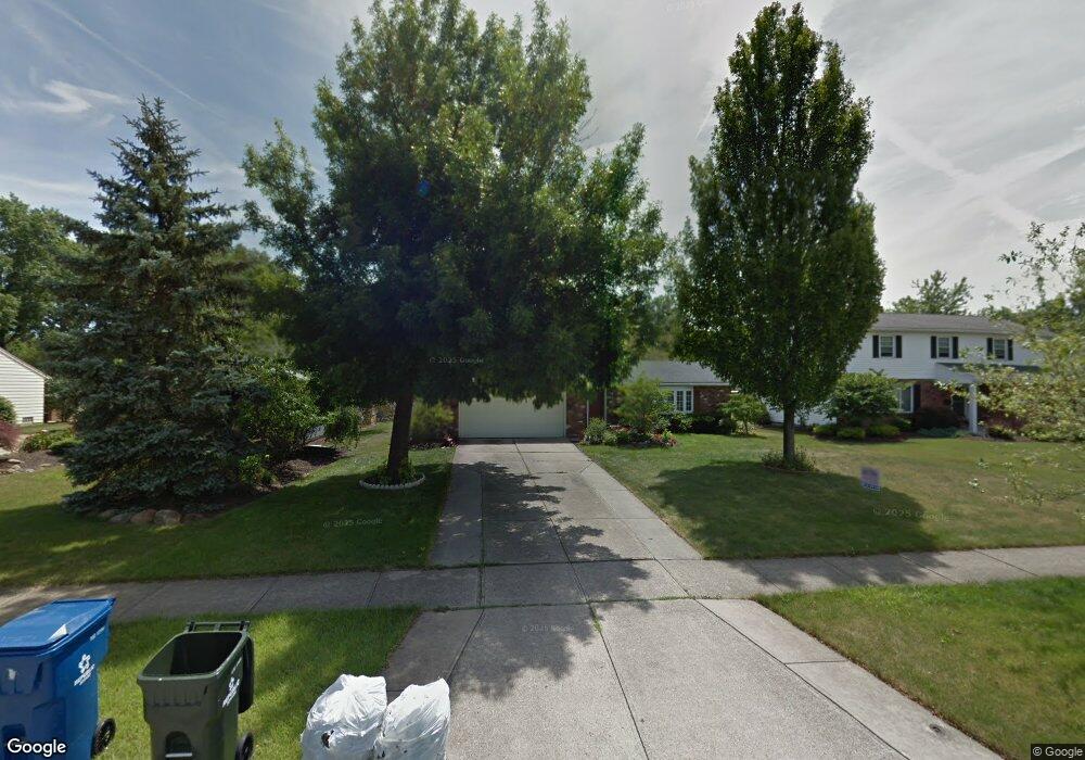
6451 Surrey Dr North Olmsted, OH 44070
Estimated Value: $294,470 - $350,000
3
Beds
2
Baths
1,848
Sq Ft
$171/Sq Ft
Est. Value
About This Home
This home is located at 6451 Surrey Dr, North Olmsted, OH 44070 and is currently estimated at $315,618, approximately $170 per square foot. 6451 Surrey Dr is a home located in Cuyahoga County with nearby schools including Chestnut Intermediate Elementary School, Pine Intermediate School, and North Olmsted Middle School.
Ownership History
Date
Name
Owned For
Owner Type
Purchase Details
Closed on
Jan 11, 2003
Sold by
Moore Alan M and Moore Tamara C
Bought by
Dukin Miliana
Current Estimated Value
Home Financials for this Owner
Home Financials are based on the most recent Mortgage that was taken out on this home.
Original Mortgage
$112,000
Interest Rate
6.3%
Purchase Details
Closed on
Jul 3, 1995
Sold by
Harmon Doris M
Bought by
Moore Alan M and Moore Tamara C
Home Financials for this Owner
Home Financials are based on the most recent Mortgage that was taken out on this home.
Original Mortgage
$100,000
Interest Rate
7.88%
Mortgage Type
New Conventional
Purchase Details
Closed on
Jan 1, 1975
Bought by
Harmon William T and D M
Create a Home Valuation Report for This Property
The Home Valuation Report is an in-depth analysis detailing your home's value as well as a comparison with similar homes in the area
Home Values in the Area
Average Home Value in this Area
Purchase History
| Date | Buyer | Sale Price | Title Company |
|---|---|---|---|
| Dukin Miliana | $166,500 | Guardian Title | |
| Moore Alan M | $125,000 | -- | |
| Harmon William T | -- | -- |
Source: Public Records
Mortgage History
| Date | Status | Borrower | Loan Amount |
|---|---|---|---|
| Previous Owner | Dukin Miliana | $112,000 | |
| Previous Owner | Moore Alan M | $100,000 |
Source: Public Records
Tax History Compared to Growth
Tax History
| Year | Tax Paid | Tax Assessment Tax Assessment Total Assessment is a certain percentage of the fair market value that is determined by local assessors to be the total taxable value of land and additions on the property. | Land | Improvement |
|---|---|---|---|---|
| 2024 | $6,119 | $89,285 | $18,025 | $71,260 |
| 2023 | $5,446 | $66,680 | $14,180 | $52,500 |
| 2022 | $5,417 | $66,675 | $14,175 | $52,500 |
| 2021 | $4,903 | $66,680 | $14,180 | $52,500 |
| 2020 | $4,730 | $56,980 | $12,110 | $44,870 |
| 2019 | $4,603 | $162,800 | $34,600 | $128,200 |
| 2018 | $4,500 | $56,980 | $12,110 | $44,870 |
| 2017 | $4,433 | $49,810 | $10,540 | $39,270 |
| 2016 | $4,367 | $49,500 | $10,540 | $38,960 |
| 2015 | $4,264 | $49,500 | $10,540 | $38,960 |
| 2014 | $4,264 | $48,060 | $10,220 | $37,840 |
Source: Public Records
Map
Nearby Homes
- 6321 Brighton Dr
- 6305 Christman Dr
- 6617 Sutton Dr
- 6281 Christman Dr
- 6723 Warrington Dr
- 30247 Lorain Rd
- 6580 Barton Rd
- 0 Stearns Rd
- 29861 Wellington Dr
- 30630 Lorain Rd
- 29408 Stewart Dr
- 28628 Aspen Dr
- 28625 Elder Dr
- 7100 Barton Rd
- 5833 Stearns Rd
- 31134 Lorain Rd
- 5920 Sherwood Dr
- 30241 Sugar Sand Ln Unit 14B
- 6427 Mackenzie Rd
- 28130 Angela Dr
- 6463 Surrey Dr
- 6439 Surrey Dr
- 6475 Surrey Dr
- 6427 Surrey Dr
- 6450 Christman Dr
- 6462 Christman Dr
- 6438 Christman Dr
- 6417 Surrey Dr
- 6487 Surrey Dr
- 6474 Christman Dr
- 6426 Christman Dr
- 6452 Surrey Dr
- 6440 Surrey Dr
- 6464 Surrey Dr
- 6476 Surrey Dr
- 6428 Surrey Dr
- 6416 Christman Dr
- 6417 Christman Dr
- 6403 Surrey Dr
- 6501 Surrey Dr