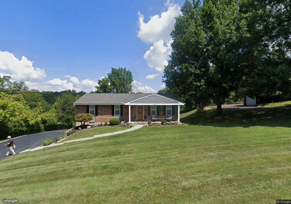
6452 W Fork Rd Cincinnati, OH 45247
Estimated Value: $326,000 - $373,000
3
Beds
3
Baths
1,437
Sq Ft
$246/Sq Ft
Est. Value
About This Home
This home is located at 6452 W Fork Rd, Cincinnati, OH 45247 and is currently estimated at $352,942, approximately $245 per square foot. 6452 W Fork Rd is a home located in Hamilton County with nearby schools including Charles W Springmyer Elementary School, Bridgetown Middle School, and Oak Hills High School.
Ownership History
Date
Name
Owned For
Owner Type
Purchase Details
Closed on
Sep 30, 1998
Sold by
Zeek Donna M and Berry Suzanne L
Bought by
Waggoner John C and Nemann Kathleen M
Current Estimated Value
Home Financials for this Owner
Home Financials are based on the most recent Mortgage that was taken out on this home.
Original Mortgage
$168,660
Interest Rate
6.98%
Create a Home Valuation Report for This Property
The Home Valuation Report is an in-depth analysis detailing your home's value as well as a comparison with similar homes in the area
Home Values in the Area
Average Home Value in this Area
Purchase History
| Date | Buyer | Sale Price | Title Company |
|---|---|---|---|
| Waggoner John C | $187,400 | -- |
Source: Public Records
Mortgage History
| Date | Status | Borrower | Loan Amount |
|---|---|---|---|
| Closed | Waggoner John C | $168,660 |
Source: Public Records
Tax History
| Year | Tax Paid | Tax Assessment Tax Assessment Total Assessment is a certain percentage of the fair market value that is determined by local assessors to be the total taxable value of land and additions on the property. | Land | Improvement |
|---|---|---|---|---|
| 2025 | $4,632 | $95,466 | $25,214 | $70,252 |
| 2023 | $4,601 | $95,466 | $25,214 | $70,252 |
| 2022 | $4,315 | $74,837 | $26,474 | $48,363 |
| 2021 | $3,952 | $74,837 | $26,474 | $48,363 |
| 2020 | $3,997 | $74,837 | $26,474 | $48,363 |
| 2019 | $4,172 | $71,274 | $25,214 | $46,060 |
| 2018 | $3,717 | $71,274 | $25,214 | $46,060 |
| 2017 | $3,510 | $71,274 | $25,214 | $46,060 |
| 2016 | $3,603 | $72,013 | $24,962 | $47,051 |
| 2015 | $3,639 | $72,013 | $24,962 | $47,051 |
| 2014 | $3,646 | $72,013 | $24,962 | $47,051 |
| 2013 | $3,928 | $72,741 | $25,214 | $47,527 |
Source: Public Records
Map
Nearby Homes
- 6020 Sheed Rd
- Site 1 Brierly Creek Rd
- 5442 Bluesky Dr
- 7007 Boulder Path Dr
- 6780 Harrison Ave
- 5725 Lofty View Ln Unit 1C
- 5473 Michelles Oak Ct
- 6384 Conifer Ln
- 6586 Hearne Rd Unit 2T
- 5632 Sarahs Oak Dr
- 5207 S Eaglesnest Dr
- 5310 Rybolt Rd
- 6864 Ruwes Oak Dr
- 6617 Hearne Rd
- 6051 Shelrich Ct
- 6646 Hearne Rd
- 6793 Jennifer Lynn Dr
- 6289 Eagles Lake Dr
- 6321 Eagles Lake Dr Unit 19
- 8060 Bridge Point Dr
Your Personal Tour Guide
Ask me questions while you tour the home.