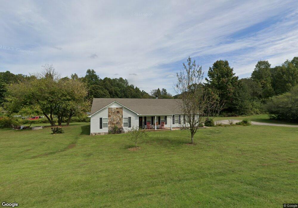
6454 Highway 115 W Cleveland, GA 30528
Estimated Value: $277,000 - $326,000
3
Beds
2
Baths
1,580
Sq Ft
$196/Sq Ft
Est. Value
About This Home
This home is located at 6454 Highway 115 W, Cleveland, GA 30528 and is currently estimated at $309,222, approximately $195 per square foot. 6454 Highway 115 W is a home located in White County with nearby schools including Tesnatee Gap Elementary (Old White County Intermediate), White County 9th Grade Academy, and Jack P. Nix Elementary School.
Ownership History
Date
Name
Owned For
Owner Type
Purchase Details
Closed on
Jan 10, 2013
Sold by
Jpmorgan Chyase Bank
Bought by
White Adrian E
Current Estimated Value
Home Financials for this Owner
Home Financials are based on the most recent Mortgage that was taken out on this home.
Original Mortgage
$76,500
Outstanding Balance
$52,977
Interest Rate
3.36%
Mortgage Type
New Conventional
Estimated Equity
$256,245
Purchase Details
Closed on
Aug 7, 2012
Sold by
Eller James H
Bought by
Jpmorgan Chase Bank National A
Purchase Details
Closed on
Nov 22, 2010
Sold by
Eller James H
Bought by
Brown Virginia R
Purchase Details
Closed on
Mar 1, 2008
Sold by
Not Provided
Bought by
Brown Virginia R
Home Financials for this Owner
Home Financials are based on the most recent Mortgage that was taken out on this home.
Original Mortgage
$134,640
Interest Rate
5.62%
Mortgage Type
New Conventional
Create a Home Valuation Report for This Property
The Home Valuation Report is an in-depth analysis detailing your home's value as well as a comparison with similar homes in the area
Home Values in the Area
Average Home Value in this Area
Purchase History
| Date | Buyer | Sale Price | Title Company |
|---|---|---|---|
| White Adrian E | $85,000 | -- | |
| Jpmorgan Chase Bank National A | $81,601 | -- | |
| Brown Virginia R | -- | -- | |
| Brown Virginia R | $132,000 | -- |
Source: Public Records
Mortgage History
| Date | Status | Borrower | Loan Amount |
|---|---|---|---|
| Open | White Adrian E | $76,500 | |
| Previous Owner | Brown Virginia R | $134,640 |
Source: Public Records
Tax History Compared to Growth
Tax History
| Year | Tax Paid | Tax Assessment Tax Assessment Total Assessment is a certain percentage of the fair market value that is determined by local assessors to be the total taxable value of land and additions on the property. | Land | Improvement |
|---|---|---|---|---|
| 2025 | $1,760 | $92,932 | $13,360 | $79,572 |
| 2024 | $1,760 | $91,596 | $12,024 | $79,572 |
| 2023 | $1,353 | $79,672 | $10,688 | $68,984 |
| 2022 | $1,607 | $69,748 | $10,020 | $59,728 |
| 2021 | $1,482 | $57,276 | $7,840 | $49,436 |
| 2020 | $1,386 | $51,252 | $7,280 | $43,972 |
| 2019 | $1,390 | $51,252 | $7,280 | $43,972 |
| 2018 | $1,390 | $51,252 | $7,280 | $43,972 |
| 2017 | $1,281 | $47,788 | $7,280 | $40,508 |
| 2016 | $1,281 | $47,788 | $7,280 | $40,508 |
| 2015 | $1,223 | $119,470 | $7,280 | $40,508 |
| 2014 | $856 | $85,000 | $0 | $0 |
Source: Public Records
Map
Nearby Homes
- LOT 24 Luther Palmer Rd
- 0 Westmoreland Rd Unit 10596625
- 3395 Asbury Mill Rd
- 4872 Highway 115 W
- 0 Valhalla Dr Unit 10621291
- 966 Wahoo Creek Rd
- 635 White Oak Trail
- 00 Deer Run Trail
- 31 Valhalla Dr
- 0 Waterfall Dr Unit 9 10472076
- 174 Leighs Crossing
- 0 Asbury Mill Rd Unit 10599324
- 0 Asbury Mill Rd Unit 7644389
- 987 Peaceful Valley Dr
- 499 Old Deer Path Way
- 59 Rocket Dr
- LOT 55 Teel Mtn Dr
- 675 Wauka Ridge Rd
- LOT 57 Teel Mtn Dr
- Chapman Ridge
- 6454 Highway 115 W Unit 1
- 6470 Highway 115 W
- 6451 Highway 115 W
- 0 Starfire Ln Unit 7074073
- 0 Starfire Ln Unit 3289780
- 0 Starfire Ln
- 40 Starfire Ln
- 128 Luther Palmer Rd
- 131 Starfire Ln
- 116 Starfire Ln
- 214 Luther Palmer Rd
- 216 Luther Palmer Rd
- 11.21 ACRES, LO Luther Palmer Rd
- 6476 Highway 115 W
- 212 Luther Palmer Rd
- 0 Lot 1 11 97 Acres Luther Palmer Rd
- 14.5 ACRES, LOT Luther Palmer Rd
- 0 Luther Palmer Rd Unit 34 AND 35
- 0 Luther Palmer Rd Unit 34 AND 35 7028438
- 0 Luther Palmer Rd Unit 3114492