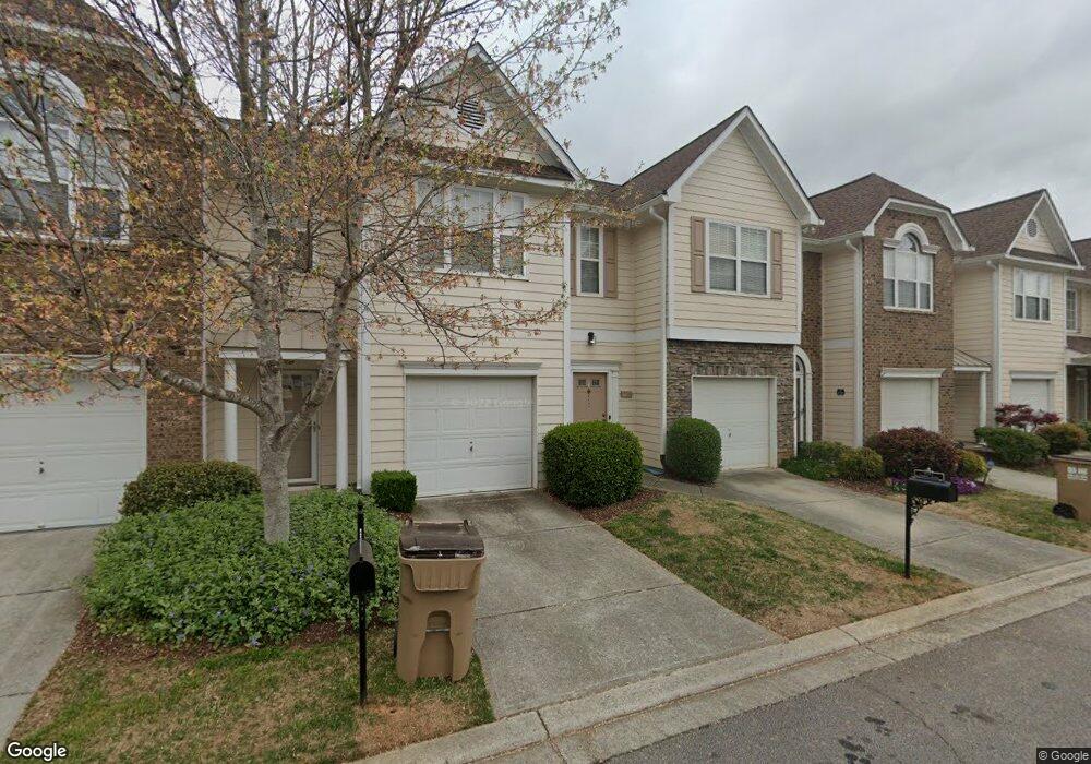
6455 Topside Ave Unit 11881188 Flowery Branch, GA 30542
Estimated Value: $286,000 - $314,000
3
Beds
3
Baths
1,548
Sq Ft
$191/Sq Ft
Est. Value
About This Home
This home is located at 6455 Topside Ave Unit 11881188, Flowery Branch, GA 30542 and is currently estimated at $295,126, approximately $190 per square foot. 6455 Topside Ave Unit 11881188 is a home located in Hall County with nearby schools including Flowery Branch Elementary School, West Hall Middle School, and West Hall High School.
Ownership History
Date
Name
Owned For
Owner Type
Purchase Details
Closed on
Jul 13, 2016
Sold by
Lois Marilyn
Bought by
Davis Michelle Noel
Current Estimated Value
Purchase Details
Closed on
Nov 27, 2001
Sold by
D R Horton Inc
Bought by
Keppel Marilyn Lois
Home Financials for this Owner
Home Financials are based on the most recent Mortgage that was taken out on this home.
Original Mortgage
$124,763
Interest Rate
6.72%
Mortgage Type
FHA
Create a Home Valuation Report for This Property
The Home Valuation Report is an in-depth analysis detailing your home's value as well as a comparison with similar homes in the area
Home Values in the Area
Average Home Value in this Area
Purchase History
| Date | Buyer | Sale Price | Title Company |
|---|---|---|---|
| Davis Michelle Noel | -- | -- | |
| Keppel Marilyn Lois | $125,800 | -- |
Source: Public Records
Mortgage History
| Date | Status | Borrower | Loan Amount |
|---|---|---|---|
| Previous Owner | Keppel Marilyn Lois | $124,763 |
Source: Public Records
Tax History Compared to Growth
Tax History
| Year | Tax Paid | Tax Assessment Tax Assessment Total Assessment is a certain percentage of the fair market value that is determined by local assessors to be the total taxable value of land and additions on the property. | Land | Improvement |
|---|---|---|---|---|
| 2025 | $3,129 | $114,280 | $18,600 | $95,680 |
| 2024 | $3,241 | $114,280 | $19,200 | $95,080 |
| 2023 | $2,658 | $105,920 | $21,200 | $84,720 |
| 2022 | $2,142 | $81,920 | $16,000 | $65,920 |
| 2021 | $1,878 | $70,520 | $10,000 | $60,520 |
| 2020 | $1,697 | $61,880 | $8,800 | $53,080 |
| 2019 | $1,634 | $59,080 | $8,800 | $50,280 |
| 2018 | $1,545 | $54,080 | $9,000 | $45,080 |
| 2017 | $524 | $50,600 | $6,000 | $44,600 |
| 2016 | $426 | $45,480 | $6,000 | $39,480 |
| 2015 | $299 | $39,240 | $5,160 | $34,080 |
| 2014 | $299 | $32,440 | $5,160 | $27,280 |
Source: Public Records
Map
Nearby Homes
- 6474 Portside Way
- 6457 Topside Ave
- 6461 Topside Ave
- 5310 Gray Birch Bend
- 5317 Briggs St
- 7219 Thistle Down Way
- 6243 Shoreview Cir
- 6250 Shoreview Cir Unit 1188
- 6184 Mitchell St
- 6140 Jones Rd
- 6115 Stella Light Dr
- 6021 Harbour Mist Dr
- 5902 Mitchell St
- 5439 Aurora Trail
- 7215 Sherwood Square Dr
- 7215 Sherwood Square Dr Unit LOT 219
- 5439 Aurora Trail Unit LOT 68
- 5419 Aurora Trail Unit LOT 63
- 5420 Aurora Trail
- 5420 Aurora Trail Unit LOT 73
- 6453 Topside Ave Unit 11881188
- 6459 Topside Ave
- 6451 Topside Ave
- 6472 Portside Way
- 6463 Topside Ave
- 6463 Topside Ave Unit 98
- 6571 Above Tide Place
- 6474 Portside Way Unit 86
- 6474 Portside Way Unit 6474
- 6440 Portside Way Unit 11881188
- 6515 Above Tide Place Unit 1188
- 6573 Above Tide Place
- 6476 Portside Way
- 6438 Portside Way
- 6575 Above Tide Place Unit 6575
- 6478 Portside Way
- 6513 Above Tide Place
- 6415 Silvertide Way
- 6415 Silvertide Way
- 6577 Above Tide Place