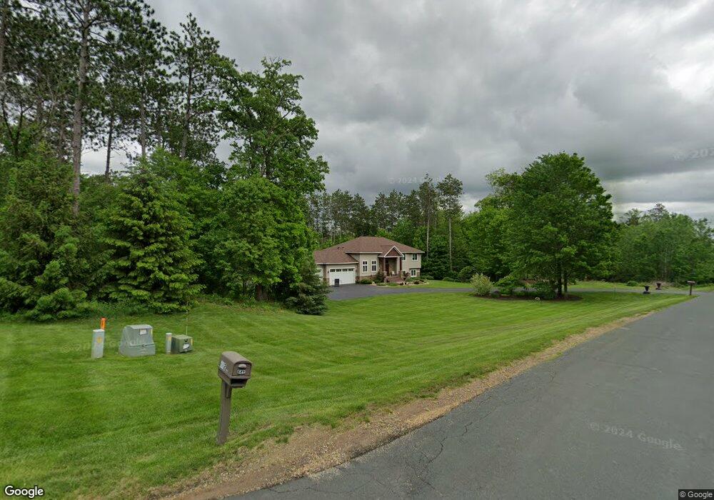
646 222nd Ave Somerset, WI 54025
Estimated Value: $725,819 - $849,000
5
Beds
4
Baths
3,820
Sq Ft
$205/Sq Ft
Est. Value
About This Home
This home is located at 646 222nd Ave, Somerset, WI 54025 and is currently estimated at $781,955, approximately $204 per square foot. 646 222nd Ave is a home located in St. Croix County with nearby schools including Somerset Elementary School, Somerset Middle School, and Somerset High School.
Ownership History
Date
Name
Owned For
Owner Type
Purchase Details
Closed on
Dec 11, 2019
Sold by
Andrews Judd
Bought by
Neumann Rebecca L and Molitor Zachary J
Current Estimated Value
Home Financials for this Owner
Home Financials are based on the most recent Mortgage that was taken out on this home.
Original Mortgage
$463,500
Outstanding Balance
$408,642
Interest Rate
3.6%
Mortgage Type
New Conventional
Estimated Equity
$373,313
Purchase Details
Closed on
Oct 15, 2018
Sold by
Andrews Natalie
Bought by
Andrews Judd
Purchase Details
Closed on
Sep 7, 2016
Sold by
Baillargeon James W and Baillargeon Christine M
Bought by
Andrews Judd and Andrews Natalie
Home Financials for this Owner
Home Financials are based on the most recent Mortgage that was taken out on this home.
Original Mortgage
$380,000
Interest Rate
3.45%
Mortgage Type
New Conventional
Create a Home Valuation Report for This Property
The Home Valuation Report is an in-depth analysis detailing your home's value as well as a comparison with similar homes in the area
Home Values in the Area
Average Home Value in this Area
Purchase History
| Date | Buyer | Sale Price | Title Company |
|---|---|---|---|
| Neumann Rebecca L | $515,000 | Legacy Title | |
| Andrews Judd | -- | None Available | |
| Andrews Judd | $475,000 | Attorney |
Source: Public Records
Mortgage History
| Date | Status | Borrower | Loan Amount |
|---|---|---|---|
| Open | Neumann Rebecca L | $463,500 | |
| Previous Owner | Andrews Judd | $380,000 |
Source: Public Records
Tax History Compared to Growth
Tax History
| Year | Tax Paid | Tax Assessment Tax Assessment Total Assessment is a certain percentage of the fair market value that is determined by local assessors to be the total taxable value of land and additions on the property. | Land | Improvement |
|---|---|---|---|---|
| 2024 | $58 | $575,200 | $92,000 | $483,200 |
| 2023 | $6,141 | $575,200 | $92,000 | $483,200 |
| 2022 | $6,873 | $575,200 | $92,000 | $483,200 |
| 2021 | $6,818 | $450,700 | $76,700 | $374,000 |
| 2020 | $6,881 | $450,700 | $76,700 | $374,000 |
| 2019 | $4,901 | $450,700 | $76,700 | $374,000 |
| 2018 | $6,174 | $450,700 | $76,700 | $374,000 |
| 2017 | $5,994 | $450,700 | $76,700 | $374,000 |
| 2016 | $5,994 | $349,400 | $41,300 | $308,100 |
| 2015 | $5,736 | $349,400 | $41,300 | $308,100 |
| 2014 | $5,464 | $349,400 | $41,300 | $308,100 |
| 2013 | $5,487 | $349,400 | $41,300 | $308,100 |
Source: Public Records
Map
Nearby Homes
- Lot #1 xxx 74th St
- Lot #19 xxx 74th St
- Lot #14 xxx 74th St
- 2136 62nd St
- 2276 44th St
- 6XX 205th Ave
- 2113 80th St
- 462 210th Ave
- 1986 57th St
- 413 210th Ave
- 2771 County Line Ave
- 1932 64th St
- 931 218th Ave
- 357 Harriman St
- 315 Harriman St
- 481 Martin Way
- 441 Charles Ln
- The Rockport Plan at Pine Vale
- The Newport Plan at Pine Vale
- The Brook View Plan at Pine Vale
- 636 222nd Ave
- 642 222nd Ave
- 632 222nd Ave
- 652 222nd Ave
- 650 222nd Ave
- 628 222nd Ave
- 625 222nd Ave
- 625 Lakeside Ln
- 2247 County Road I
- 649 Lakeside Ln
- 2237 County Road I
- 614 222nd Ave
- 614 222nd Ave
- 617 Lakeside Ln
- 650 Lakeside Ln
- xxx County Road I
- xxx County Road I Rd
- 224X Cty Rd I
- 605 Lakeside Ln
- 618 Lakeside Ln