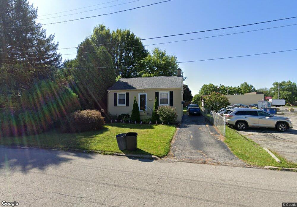
646 Brandon Ave Struthers, OH 44471
Estimated Value: $75,179 - $95,000
2
Beds
1
Bath
672
Sq Ft
$123/Sq Ft
Est. Value
About This Home
This home is located at 646 Brandon Ave, Struthers, OH 44471 and is currently estimated at $82,795, approximately $123 per square foot. 646 Brandon Ave is a home located in Mahoning County with nearby schools including Struthers Elementary School, Struthers Middle School, and Struthers High School.
Ownership History
Date
Name
Owned For
Owner Type
Purchase Details
Closed on
Apr 7, 2005
Sold by
Deutsche National Trust
Bought by
Boyd Property Management Llc
Current Estimated Value
Purchase Details
Closed on
Aug 16, 2004
Sold by
Maizel Michael A
Bought by
Indymac Bank Fsb
Purchase Details
Closed on
May 22, 1996
Sold by
Est Saxon C Diser
Bought by
Maizel Michael A
Purchase Details
Closed on
Oct 23, 1967
Bought by
Diser Saxon C
Create a Home Valuation Report for This Property
The Home Valuation Report is an in-depth analysis detailing your home's value as well as a comparison with similar homes in the area
Home Values in the Area
Average Home Value in this Area
Purchase History
| Date | Buyer | Sale Price | Title Company |
|---|---|---|---|
| Boyd Property Management Llc | $29,500 | Sovereign Title Agency Llc | |
| Indymac Bank Fsb | $36,900 | -- | |
| Maizel Michael A | $13,750 | -- | |
| Diser Saxon C | -- | -- |
Source: Public Records
Tax History
| Year | Tax Paid | Tax Assessment Tax Assessment Total Assessment is a certain percentage of the fair market value that is determined by local assessors to be the total taxable value of land and additions on the property. | Land | Improvement |
|---|---|---|---|---|
| 2025 | $612 | $14,340 | $3,330 | $11,010 |
| 2024 | $612 | $14,340 | $3,330 | $11,010 |
| 2023 | $602 | $14,340 | $3,330 | $11,010 |
| 2022 | $650 | $11,720 | $3,130 | $8,590 |
| 2021 | $644 | $11,720 | $3,130 | $8,590 |
| 2020 | $647 | $11,720 | $3,130 | $8,590 |
| 2019 | $621 | $10,190 | $2,720 | $7,470 |
| 2018 | $594 | $10,190 | $2,720 | $7,470 |
| 2017 | $591 | $10,190 | $2,720 | $7,470 |
| 2016 | $745 | $13,170 | $3,170 | $10,000 |
| 2015 | $729 | $13,170 | $3,170 | $10,000 |
| 2014 | $731 | $13,170 | $3,170 | $10,000 |
| 2013 | $681 | $13,170 | $3,170 | $10,000 |
Source: Public Records
Map
Nearby Homes
- 563 Geneva Ave
- 587 Edison St
- 1933 Brandon Ave
- 1926 Brandon Ave
- 611 W Wilson St
- 2089 Shetland Ln
- 1928 Palo Verde Dr
- 5425 Sheridan Rd
- 453 W Omar St
- 1913 Country Club Ave
- 5710 Youngstown Poland Rd
- 5007 Sheridan Rd
- 0 Woodlawn Ave
- 0 Oles Ave
- 1654 Thalia Ave
- 0 Lemoyne Ave
- 612 Maplewood Ave
- 795 5th St
- 2301 Lyon Blvd
- 2370 Lyon Blvd
- 638 Brandon Ave
- 634 Brandon Ave
- 623 W Harvey St
- 621 W Harvey St
- 624 Brandon Ave
- 615 W Harvey St
- 627 Brandon Ave
- 610 Brandon Ave
- 609 W Harvey St
- 615 Brandon Ave
- 636 Geneva Ave
- 603 W Harvey St
- 626 Geneva Ave
- 620 W Harvey St
- 605 W Harvey St
- 886 Youngstown Poland Rd
- 614 W Harvey St
- 609 Brandon Ave
- 624 Geneva Ave
- 5226 Youngstown Poland Rd
Your Personal Tour Guide
Ask me questions while you tour the home.