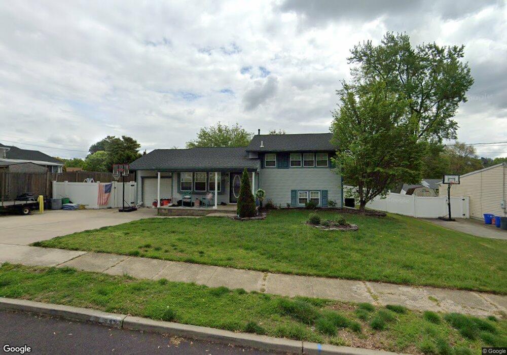
646 Cornell Ave Wenonah, NJ 08090
Deptford Township NeighborhoodEstimated Value: $301,000 - $358,000
3
Beds
1
Bath
1,403
Sq Ft
$232/Sq Ft
Est. Value
About This Home
This home is located at 646 Cornell Ave, Wenonah, NJ 08090 and is currently estimated at $324,831, approximately $231 per square foot. 646 Cornell Ave is a home located in Gloucester County with nearby schools including Deptford Township High School and St Margaret Regional School.
Ownership History
Date
Name
Owned For
Owner Type
Purchase Details
Closed on
Jan 28, 2011
Sold by
Cogan Raymond and Cogan Courtney
Bought by
Walsh Michael and Walsh Alyssa
Current Estimated Value
Home Financials for this Owner
Home Financials are based on the most recent Mortgage that was taken out on this home.
Original Mortgage
$175,437
Interest Rate
4.82%
Mortgage Type
FHA
Purchase Details
Closed on
Mar 29, 2002
Sold by
Tortorice Anthony L
Bought by
Cogan Raymond A
Home Financials for this Owner
Home Financials are based on the most recent Mortgage that was taken out on this home.
Original Mortgage
$123,068
Interest Rate
6.88%
Mortgage Type
FHA
Purchase Details
Closed on
Jan 24, 1994
Sold by
Sowers Robert
Bought by
Torterice Anthony
Create a Home Valuation Report for This Property
The Home Valuation Report is an in-depth analysis detailing your home's value as well as a comparison with similar homes in the area
Home Values in the Area
Average Home Value in this Area
Purchase History
| Date | Buyer | Sale Price | Title Company |
|---|---|---|---|
| Walsh Michael | $180,000 | Homestead Title Agency | |
| Cogan Raymond A | $125,000 | -- | |
| Torterice Anthony | $84,000 | -- |
Source: Public Records
Mortgage History
| Date | Status | Borrower | Loan Amount |
|---|---|---|---|
| Previous Owner | Walsh Michael | $175,437 | |
| Previous Owner | Cogan Raymond A | $123,068 |
Source: Public Records
Tax History Compared to Growth
Tax History
| Year | Tax Paid | Tax Assessment Tax Assessment Total Assessment is a certain percentage of the fair market value that is determined by local assessors to be the total taxable value of land and additions on the property. | Land | Improvement |
|---|---|---|---|---|
| 2025 | $5,553 | $154,900 | $38,900 | $116,000 |
| 2024 | $5,375 | $154,900 | $38,900 | $116,000 |
| 2023 | $5,375 | $154,900 | $38,900 | $116,000 |
| 2022 | $5,336 | $154,900 | $38,900 | $116,000 |
| 2021 | $5,260 | $154,900 | $38,900 | $116,000 |
| 2020 | $5,200 | $154,900 | $38,900 | $116,000 |
| 2019 | $5,101 | $154,900 | $38,900 | $116,000 |
| 2018 | $4,986 | $154,900 | $38,900 | $116,000 |
| 2017 | $4,853 | $154,900 | $38,900 | $116,000 |
| 2016 | $4,754 | $154,900 | $38,900 | $116,000 |
| 2015 | $4,607 | $154,900 | $38,900 | $116,000 |
| 2014 | $4,487 | $154,900 | $38,900 | $116,000 |
Source: Public Records
Map
Nearby Homes
- 629 Vassar Rd
- 7 Manchester Ct
- 213 Barclay Ct
- 114 Buddy Powell Ln
- 100 Buddy Powell Ln
- 807 Saint Regis Ct
- 916 Georgetown Rd
- 827 Saint Regis Ct
- 136 Vanderbilt Ave
- 411 Durham Ct Unit 411
- 463 Durham Ct
- 313 Ogden Station Rd
- 125 Ivy Ln
- 315 Ogden Station Rd
- 111 Cove Rd
- 505 University Blvd
- 711 Howard Ave
- 748 Dartmouth Dr
- 417 Auburn St
- 751 Garrison Ct