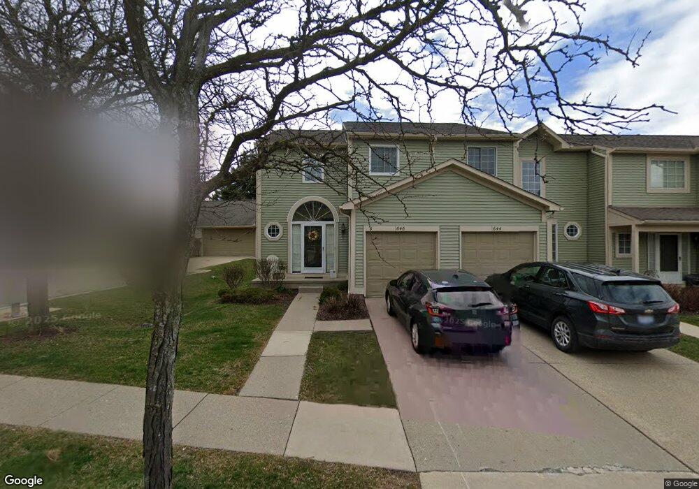
646 Liberty Pointe Dr Ann Arbor, MI 48103
Liberty Glen NeighborhoodEstimated Value: $319,094 - $361,000
2
Beds
2
Baths
1,378
Sq Ft
$247/Sq Ft
Est. Value
About This Home
This home is located at 646 Liberty Pointe Dr, Ann Arbor, MI 48103 and is currently estimated at $341,024, approximately $247 per square foot. 646 Liberty Pointe Dr is a home located in Washtenaw County with nearby schools including Lakewood Elementary School, Forsythe Middle School, and Skyline High School.
Ownership History
Date
Name
Owned For
Owner Type
Purchase Details
Closed on
Jul 17, 2018
Sold by
Grabbe Robert L and Grabbe Barbara K
Bought by
Grabbe Robert K and Grabbe Barbara K
Current Estimated Value
Purchase Details
Closed on
Oct 1, 2001
Sold by
Daugherty R Douglas
Bought by
Grabbe Robert L
Purchase Details
Closed on
Jun 3, 1996
Sold by
Martin Vickie
Bought by
Klotz Douglas Daugherty and Klotz Michelle
Home Financials for this Owner
Home Financials are based on the most recent Mortgage that was taken out on this home.
Original Mortgage
$104,400
Interest Rate
8.05%
Mortgage Type
New Conventional
Create a Home Valuation Report for This Property
The Home Valuation Report is an in-depth analysis detailing your home's value as well as a comparison with similar homes in the area
Home Values in the Area
Average Home Value in this Area
Purchase History
| Date | Buyer | Sale Price | Title Company |
|---|---|---|---|
| Grabbe Robert K | -- | None Available | |
| Grabbe Robert L | $195,000 | -- | |
| Klotz Douglas Daugherty | $130,500 | -- |
Source: Public Records
Mortgage History
| Date | Status | Borrower | Loan Amount |
|---|---|---|---|
| Previous Owner | Klotz Douglas Daugherty | $104,400 |
Source: Public Records
Tax History Compared to Growth
Tax History
| Year | Tax Paid | Tax Assessment Tax Assessment Total Assessment is a certain percentage of the fair market value that is determined by local assessors to be the total taxable value of land and additions on the property. | Land | Improvement |
|---|---|---|---|---|
| 2025 | $5,468 | $152,500 | $0 | $0 |
| 2024 | $4,594 | $152,600 | $0 | $0 |
| 2023 | $4,242 | $146,000 | $0 | $0 |
| 2022 | $5,134 | $134,900 | $0 | $0 |
| 2021 | $4,989 | $128,800 | $0 | $0 |
| 2020 | $4,832 | $127,200 | $0 | $0 |
| 2019 | $4,609 | $118,000 | $118,000 | $0 |
| 2018 | $4,522 | $110,000 | $0 | $0 |
| 2017 | $4,362 | $104,000 | $0 | $0 |
| 2016 | $3,394 | $68,699 | $0 | $0 |
| 2015 | $4,076 | $68,494 | $0 | $0 |
| 2014 | $4,076 | $66,355 | $0 | $0 |
| 2013 | -- | $66,355 | $0 | $0 |
Source: Public Records
Map
Nearby Homes
- 609 Liberty Pointe Dr Unit 45
- 813 E Summerfield Glen Cir
- 922 W Summerfield Glen Cir Unit 110
- 2564 W Towne St
- 2509 W Liberty St
- 324 Highlake Ave
- 570 S Maple Rd
- 1053 Bluestem Ln
- 3177 Sunnywood Dr
- 1235 S Maple Rd Unit 202
- 1225 S Maple Rd Unit 307
- 2149 Fair St
- 3224 Lakewood Dr
- 1265 S Maple Rd Unit 207
- 2120 Pauline Blvd Unit 305
- 1366 N Bay Dr Unit 144
- 2052 Liberty Heights
- 2104 Pauline Blvd Unit 305
- 2126 Pauline Blvd Unit 104
- 1419 N Bay Dr Unit 73
- 644 Liberty Pointe Dr Unit 26
- 642 Liberty Pointe Dr
- 640 Liberty Pointe Dr Unit 28
- 2905 Salem Dr Unit 20
- 688 Liberty Pointe Dr
- 2915 Salem Dr Unit 19
- 690 Liberty Pointe Dr Unit 9
- 641 Liberty Pointe Dr Unit 21
- 643 Liberty Pointe Dr Unit 20
- 639 Liberty Pointe Dr
- 639 Liberty Pointe Dr Unit 22
- 645 Liberty Pointe Dr
- 637 Liberty Pointe Dr
- 692 Liberty Pointe Dr Unit 8
- 635 Liberty Pointe Dr Unit 24
- 0 Liberty Pointe Dr
- 2925 Salem Dr
- 694 Liberty Pointe Dr
- 588 Liberty Pointe Dr
- 671 Boston Ct Unit 16