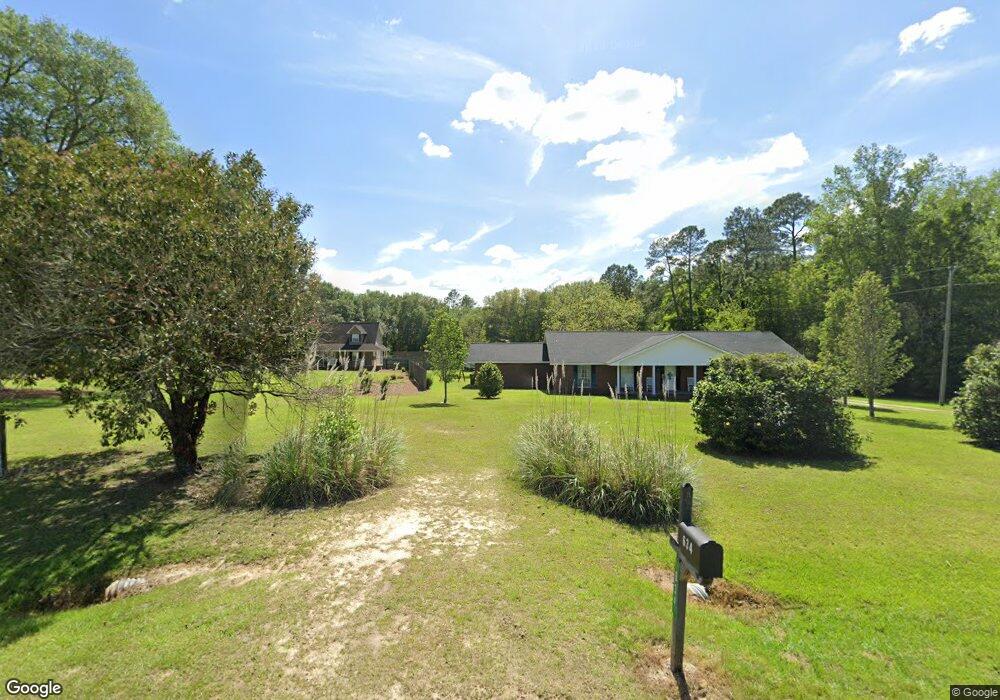
646 Livingston Bridge Rd Norman Park, GA 31771
Estimated Value: $219,000 - $292,000
--
Bed
2
Baths
2,828
Sq Ft
$94/Sq Ft
Est. Value
About This Home
This home is located at 646 Livingston Bridge Rd, Norman Park, GA 31771 and is currently estimated at $266,926, approximately $94 per square foot. 646 Livingston Bridge Rd is a home located in Colquitt County with nearby schools including Norman Park Elementary School, C.A. Gray Junior High School, and Willie J. Williams Middle School.
Ownership History
Date
Name
Owned For
Owner Type
Purchase Details
Closed on
Aug 18, 2012
Sold by
Deloach Amy M
Bought by
Deloach Amy
Current Estimated Value
Home Financials for this Owner
Home Financials are based on the most recent Mortgage that was taken out on this home.
Original Mortgage
$170,100
Outstanding Balance
$101,336
Interest Rate
3.87%
Mortgage Type
FHA
Estimated Equity
$165,590
Purchase Details
Closed on
Feb 7, 2008
Sold by
Deloach Amy M
Bought by
Deloach Amy
Purchase Details
Closed on
Jul 8, 2004
Sold by
Tillman Patsy S
Bought by
Deloach Amy M
Purchase Details
Closed on
Feb 10, 2004
Sold by
Tillman David G
Bought by
Tillman Patsy S
Purchase Details
Closed on
Feb 26, 1992
Bought by
Tillman David G
Create a Home Valuation Report for This Property
The Home Valuation Report is an in-depth analysis detailing your home's value as well as a comparison with similar homes in the area
Home Values in the Area
Average Home Value in this Area
Purchase History
| Date | Buyer | Sale Price | Title Company |
|---|---|---|---|
| Deloach Amy | -- | -- | |
| Deloach Amy | -- | -- | |
| Deloach Amy M | $100,000 | -- | |
| Tillman Patsy S | -- | -- | |
| Tillman David G | $7,500 | -- |
Source: Public Records
Mortgage History
| Date | Status | Borrower | Loan Amount |
|---|---|---|---|
| Open | Deloach Amy | $170,100 |
Source: Public Records
Tax History Compared to Growth
Tax History
| Year | Tax Paid | Tax Assessment Tax Assessment Total Assessment is a certain percentage of the fair market value that is determined by local assessors to be the total taxable value of land and additions on the property. | Land | Improvement |
|---|---|---|---|---|
| 2024 | $2,123 | $95,950 | $4,122 | $91,828 |
| 2023 | $1,735 | $74,873 | $4,122 | $70,751 |
| 2022 | $1,536 | $66,512 | $3,664 | $62,848 |
| 2021 | $1,370 | $58,399 | $3,664 | $54,735 |
| 2020 | $1,297 | $54,458 | $3,664 | $50,794 |
| 2019 | $1,370 | $51,830 | $3,664 | $48,166 |
| 2018 | $1,326 | $51,830 | $3,664 | $48,166 |
| 2017 | $1,410 | $53,815 | $5,649 | $48,166 |
| 2016 | $1,429 | $53,815 | $5,649 | $48,166 |
| 2015 | $1,442 | $53,815 | $5,649 | $48,166 |
| 2014 | $1,415 | $53,815 | $5,649 | $48,166 |
| 2013 | -- | $53,814 | $5,649 | $48,165 |
Source: Public Records
Map
Nearby Homes
- 160 Main Street Crosland
- 1396 Livingston Bridge Rd
- 000 Star Cir
- 000 U S Highway 319
- 173 Middlebrooks St
- 146 Lamar St
- 142 Lamar St
- 122 New St
- 1427 S Ty Omega Rd
- 1852 Doerun Norman Park Rd
- 0 Sleepy Bear Rd
- 3332 Ellenton Norman Park Rd
- 0 Mark Orton Ln
- 0 Old Norman Park Rd
- 0 Murray McCranie Rd Unit 25079284
- 0 Murray McCranie Rd Unit 11586683
- 210 Arrowhead Dr
- 209 Cherokee Dr
- 441 Cherokee Dr
- 273 Seminole Dr
- 607 Livingston Bridge Rd
- 392 Livingston Bridge Rd
- 947 Livingston Bridge Rd
- 274 Livingston Bridge Rd
- 210 Livingston Bridge Rd
- 250 Zorn Rd
- 233 Zorn Rd
- 240 Zorn Rd
- 216 Zorn Rd
- 207 Livingston Bridge Rd
- 213 Livingston Bridge Rd
- 212 Zorn Rd
- 152 Zorn Rd
- 300 Sandy Ridge Cemetery Rd
- 293 Sandy Ridge Cemetery Rd
- 172 Mount Zion Church Rd
- 262 Sandy Ridge Cemetery Rd
- 165 Mount Zion Church Rd