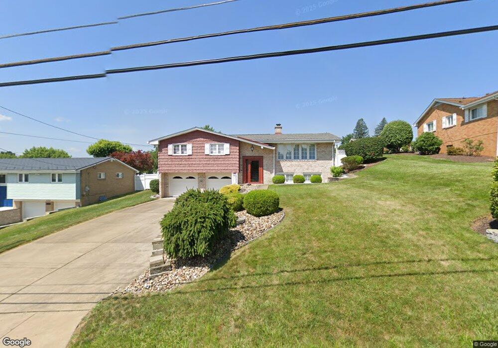
646 Longvue Dr Houston, PA 15342
Chartiers Township NeighborhoodEstimated Value: $204,000 - $419,000
2
Beds
3
Baths
1,664
Sq Ft
$195/Sq Ft
Est. Value
About This Home
This home is located at 646 Longvue Dr, Houston, PA 15342 and is currently estimated at $324,638, approximately $195 per square foot. 646 Longvue Dr is a home located in Washington County with nearby schools including Allison Park Elementary School, Chartiers-Houston Junior/Senior High School, and Central Christian Academy.
Ownership History
Date
Name
Owned For
Owner Type
Purchase Details
Closed on
Jul 10, 2012
Sold by
Provenzano Barbara A
Bought by
Bebout Edward A
Current Estimated Value
Home Financials for this Owner
Home Financials are based on the most recent Mortgage that was taken out on this home.
Original Mortgage
$196,000
Outstanding Balance
$135,871
Interest Rate
3.76%
Mortgage Type
New Conventional
Estimated Equity
$188,767
Create a Home Valuation Report for This Property
The Home Valuation Report is an in-depth analysis detailing your home's value as well as a comparison with similar homes in the area
Home Values in the Area
Average Home Value in this Area
Purchase History
| Date | Buyer | Sale Price | Title Company |
|---|---|---|---|
| Bebout Edward A | $245,000 | -- |
Source: Public Records
Mortgage History
| Date | Status | Borrower | Loan Amount |
|---|---|---|---|
| Open | Bebout Edward A | $196,000 |
Source: Public Records
Tax History Compared to Growth
Tax History
| Year | Tax Paid | Tax Assessment Tax Assessment Total Assessment is a certain percentage of the fair market value that is determined by local assessors to be the total taxable value of land and additions on the property. | Land | Improvement |
|---|---|---|---|---|
| 2025 | $2,231 | $135,200 | $30,000 | $105,200 |
| 2024 | $2,018 | $135,200 | $30,000 | $105,200 |
| 2023 | $2,018 | $135,200 | $30,000 | $105,200 |
| 2022 | $1,797 | $135,200 | $30,000 | $105,200 |
| 2021 | $1,884 | $135,200 | $30,000 | $105,200 |
| 2020 | $1,684 | $135,200 | $30,000 | $105,200 |
| 2019 | $1,788 | $135,200 | $30,000 | $105,200 |
| 2018 | $2,571 | $135,200 | $30,000 | $105,200 |
| 2017 | $235 | $194,400 | $89,200 | $105,200 |
| 2016 | $235 | $9,428 | $1,500 | $7,928 |
| 2015 | -- | $9,428 | $1,500 | $7,928 |
| 2014 | $235 | $9,428 | $1,500 | $7,928 |
| 2013 | $235 | $9,428 | $1,500 | $7,928 |
Source: Public Records
Map
Nearby Homes
- 528 Forrest Ave
- XX N Shady Ave
- X N Shady Ave
- 533 Hickory Ln
- 473 Hickory Ln
- 543 Birch Dr
- 572 Birch Dr
- 150 N Haft St
- 112 Cherry Ave
- 110 E Country Barn Rd
- 211 Reed Ave
- 249 Walnut St
- 211 Crawford St
- 401 N Main St
- 123 Latimer Ave
- 1024 Mcgovern Rd
- Lot 6 Wylie Ave
- 352 Pershing Ave
- 330 Everest Cir
- 415 North Ave