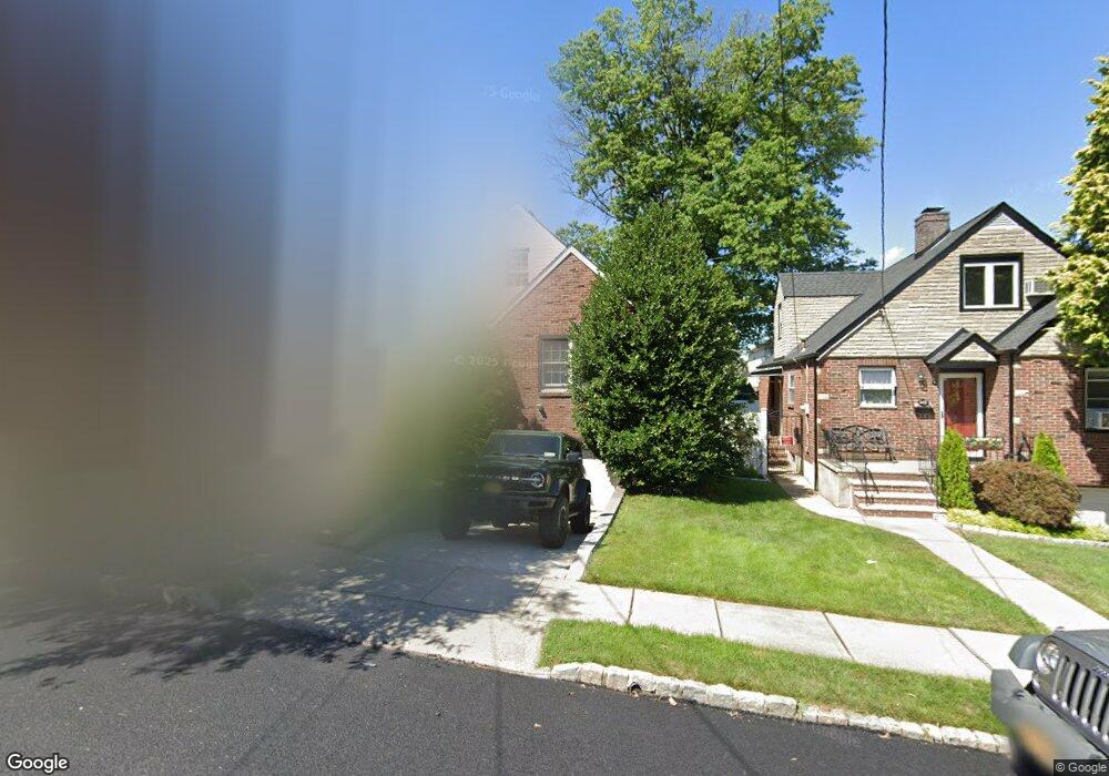
646 Pelton Ave Staten Island, NY 10310
West Brighton NeighborhoodEstimated Value: $805,301 - $975,000
4
Beds
2
Baths
1,320
Sq Ft
$675/Sq Ft
Est. Value
About This Home
This home is located at 646 Pelton Ave, Staten Island, NY 10310 and is currently estimated at $890,825, approximately $674 per square foot. 646 Pelton Ave is a home located in Richmond County with nearby schools including P.S. 45 John Tyler, Is 61 William A Morris, and Curtis High School.
Ownership History
Date
Name
Owned For
Owner Type
Purchase Details
Closed on
Mar 28, 2011
Sold by
Laird Stuart L
Bought by
Tripodi Dominick
Current Estimated Value
Home Financials for this Owner
Home Financials are based on the most recent Mortgage that was taken out on this home.
Original Mortgage
$348,000
Outstanding Balance
$242,764
Interest Rate
5.04%
Mortgage Type
New Conventional
Estimated Equity
$648,061
Purchase Details
Closed on
Oct 22, 2001
Sold by
Laird James W
Bought by
Laird Stuart L
Create a Home Valuation Report for This Property
The Home Valuation Report is an in-depth analysis detailing your home's value as well as a comparison with similar homes in the area
Home Values in the Area
Average Home Value in this Area
Purchase History
| Date | Buyer | Sale Price | Title Company |
|---|---|---|---|
| Tripodi Dominick | $498,000 | Westcor Land Title Ins Co | |
| Laird Stuart L | -- | -- |
Source: Public Records
Mortgage History
| Date | Status | Borrower | Loan Amount |
|---|---|---|---|
| Open | Tripodi Dominick | $348,000 |
Source: Public Records
Tax History Compared to Growth
Tax History
| Year | Tax Paid | Tax Assessment Tax Assessment Total Assessment is a certain percentage of the fair market value that is determined by local assessors to be the total taxable value of land and additions on the property. | Land | Improvement |
|---|---|---|---|---|
| 2025 | $7,757 | $45,420 | $15,242 | $30,178 |
| 2024 | $7,769 | $40,020 | $17,406 | $22,614 |
| 2023 | $8,191 | $41,731 | $14,515 | $27,216 |
| 2022 | $7,834 | $45,780 | $16,320 | $29,460 |
| 2021 | $7,773 | $48,240 | $16,320 | $31,920 |
| 2020 | $7,684 | $45,900 | $16,320 | $29,580 |
| 2019 | $7,148 | $40,020 | $16,320 | $23,700 |
| 2018 | $6,791 | $34,776 | $16,253 | $18,523 |
| 2017 | $6,610 | $33,898 | $16,261 | $17,637 |
| 2016 | $6,083 | $31,980 | $16,320 | $15,660 |
| 2015 | $5,383 | $31,418 | $17,970 | $13,448 |
| 2014 | $5,383 | $29,640 | $18,120 | $11,520 |
Source: Public Records
Map
Nearby Homes
- 152 Harvest Ave
- 100 Lawrence Ave
- 677 Bement Ave
- 34 Harvest Ave
- 710 Oakland Ave
- 1 Whitewood Ave
- 751 Oakland Ave
- 605 Bard Ave
- 20 Baker Place
- 54 City Blvd
- 1 Sunset Hill Dr
- 706 Broadway
- 64 Greenway Dr
- 372 Sharon Ave
- 40 Greenway Dr
- 967 Bard Ave
- 432 Pelton Ave
- 244 Delafield Ave
- 966 Clove Rd Unit A
- 26 Fairway Ln
- 642 Pelton Ave
- 650 Pelton Ave
- 638 Pelton Ave
- 654 Pelton Ave
- 615 Oakland Ave
- 619 Oakland Ave
- 611 Oakland Ave
- 634 Pelton Ave
- 623 Oakland Ave
- 658 Pelton Ave
- 607 Oakland Ave
- 645 Pelton Ave
- 649 Pelton Ave
- 629 Oakland Ave
- 641 Pelton Ave
- 653 Pelton Ave
- 662 Pelton Ave
- 603 Oakland Ave
- 630 Pelton Ave
- 657 Pelton Ave