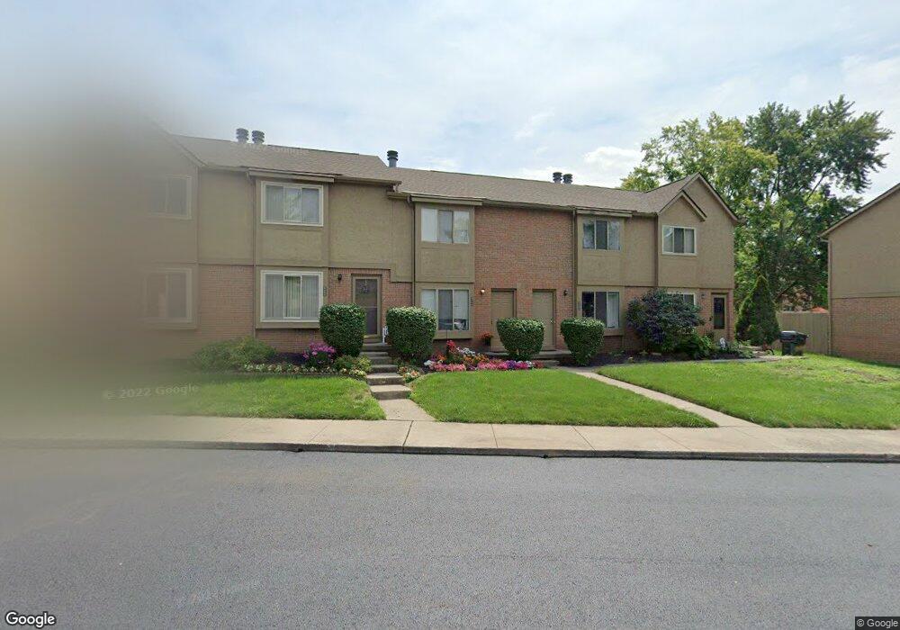
6464 Cranston Way Dublin, OH 43017
Riverside NeighborhoodEstimated Value: $178,000 - $224,477
2
Beds
2
Baths
1,038
Sq Ft
$200/Sq Ft
Est. Value
About This Home
This home is located at 6464 Cranston Way, Dublin, OH 43017 and is currently estimated at $207,119, approximately $199 per square foot. 6464 Cranston Way is a home located in Franklin County with nearby schools including Riverside Elementary School, Ann Simpson Davis Middle School, and Dublin Scioto High School.
Ownership History
Date
Name
Owned For
Owner Type
Purchase Details
Closed on
Jun 30, 2002
Sold by
Araghi Mehdi and Araghi Elham
Bought by
M E S H Properties Ltd
Current Estimated Value
Purchase Details
Closed on
Jul 10, 2001
Sold by
Hagey Antionette
Bought by
Araghi Mehdi and Khaksarfard Elham
Purchase Details
Closed on
Jun 24, 1992
Bought by
Hagey Antionette
Purchase Details
Closed on
Dec 1, 1987
Create a Home Valuation Report for This Property
The Home Valuation Report is an in-depth analysis detailing your home's value as well as a comparison with similar homes in the area
Home Values in the Area
Average Home Value in this Area
Purchase History
| Date | Buyer | Sale Price | Title Company |
|---|---|---|---|
| M E S H Properties Ltd | -- | -- | |
| Araghi Mehdi | $56,000 | Chicago Title | |
| Hagey Antionette | $47,500 | -- | |
| -- | $45,000 | -- |
Source: Public Records
Tax History
| Year | Tax Paid | Tax Assessment Tax Assessment Total Assessment is a certain percentage of the fair market value that is determined by local assessors to be the total taxable value of land and additions on the property. | Land | Improvement |
|---|---|---|---|---|
| 2025 | $2,781 | $45,050 | $7,000 | $38,050 |
| 2024 | $2,781 | $45,050 | $7,000 | $38,050 |
| 2023 | $2,743 | $45,050 | $7,000 | $38,050 |
| 2022 | $2,376 | $36,160 | $4,270 | $31,890 |
| 2021 | $2,415 | $36,160 | $4,270 | $31,890 |
| 2020 | $2,401 | $36,160 | $4,270 | $31,890 |
| 2019 | $2,009 | $26,780 | $3,150 | $23,630 |
| 2018 | $1,995 | $26,780 | $3,150 | $23,630 |
| 2017 | $1,862 | $26,780 | $3,150 | $23,630 |
| 2016 | $1,959 | $26,470 | $4,380 | $22,090 |
| 2015 | $1,971 | $26,470 | $4,380 | $22,090 |
| 2014 | $1,973 | $26,470 | $4,380 | $22,090 |
| 2013 | $1,002 | $26,460 | $4,375 | $22,085 |
Source: Public Records
Map
Nearby Homes
- 5622 Riverside Dr
- 3223 Banting St
- 3263 Scioto Ridge Rd
- 6187 Water Bank St
- 6171 Water Bank St
- 3118 Baffin Ct
- 3107 Hamden Ct
- 6628 Brock St
- 3143 Brampton St
- 6802 Chesley Rd
- 105 Marion St
- 6117 Maryhurst Dr
- 2960 Sawdust Ln Unit 2960
- 2942 Sawdust Ln Unit 2942
- 6841 Riverside Glen Ct
- 5850 Chatterfield Dr
- 180 S Riverview St
- 3075 Glenloch Cir Unit 3075
- 295 Beckley Ln
- 3002 Glenloch Cir Unit 3002
- 6456 Cranston Way Unit 24
- 6462 Cranston Way
- 6462 Cranston Way Unit 30
- 6454 Cranston Way
- 6454 Cranston Way Unit 23
- 6460 Cranston Way
- 6460 Cranston Way Unit 29
- 6452 Cranston Way
- 6452 Cranston Way Unit 22
- 6466 Cranston Way
- 6450 Cranston Way Unit 21
- 6468 Cranston Way
- 6468 Cranston Way Unit 33
- 6455 Cranston Way Unit 26
- 6472 Cranston Way Unit 38
- 6463 Cranston Way
- 6463 Cranston Way Unit 34
- 6449 Cranston Way
- 6449 Cranston Way Unit 20
- 6474 Cranston Way Unit 39
Your Personal Tour Guide
Ask me questions while you tour the home.