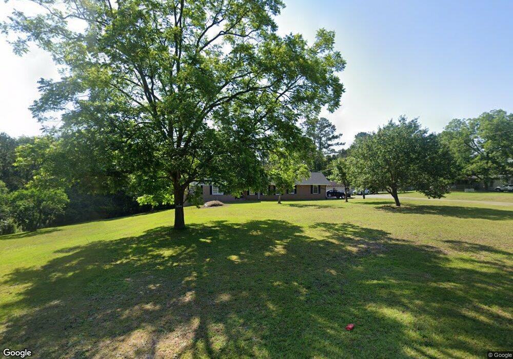
6464 Skipper Rd Macon, GA 31216
Estimated Value: $199,000 - $218,000
3
Beds
2
Baths
1,914
Sq Ft
$109/Sq Ft
Est. Value
About This Home
This home is located at 6464 Skipper Rd, Macon, GA 31216 and is currently estimated at $209,306, approximately $109 per square foot. 6464 Skipper Rd is a home located in Bibb County with nearby schools including Porter Elementary School, Rutland Middle School, and Rutland High School.
Ownership History
Date
Name
Owned For
Owner Type
Purchase Details
Closed on
Oct 2, 2009
Sold by
Abercrombie Theresa
Bought by
Abercrombie Thomas Charles
Current Estimated Value
Purchase Details
Closed on
Jul 20, 2007
Sold by
Moore E Earl and Moore Ruby C
Bought by
Abercrombie Thomas C and Abercrombie Theresa
Home Financials for this Owner
Home Financials are based on the most recent Mortgage that was taken out on this home.
Original Mortgage
$120,000
Outstanding Balance
$75,238
Interest Rate
6.65%
Mortgage Type
Purchase Money Mortgage
Estimated Equity
$134,068
Purchase Details
Closed on
May 6, 2002
Create a Home Valuation Report for This Property
The Home Valuation Report is an in-depth analysis detailing your home's value as well as a comparison with similar homes in the area
Purchase History
| Date | Buyer | Sale Price | Title Company |
|---|---|---|---|
| Abercrombie Thomas Charles | -- | None Available | |
| Abercrombie Thomas C | $120,000 | None Available | |
| -- | $87,000 | -- |
Source: Public Records
Mortgage History
| Date | Status | Borrower | Loan Amount |
|---|---|---|---|
| Open | Abercrombie Thomas C | $120,000 |
Source: Public Records
Tax History
| Year | Tax Paid | Tax Assessment Tax Assessment Total Assessment is a certain percentage of the fair market value that is determined by local assessors to be the total taxable value of land and additions on the property. | Land | Improvement |
|---|---|---|---|---|
| 2025 | $1,178 | $54,956 | $5,548 | $49,408 |
| 2024 | $1,193 | $53,976 | $4,568 | $49,408 |
| 2023 | $1,353 | $52,671 | $3,263 | $49,408 |
| 2022 | $1,617 | $53,696 | $10,896 | $42,800 |
| 2021 | $1,742 | $52,837 | $10,896 | $41,941 |
| 2020 | $1,780 | $52,837 | $10,896 | $41,941 |
| 2019 | $1,794 | $52,837 | $10,896 | $41,941 |
| 2018 | $2,928 | $52,837 | $10,896 | $41,941 |
| 2017 | $1,717 | $52,837 | $10,896 | $41,941 |
| 2016 | $1,586 | $52,837 | $10,896 | $41,941 |
| 2015 | $2,245 | $52,837 | $10,896 | $41,941 |
| 2014 | $2,249 | $52,837 | $10,896 | $41,941 |
Source: Public Records
Map
Nearby Homes
- 4001 Springhead Way
- 4001 Springhead Way Unit LOT 102
- 4003 Springhead Way Unit LOT 101
- 4003 Springhead Way
- 4009 Springhead Way Unit LOT 98
- 4009 Springhead Way
- 4005 Springhead Way Unit LOT 100
- 4005 Springhead Way
- 6662 Goodall Mill Rd
- 114 Alayna Ct
- 6233 Skipperton Rd
- 221 Pendleton Ct
- 4651 Griffin Dr
- 312 Mill Meadow Rd
- 2165 Griffin Dr
- 201 Shetland Ct
- 334 Cody Dr
- 344 Cody Dr
- 332 Cody Dr
- 303 Cody Dr
- 6430 Skipper Rd
- 6502 Skipper Rd
- 6483 Skipper Rd
- 6540 Skipper Rd
- 6425 Skipper Rd
- 6509 Skipper Rd
- 6410 Skipper Rd
- 115 Farwell St
- 113 Farwell St
- 117 Farwell St
- 111 Farwell St
- 6388 Skipper Rd
- 109 Farwell St
- 6558 Skipper Rd
- 6395 Skipper Rd
- 107 Farwell St
- 116 Farwell St
- 108 Farwell St
- 6570 Skipper Rd Unit 108
- 6570 Skipper Rd
Your Personal Tour Guide
Ask me questions while you tour the home.