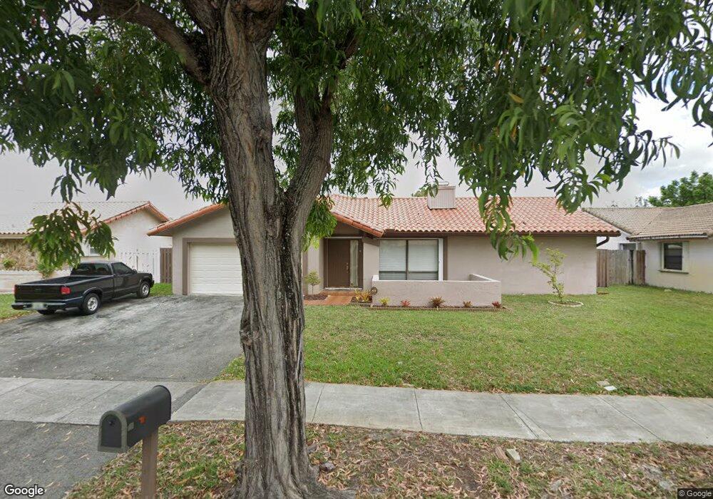
6465 NW 201st St Hialeah, FL 33015
Estimated Value: $626,000 - $751,000
3
Beds
2
Baths
2,031
Sq Ft
$341/Sq Ft
Est. Value
About This Home
This home is located at 6465 NW 201st St, Hialeah, FL 33015 and is currently estimated at $692,271, approximately $340 per square foot. 6465 NW 201st St is a home located in Miami-Dade County with nearby schools including Joella Good Elementary School, Country Club Middle School, and American Senior High School.
Ownership History
Date
Name
Owned For
Owner Type
Purchase Details
Closed on
Nov 29, 2022
Sold by
Castillo Jossy A and Castillo Trishia M
Bought by
Castillo Jossy A and Castillo Trishia M
Current Estimated Value
Purchase Details
Closed on
May 27, 2011
Sold by
Brown Phyllis
Bought by
Castillo Jossy A and Castillo Trishia M
Home Financials for this Owner
Home Financials are based on the most recent Mortgage that was taken out on this home.
Original Mortgage
$177,386
Interest Rate
4.75%
Mortgage Type
FHA
Purchase Details
Closed on
Feb 9, 2011
Sold by
Samuels Patrick
Bought by
Brown Phyllis
Purchase Details
Closed on
Dec 30, 2007
Sold by
Brown Phyllis
Bought by
Samuels Patrick
Purchase Details
Closed on
Aug 15, 2007
Sold by
Samuels Patrick
Bought by
Brown Phyllis
Home Financials for this Owner
Home Financials are based on the most recent Mortgage that was taken out on this home.
Original Mortgage
$347,000
Interest Rate
9.9%
Mortgage Type
Balloon
Purchase Details
Closed on
Dec 27, 2005
Sold by
Miller Hazel
Bought by
Samuels Patrick
Purchase Details
Closed on
May 23, 2005
Sold by
Samuels Patrick
Bought by
Miller Hazel
Home Financials for this Owner
Home Financials are based on the most recent Mortgage that was taken out on this home.
Original Mortgage
$232,000
Interest Rate
8.32%
Mortgage Type
Fannie Mae Freddie Mac
Purchase Details
Closed on
Apr 16, 1998
Sold by
Pledged Property Iii Llc
Bought by
Samuels Patrick
Home Financials for this Owner
Home Financials are based on the most recent Mortgage that was taken out on this home.
Original Mortgage
$109,250
Interest Rate
7.14%
Mortgage Type
New Conventional
Purchase Details
Closed on
Jan 14, 1998
Sold by
The Chase Manhattan Bank
Bought by
Pledged Property Iii Lc
Purchase Details
Closed on
Aug 26, 1997
Sold by
Dade County Circuit Court
Bought by
Chase Manhattan Bank
Create a Home Valuation Report for This Property
The Home Valuation Report is an in-depth analysis detailing your home's value as well as a comparison with similar homes in the area
Home Values in the Area
Average Home Value in this Area
Purchase History
| Date | Buyer | Sale Price | Title Company |
|---|---|---|---|
| Castillo Jossy A | -- | None Listed On Document | |
| Castillo Jossy A | $182,000 | Phoenix Land Title & Escrow | |
| Brown Phyllis | -- | None Available | |
| Samuels Patrick | $41,000 | None Available | |
| Brown Phyllis | $390,000 | Countryline Title Group Inc | |
| Samuels Patrick | -- | -- | |
| Miller Hazel | $290,000 | Countyline Title Group Inc | |
| Samuels Patrick | $115,000 | -- | |
| Pledged Property Iii Lc | $104,300 | -- | |
| Chase Manhattan Bank | $100 | -- |
Source: Public Records
Mortgage History
| Date | Status | Borrower | Loan Amount |
|---|---|---|---|
| Previous Owner | Castillo Jossy A | $177,386 | |
| Previous Owner | Brown Phyllis | $347,000 | |
| Previous Owner | Miller Hazel | $232,000 | |
| Previous Owner | Chase Manhattan Bank | $47,747 | |
| Previous Owner | Chase Manhattan Bank | $109,250 | |
| Closed | Miller Hazel | $58,000 |
Source: Public Records
Tax History
| Year | Tax Paid | Tax Assessment Tax Assessment Total Assessment is a certain percentage of the fair market value that is determined by local assessors to be the total taxable value of land and additions on the property. | Land | Improvement |
|---|---|---|---|---|
| 2025 | $3,723 | $218,733 | -- | -- |
| 2024 | $3,487 | $212,569 | -- | -- |
| 2023 | $3,487 | $206,378 | $0 | $0 |
| 2022 | $3,342 | $200,367 | $0 | $0 |
| 2021 | $3,295 | $194,532 | $0 | $0 |
| 2020 | $3,258 | $191,847 | $0 | $0 |
| 2019 | $3,189 | $187,534 | $0 | $0 |
| 2018 | $3,029 | $184,038 | $0 | $0 |
| 2017 | $3,037 | $180,253 | $0 | $0 |
| 2016 | $2,949 | $176,546 | $0 | $0 |
| 2015 | $2,987 | $175,319 | $0 | $0 |
| 2014 | $3,041 | $173,928 | $0 | $0 |
Source: Public Records
Map
Nearby Homes
- 19816 Bobolink Dr
- 19750 Cypress Ct
- 6325 NW 200th St
- 20031 NW 63rd Ave
- 20013 NW 62nd Place
- 6771 NW 199th Terrace
- 5361 SW 125th Ave
- 19907 NW 67th Ct
- 19903 NW 67th Ct
- 19926 NW 67th Place
- 12627 SW 54th St
- 12652 SW 54th St
- 12637 SW 54th St
- 6830 Winged Foot Dr
- 19804 NW 67th Ct
- 19897 NW 62nd Ave
- 6080 NW 199th St
- 5965 NW 200th St
- 6708 NW 193rd Terrace
- 6722 NW 192nd Ln
- 6455 NW 201st St
- 6475 NW 201st St
- 6460 NW 201st Terrace
- 6450 NW 201st Terrace
- 6470 NW 201st Terrace
- 20052 NW 64th Place
- 6445 NW 201st St
- 6485 NW 201st St
- 20057 NW 65th Ct
- 6480 NW 201st Terrace
- 20051 NW 64th Place
- 6435 NW 201st St
- 20053 NW 65th Ct
- 6515 NW 201st St
- 6430 NW 201st Terrace
- 6457 NW 201st Terrace
- 6467 NW 201st Terrace
- 6510 NW 201st Terrace
- 6447 NW 201st Terrace
Your Personal Tour Guide
Ask me questions while you tour the home.