Estimated Value: $141,000 - $205,000
--
Bed
--
Bath
950
Sq Ft
$170/Sq Ft
Est. Value
About This Home
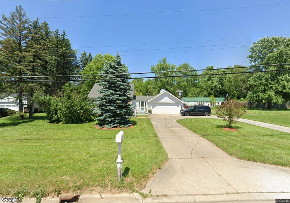
This home is located at 6467 Richfield Rd, Flint, MI 48506 and is currently estimated at $161,447, approximately $169 per square foot. 6467 Richfield Rd is a home located in Genesee County with nearby schools including Weston Elementary School, Leota Fiedler Elementary School, and Kate Dowdall Elementary School.
Ownership History
Date
Name
Owned For
Owner Type
Purchase Details
Closed on
Oct 9, 2012
Sold by
Hubbard Gregory
Bought by
Hubbard Gregory E and Hubbard Joshua
Current Estimated Value
Purchase Details
Closed on
Sep 27, 2001
Sold by
Hansmeyer Marie A and Hansmeyer Roy N
Bought by
Hubbard Gregory
Home Financials for this Owner
Home Financials are based on the most recent Mortgage that was taken out on this home.
Original Mortgage
$87,805
Outstanding Balance
$34,239
Interest Rate
6.99%
Mortgage Type
FHA
Estimated Equity
$127,208
Create a Home Valuation Report for This Property
The Home Valuation Report is an in-depth analysis detailing your home's value as well as a comparison with similar homes in the area
Home Values in the Area
Average Home Value in this Area
Purchase History
| Date | Buyer | Sale Price | Title Company |
|---|---|---|---|
| Hubbard Gregory E | -- | None Available | |
| Hubbard Gregory | $90,100 | First American Title Ins Co |
Source: Public Records
Mortgage History
| Date | Status | Borrower | Loan Amount |
|---|---|---|---|
| Open | Hubbard Gregory | $87,805 |
Source: Public Records
Tax History Compared to Growth
Tax History
| Year | Tax Paid | Tax Assessment Tax Assessment Total Assessment is a certain percentage of the fair market value that is determined by local assessors to be the total taxable value of land and additions on the property. | Land | Improvement |
|---|---|---|---|---|
| 2025 | $1,500 | $59,400 | $0 | $0 |
| 2024 | $397 | $54,800 | $0 | $0 |
| 2023 | $378 | $50,300 | $0 | $0 |
| 2022 | $1,339 | $45,800 | $0 | $0 |
| 2021 | $1,328 | $42,100 | $0 | $0 |
| 2020 | $346 | $38,600 | $0 | $0 |
| 2019 | $341 | $34,600 | $0 | $0 |
| 2018 | $1,245 | $33,900 | $0 | $0 |
| 2017 | $1,088 | $33,300 | $0 | $0 |
| 2016 | $1,086 | $32,000 | $0 | $0 |
| 2015 | $1,441 | $30,500 | $0 | $0 |
Source: Public Records
Map
Nearby Homes
- 6443 Richfield Rd
- 3485 N Vassar Rd
- 4156 Bobwhite Dr
- 6298 Nightingale Dr
- 3454 Eastdale Dr
- 6077 Crown Point
- 3389 Eastdale Dr
- 3365 Eastdale Dr
- 4062 N Belsay Rd
- 6363 Bluejay Dr
- 6323 Bluejay Dr
- 0 Whisper Ridge Ct
- 1 Whisper Ridge Ct
- 5467 Richfield Rd
- 2411 Briar Creek Ln
- 7020 E Carpenter Rd
- 3201 Gehring Dr
- 5091 N Irish Rd
- 2441 Mcclellan Blvd
- 3247 Mills Acres St
- 6493 Richfield Rd
- 6461 Richfield Rd
- 6451 Richfield Rd Unit Bldg-Unit
- 6451 Richfield Rd
- 6422 E Pierson Rd
- 6501 Richfield Rd
- 6448 E Pierson Rd
- 6509 Richfield Rd
- 6412 E Pierson Rd
- 6456 E Pierson Rd
- 6462 E Pierson Rd
- 6438 E Pierson Rd
- 6428 E Pierson Rd
- 6394 E Pierson Rd
- 6435 Richfield Rd
- 6474 Richfield Rd
- 6517 Richfield Rd
- 6474 E Pierson Rd
- 6474 E Pierson Rd
- 6431 Richfield Rd