Estimated Value: $131,000 - $148,861
3
Beds
2
Baths
1,532
Sq Ft
$92/Sq Ft
Est. Value
About This Home
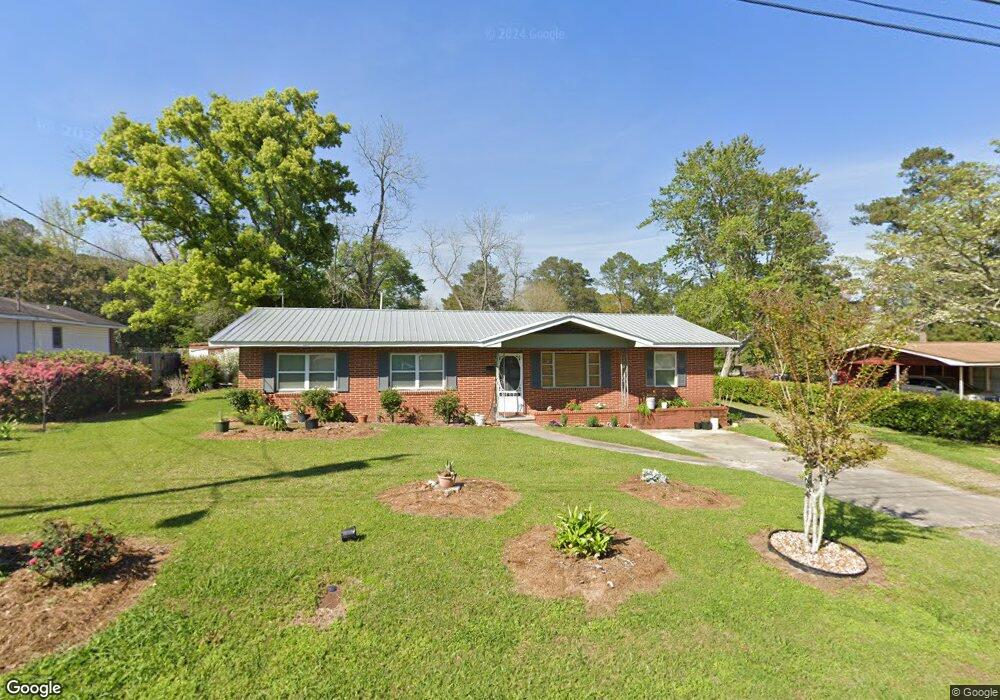
This home is located at 647 9th Ave SE, Cairo, GA 39828 and is currently estimated at $140,965, approximately $92 per square foot. 647 9th Ave SE is a home located in Grady County with nearby schools including Cairo High School.
Ownership History
Date
Name
Owned For
Owner Type
Purchase Details
Closed on
Jan 11, 2017
Sold by
Morales Dionisio
Bought by
Morales Dionisio and Mendoza Isabel P
Current Estimated Value
Purchase Details
Closed on
Oct 31, 2016
Sold by
Anna M
Bought by
Morales Dionisio
Purchase Details
Closed on
Dec 30, 2011
Sold by
Fannie Mae
Bought by
Wyatt Anna M
Home Financials for this Owner
Home Financials are based on the most recent Mortgage that was taken out on this home.
Original Mortgage
$56,529
Interest Rate
4.4%
Mortgage Type
FHA
Purchase Details
Closed on
Sep 6, 2011
Sold by
Suntrust Mortgage Inc
Bought by
Federal National Mortgage Association
Purchase Details
Closed on
May 31, 2007
Sold by
Collett Jerry
Bought by
Lee B Mark and Lee Jessica Nicole
Home Financials for this Owner
Home Financials are based on the most recent Mortgage that was taken out on this home.
Original Mortgage
$97,800
Interest Rate
6.12%
Mortgage Type
New Conventional
Purchase Details
Closed on
May 3, 1991
Bought by
Collett Jerry
Create a Home Valuation Report for This Property
The Home Valuation Report is an in-depth analysis detailing your home's value as well as a comparison with similar homes in the area
Home Values in the Area
Average Home Value in this Area
Purchase History
| Date | Buyer | Sale Price | Title Company |
|---|---|---|---|
| Morales Dionisio | -- | -- | |
| Morales Dionisio | $65,000 | -- | |
| Wyatt Anna M | $58,000 | -- | |
| Federal National Mortgage Association | $71,367 | -- | |
| Suntrust Mortgage Inc | $71,367 | -- | |
| Lee B Mark | $97,800 | -- | |
| Collett Jerry | $36,000 | -- |
Source: Public Records
Mortgage History
| Date | Status | Borrower | Loan Amount |
|---|---|---|---|
| Previous Owner | Wyatt Anna M | $56,529 | |
| Previous Owner | Lee B Mark | $97,800 |
Source: Public Records
Tax History Compared to Growth
Tax History
| Year | Tax Paid | Tax Assessment Tax Assessment Total Assessment is a certain percentage of the fair market value that is determined by local assessors to be the total taxable value of land and additions on the property. | Land | Improvement |
|---|---|---|---|---|
| 2024 | $2,421 | $61,371 | $2,440 | $58,931 |
| 2023 | $1,024 | $27,669 | $2,976 | $24,693 |
| 2022 | $1,065 | $27,669 | $2,976 | $24,693 |
| 2021 | $1,068 | $27,669 | $2,976 | $24,693 |
| 2020 | $1,071 | $27,669 | $2,976 | $24,693 |
| 2019 | $1,071 | $27,669 | $2,976 | $24,693 |
| 2018 | $1,018 | $27,669 | $2,976 | $24,693 |
| 2017 | $920 | $27,669 | $2,976 | $24,693 |
| 2016 | $1,152 | $33,381 | $2,976 | $30,405 |
| 2015 | $1,141 | $33,381 | $2,976 | $30,405 |
| 2014 | $1,141 | $33,381 | $2,976 | $30,405 |
| 2013 | -- | $30,054 | $2,976 | $27,078 |
Source: Public Records
Map
Nearby Homes
- 530 6th Ave SE
- 530 6th St
- 602 4th St SE
- 481 4th St SE
- 471 4th St SE
- 1310 Stone Ave
- 270 Muggridge Ln
- 309 3rd St SE
- 1193 S Broad St
- 1406 Platt Ave
- 75 14th Ave SE
- 000 S Broad St
- 27 6th Ave SW
- Lot #15, 3 64 Acres Oakbend Cir
- 720 1st St SW
- 711 2nd Ave NE
- 40 5th Ave SW
- 112 Pine Cir SW
- 117 Pine Cir SW
- 000 Hwy 111 South 20 59 Acres
- 647 9th Ave SE
- 665 9th Ave SE
- 620 8th Ave SE
- 618 8th Ave SE
- 675 9th Ave SE
- 646 8th Ave SE
- 644 9th Ave SE
- 634 9th Ave SE
- 631 9th Ave SE
- 650 8th Ave SE
- 660 9th Ave SE
- 616 8th Ave SE
- 611 9th Ave SE
- 685 9th Ave SE
- 656 8th Ave SE
- 610 9th Ave SE
- 610 8th Ave SE
- 673 10th Ave SE
- 619 8th Ave SE
- 615 8th Ave SE