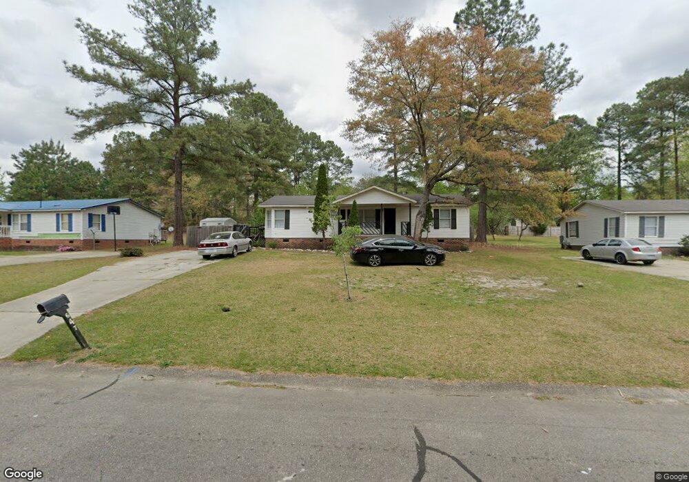
647 Dunrobin Dr Raeford, NC 28376
Estimated Value: $64,452 - $151,000
3
Beds
2
Baths
1,296
Sq Ft
$76/Sq Ft
Est. Value
About This Home
This home is located at 647 Dunrobin Dr, Raeford, NC 28376 and is currently estimated at $97,863, approximately $75 per square foot. 647 Dunrobin Dr is a home located in Hoke County with nearby schools including Upchurch Elementary School, East Hoke Middle, and Hoke County High.
Ownership History
Date
Name
Owned For
Owner Type
Purchase Details
Closed on
Sep 16, 2025
Sold by
Bullock Rasheem A
Bought by
Engram Camille
Current Estimated Value
Purchase Details
Closed on
Dec 6, 2013
Sold by
Dill Holly and Dill Mary
Bought by
Bullock Rasheem A
Purchase Details
Closed on
Jun 16, 2011
Sold by
Dill Holly
Bought by
Dill Holly and Dill Mary
Purchase Details
Closed on
Jun 10, 2011
Sold by
Homesales Inc
Bought by
Dill Holly E
Purchase Details
Closed on
Mar 15, 2011
Sold by
Chase Home Finance Llc
Bought by
Homesales Inc
Purchase Details
Closed on
Jan 5, 2011
Sold by
Secretary Of Veterans Affairs
Bought by
Chase Home Finance Llc
Create a Home Valuation Report for This Property
The Home Valuation Report is an in-depth analysis detailing your home's value as well as a comparison with similar homes in the area
Home Values in the Area
Average Home Value in this Area
Purchase History
| Date | Buyer | Sale Price | Title Company |
|---|---|---|---|
| Engram Camille | -- | None Listed On Document | |
| Bullock Rasheem A | $32,000 | None Available | |
| Dill Holly | -- | -- | |
| Dill Holly E | $18,500 | -- | |
| Homesales Inc | -- | -- | |
| Chase Home Finance Llc | -- | -- |
Source: Public Records
Tax History
| Year | Tax Paid | Tax Assessment Tax Assessment Total Assessment is a certain percentage of the fair market value that is determined by local assessors to be the total taxable value of land and additions on the property. | Land | Improvement |
|---|---|---|---|---|
| 2025 | $672 | $66,940 | $20,000 | $46,940 |
| 2024 | $672 | $66,940 | $20,000 | $46,940 |
| 2023 | $672 | $66,940 | $20,000 | $46,940 |
| 2022 | $661 | $66,940 | $20,000 | $46,940 |
| 2021 | $521 | $48,110 | $10,000 | $38,110 |
| 2020 | $527 | $48,110 | $10,000 | $38,110 |
| 2019 | $527 | $48,110 | $10,000 | $38,110 |
| 2018 | $527 | $48,110 | $10,000 | $38,110 |
| 2017 | $527 | $48,110 | $10,000 | $38,110 |
| 2016 | $519 | $48,110 | $10,000 | $38,110 |
| 2015 | $519 | $48,110 | $10,000 | $38,110 |
| 2014 | $500 | $48,110 | $10,000 | $38,110 |
| 2013 | -- | $64,290 | $19,000 | $45,290 |
Source: Public Records
Map
Nearby Homes
- 340 Marlborough (Lot 434) St
- 2410 Ohara Dr
- 784 Union (Lot 359) St
- 520 Inverary Dr
- 765 Union St (Lot 424) St
- 775 Union St (Lot 425) St
- 172 London Dr
- 270 Marlborough (Lot 440) St
- 685 Union St
- 835 Union (Lot 430) St
- 818 Union (Lot 362) St
- 105 McDougald Dr
- 1570 Clan Campbell Dr
- 204 Independence Dr
- 175 Marlborough Homesite 404
- 157 Marlborough Homesite 406
- 1410 Darby Dr
- 196 Independence Dr
- 247 Cloverwood Ln
- 639 Union Homesite 413
- 645 Dunrobin Dr
- 649 Dunrobin Dr
- 1009 Dunvegan Dr
- 643 Dunrobin Dr
- 1011 Dunvegan Dr
- 1007 Dunvegan Dr
- 641 Dunrobin Dr
- 1005 Dunvegan Dr
- 639 Dunrobin Dr
- 644 Dunrobin Dr
- 1003 Dunvegan Dr
- 1004 Dunvegan Dr
- 1015 Dunvegan Dr
- 1001 Dunvegan Dr
- 637 Dunrobin Dr
- 1006 Dunvegan Dr
- 1002 Dunvegan Dr
- 530 McDougald Dr
- 530 Mcdougal
- 901 Stirling Ct
Your Personal Tour Guide
Ask me questions while you tour the home.