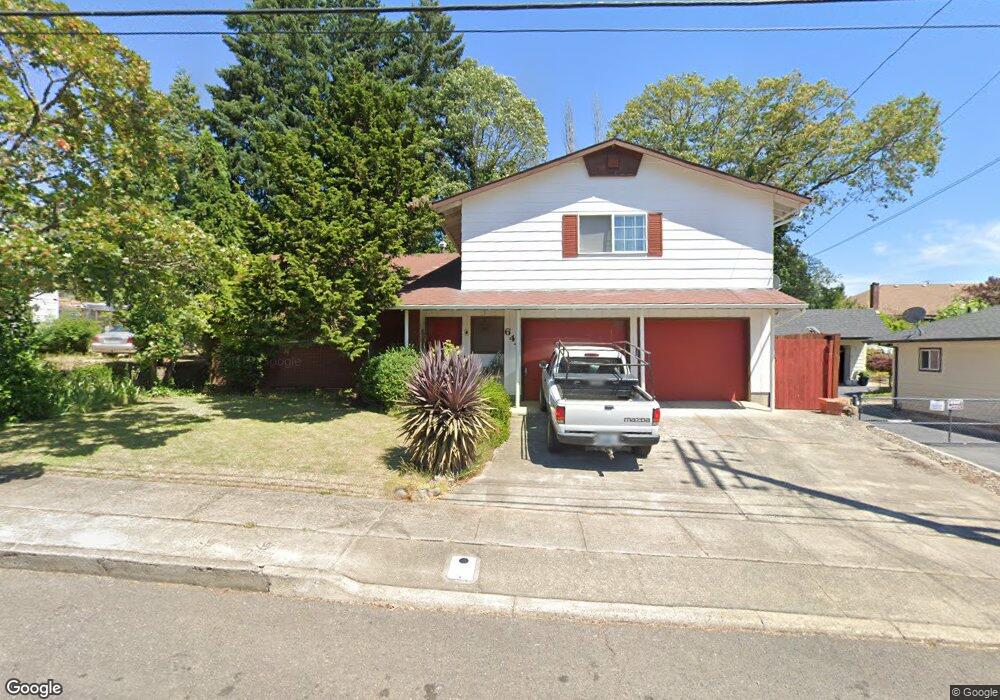
647 NE Cedar Ave Myrtle Creek, OR 97457
Estimated Value: $334,000 - $405,000
3
Beds
3
Baths
2,551
Sq Ft
$148/Sq Ft
Est. Value
About This Home
This home is located at 647 NE Cedar Ave, Myrtle Creek, OR 97457 and is currently estimated at $378,808, approximately $148 per square foot. 647 NE Cedar Ave is a home located in Douglas County with nearby schools including South Umpqua High School.
Ownership History
Date
Name
Owned For
Owner Type
Purchase Details
Closed on
Aug 17, 2015
Sold by
Ciraulo Peter A and Ciraulo Lori J
Bought by
Ciraulo Lori J
Current Estimated Value
Purchase Details
Closed on
Dec 13, 2004
Sold by
Hammond Scott E and Hammond Pamela J
Bought by
Ciraulo Peter A and Ciraulo Lori J
Home Financials for this Owner
Home Financials are based on the most recent Mortgage that was taken out on this home.
Original Mortgage
$168,625
Outstanding Balance
$83,941
Interest Rate
5.64%
Mortgage Type
Purchase Money Mortgage
Estimated Equity
$294,867
Create a Home Valuation Report for This Property
The Home Valuation Report is an in-depth analysis detailing your home's value as well as a comparison with similar homes in the area
Home Values in the Area
Average Home Value in this Area
Purchase History
| Date | Buyer | Sale Price | Title Company |
|---|---|---|---|
| Ciraulo Lori J | -- | First American Els | |
| Ciraulo Peter A | $177,500 | First American Title Ins Co |
Source: Public Records
Mortgage History
| Date | Status | Borrower | Loan Amount |
|---|---|---|---|
| Open | Ciraulo Peter A | $168,625 |
Source: Public Records
Tax History Compared to Growth
Tax History
| Year | Tax Paid | Tax Assessment Tax Assessment Total Assessment is a certain percentage of the fair market value that is determined by local assessors to be the total taxable value of land and additions on the property. | Land | Improvement |
|---|---|---|---|---|
| 2024 | $2,891 | $216,151 | -- | -- |
| 2023 | $2,807 | $209,856 | $0 | $0 |
| 2022 | $2,725 | $203,744 | $0 | $0 |
| 2021 | $2,646 | $197,810 | $0 | $0 |
| 2020 | $2,569 | $192,049 | $0 | $0 |
| 2019 | $2,494 | $186,456 | $0 | $0 |
| 2018 | $2,421 | $181,026 | $0 | $0 |
| 2017 | $2,351 | $175,754 | $0 | $0 |
| 2016 | $2,268 | $170,635 | $0 | $0 |
| 2015 | $2,202 | $165,666 | $0 | $0 |
| 2014 | $2,151 | $160,841 | $0 | $0 |
| 2013 | -- | $156,157 | $0 | $0 |
Source: Public Records
Map
Nearby Homes
- 407 NE Waite St
- 186 NE Division St
- 629 NE Johnson St
- 1056 NE Orchard Dr
- 206 NE Laurel Ave
- 728 NW Morrison Ave
- 910 NE Leon Ave
- 0 NE Orchard Dr Unit 24552379
- 769 NE Christian St
- 455 Woody Ct
- 231 Chestnut St
- 650 SE Riverside Dr
- 961 NE Broadway St
- 195 SE Mill St
- 217 SE Mill St
- 0 N Main St
- 420 SW 4th Ave
- 195 NE Sandy Terrace
- 0 NE Simpson Ln Unit 734646510
- 0 S Main St Unit 24686107
- 711 NE Cedar Ave
- 629 NE Cedar Ave
- 725 NE Cedar Ave
- 644 NE Cedar Ave
- 613 NE Cedar Ave
- 706 NE Cedar Ave
- 640 NE Cedar Ave
- 726 NE Cedar Ave
- 405 NE Division St
- 331 NE Division St
- 739 NE Cedar Ave
- 740 NE Cedar Ave
- 321 NE Division St
- 643 NE Maple Ave
- 703 NE Maple Ave
- 637 NE Maple Ave
- 713 NE Maple Ave
- 320 NE Rice St
- 625 NE Maple Ave
- 721 NE Maple Ave