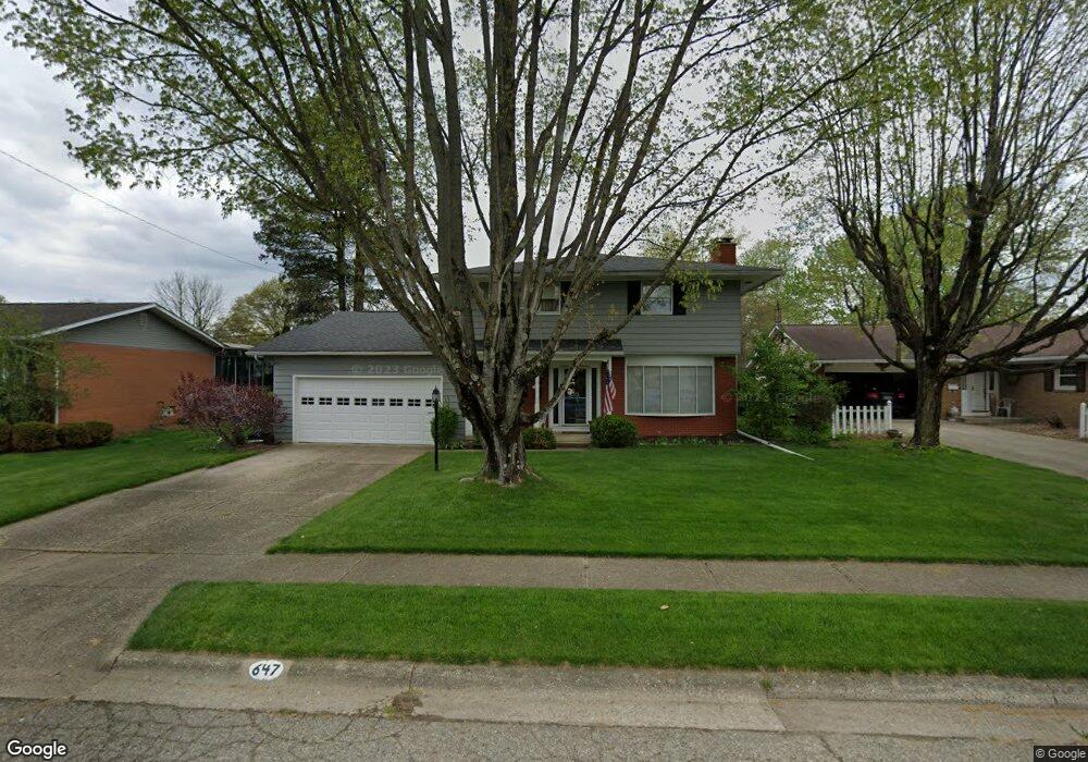
647 Robin Ln Newark, OH 43055
Estimated Value: $306,000 - $348,000
4
Beds
3
Baths
2,620
Sq Ft
$125/Sq Ft
Est. Value
About This Home
This home is located at 647 Robin Ln, Newark, OH 43055 and is currently estimated at $328,427, approximately $125 per square foot. 647 Robin Ln is a home located in Licking County with nearby schools including John Clem Elementary School, Liberty Middle School, and Newark High School.
Ownership History
Date
Name
Owned For
Owner Type
Purchase Details
Closed on
Apr 18, 2022
Sold by
Barbara A Hines Inter-Vivos Trust
Bought by
Mylin Barbara A
Current Estimated Value
Purchase Details
Closed on
Jul 21, 2016
Sold by
David M Odaniel
Bought by
Mylin Thomas and Mylin Barbara
Home Financials for this Owner
Home Financials are based on the most recent Mortgage that was taken out on this home.
Original Mortgage
$58,000
Interest Rate
3.45%
Create a Home Valuation Report for This Property
The Home Valuation Report is an in-depth analysis detailing your home's value as well as a comparison with similar homes in the area
Home Values in the Area
Average Home Value in this Area
Purchase History
| Date | Buyer | Sale Price | Title Company |
|---|---|---|---|
| Mylin Barbara A | -- | -- | |
| Mylin Thomas | -- | -- |
Source: Public Records
Mortgage History
| Date | Status | Borrower | Loan Amount |
|---|---|---|---|
| Previous Owner | Mylin Thomas | $58,000 | |
| Previous Owner | Mylin Thomas | -- |
Source: Public Records
Tax History
| Year | Tax Paid | Tax Assessment Tax Assessment Total Assessment is a certain percentage of the fair market value that is determined by local assessors to be the total taxable value of land and additions on the property. | Land | Improvement |
|---|---|---|---|---|
| 2024 | $2,731 | $86,180 | $18,030 | $68,150 |
| 2023 | $2,748 | $86,180 | $18,030 | $68,150 |
| 2022 | $1,971 | $57,900 | $10,260 | $47,640 |
| 2021 | $2,067 | $57,900 | $10,260 | $47,640 |
| 2020 | $2,117 | $57,900 | $10,260 | $47,640 |
| 2019 | $1,665 | $46,000 | $7,880 | $38,120 |
| 2018 | $1,666 | $0 | $0 | $0 |
| 2017 | $1,635 | $0 | $0 | $0 |
| 2016 | $1,638 | $0 | $0 | $0 |
| 2015 | $1,674 | $0 | $0 | $0 |
| 2014 | $2,663 | $0 | $0 | $0 |
| 2013 | $1,783 | $0 | $0 | $0 |
Source: Public Records
Map
Nearby Homes
- 469 King Ct
- 584 Moull St Unit A
- 946 Lateglow Ct
- 189 N Quentin Rd
- 222 Bachmann Ave
- 476 W Shields St
- 188 Meadow Dr
- 184 Meadow Dr
- 632 Moull St
- 1008 Kingsbury Ct Unit 1008
- 792 Stone Ridge Way Unit 792
- 655 Evans St
- 158 English Ave
- 15 W Postal Ave
- 34 Charles St
- 385 Woods Ave
- 565 Granville St
- 49 E Channel St
- 355 Eddy St
- 574 Blakeley Place Unit 574
- 641 Robin Ln
- 651 Robin Ln
- 648 Canterbury Ct
- 654 Canterbury Ct
- 657 Robin Ln
- 635 Robin Ln
- 640 Canterbury Ct
- 652 Robin Ln
- 634 Canterbury Ct
- 638 Robin Ln
- 627 Robin Ln
- 658 Canterbury Ct
- 656 Robin Ln
- 634 Robin Ln
- 626 Canterbury Ct
- 660 Robin Ln
- 429 Catalina Dr
- 422 Alford Dr
- 649 Canterbury Ct
- 419 Catalina Dr
Your Personal Tour Guide
Ask me questions while you tour the home.