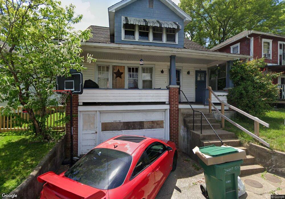
647 Washington Ave Unit 649 Clarksburg, WV 26301
Estimated Value: $83,000 - $484,311
4
Beds
2
Baths
1,729
Sq Ft
$120/Sq Ft
Est. Value
About This Home
This home is located at 647 Washington Ave Unit 649, Clarksburg, WV 26301 and is currently estimated at $207,078, approximately $119 per square foot. 647 Washington Ave Unit 649 is a home located in Harrison County with nearby schools including St. Mary's Grade School, Emmanuel Christian School, and Notre Dame Middle School and Notre Dame High School.
Ownership History
Date
Name
Owned For
Owner Type
Purchase Details
Closed on
May 11, 2022
Sold by
Rm Enterprises Llc
Bought by
Payne Ebony N D
Current Estimated Value
Purchase Details
Closed on
Jun 13, 2006
Sold by
Rollins Robert F and Rollins Suea A
Bought by
R M Enterprises Llc
Home Financials for this Owner
Home Financials are based on the most recent Mortgage that was taken out on this home.
Original Mortgage
$50,000
Interest Rate
6.58%
Create a Home Valuation Report for This Property
The Home Valuation Report is an in-depth analysis detailing your home's value as well as a comparison with similar homes in the area
Home Values in the Area
Average Home Value in this Area
Purchase History
| Date | Buyer | Sale Price | Title Company |
|---|---|---|---|
| Payne Ebony N D | -- | Siegrist & White Pllc | |
| Payne Ebony N D | -- | None Listed On Document | |
| R M Enterprises Llc | $50,000 | None Available |
Source: Public Records
Mortgage History
| Date | Status | Borrower | Loan Amount |
|---|---|---|---|
| Previous Owner | R M Enterprises Llc | $50,000 |
Source: Public Records
Tax History Compared to Growth
Tax History
| Year | Tax Paid | Tax Assessment Tax Assessment Total Assessment is a certain percentage of the fair market value that is determined by local assessors to be the total taxable value of land and additions on the property. | Land | Improvement |
|---|---|---|---|---|
| 2025 | $730 | $23,700 | $5,760 | $17,940 |
| 2024 | $730 | $22,320 | $5,760 | $16,560 |
| 2023 | $679 | $33,720 | $5,760 | $27,960 |
| 2022 | $1,040 | $33,480 | $5,760 | $27,720 |
| 2021 | $1,020 | $33,120 | $5,760 | $27,360 |
| 2020 | $1,001 | $32,760 | $5,760 | $27,000 |
| 2019 | $996 | $32,580 | $5,760 | $26,820 |
| 2018 | $982 | $32,220 | $5,760 | $26,460 |
| 2017 | $964 | $31,740 | $5,760 | $25,980 |
| 2016 | $910 | $30,240 | $4,800 | $25,440 |
| 2015 | $895 | $29,640 | $4,800 | $24,840 |
| 2014 | $846 | $28,020 | $3,540 | $24,480 |
Source: Public Records
Map
Nearby Homes
- 439 S Chestnut St
- 614 W Main St
- 31 cupid dr Cupid Dr
- 124 N Chestnut St
- 247 Park Blvd
- 655/655 1/2 Mulberry Ave
- 645 Mulberry Ave
- 735 Mulberry Ave
- 342 Lee Ave
- 311 Stealey Ave
- 328.5 Milford St
- 505 S 3rd St
- 150 Coleman Ave
- 949 Washburn St
- 179 Elliot St
- 426 Duff Ave
- 312 Clark St
- 992 W Pike St
- 511 Milford St
- 210 Bond St
- 651 Washington Ave
- 645 Washington Ave
- 128 Dodge Ct
- 130 Dodge Ct
- 317 Sumner St
- 643 Washington Ave
- 646 Washington Ave
- 648 Washington Ave
- 315 Sumner St
- 705 Washington Ave
- 122 Dodge Ct
- 313 Sumner St
- 639 Washington Ave
- 316 Sumner St
- 118 Dodge Ct
- 633 Dale Ave
- 637 Dale Ave
- 707 Washington Ave
- 641 Dale Ave
- 633 Washington Ave