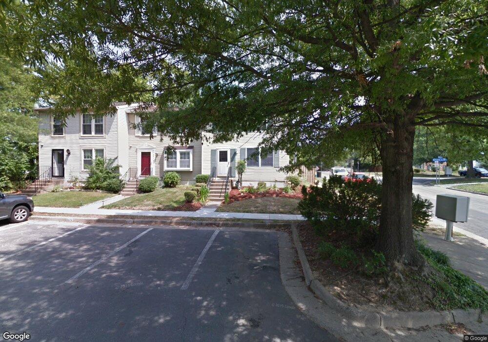
6470 Merritt Ct Alexandria, VA 22312
Estimated Value: $551,502 - $606,000
3
Beds
4
Baths
1,220
Sq Ft
$471/Sq Ft
Est. Value
About This Home
This home is located at 6470 Merritt Ct, Alexandria, VA 22312 and is currently estimated at $574,126, approximately $470 per square foot. 6470 Merritt Ct is a home located in Fairfax County with nearby schools including Columbia Elementary School, Holmes Middle School, and Annandale High School.
Ownership History
Date
Name
Owned For
Owner Type
Purchase Details
Closed on
Feb 24, 2006
Sold by
Bristol Michael E
Bought by
Jalloh Latisha N
Current Estimated Value
Home Financials for this Owner
Home Financials are based on the most recent Mortgage that was taken out on this home.
Original Mortgage
$334,800
Outstanding Balance
$189,215
Interest Rate
6.17%
Mortgage Type
New Conventional
Estimated Equity
$384,911
Purchase Details
Closed on
Jun 13, 1996
Sold by
Lyell David R
Bought by
Capitano Cataldo D
Home Financials for this Owner
Home Financials are based on the most recent Mortgage that was taken out on this home.
Original Mortgage
$142,500
Interest Rate
7.97%
Create a Home Valuation Report for This Property
The Home Valuation Report is an in-depth analysis detailing your home's value as well as a comparison with similar homes in the area
Home Values in the Area
Average Home Value in this Area
Purchase History
| Date | Buyer | Sale Price | Title Company |
|---|---|---|---|
| Jalloh Latisha N | $418,500 | -- | |
| Capitano Cataldo D | $150,000 | -- |
Source: Public Records
Mortgage History
| Date | Status | Borrower | Loan Amount |
|---|---|---|---|
| Open | Jalloh Latisha N | $334,800 | |
| Previous Owner | Capitano Cataldo D | $142,500 |
Source: Public Records
Tax History Compared to Growth
Tax History
| Year | Tax Paid | Tax Assessment Tax Assessment Total Assessment is a certain percentage of the fair market value that is determined by local assessors to be the total taxable value of land and additions on the property. | Land | Improvement |
|---|---|---|---|---|
| 2025 | $5,556 | $518,590 | $165,000 | $353,590 |
| 2024 | $5,556 | $479,580 | $155,000 | $324,580 |
| 2023 | $5,173 | $458,370 | $150,000 | $308,370 |
| 2022 | $5,015 | $438,560 | $135,000 | $303,560 |
| 2021 | $4,731 | $403,140 | $125,000 | $278,140 |
| 2020 | $4,658 | $393,600 | $125,000 | $268,600 |
| 2019 | $4,289 | $362,410 | $118,000 | $244,410 |
| 2018 | $4,133 | $359,410 | $115,000 | $244,410 |
| 2017 | $3,928 | $338,290 | $106,000 | $232,290 |
| 2016 | $3,919 | $338,290 | $106,000 | $232,290 |
| 2015 | $3,646 | $326,740 | $99,000 | $227,740 |
| 2014 | $3,352 | $301,010 | $99,000 | $202,010 |
Source: Public Records
Map
Nearby Homes
- 4801 Seminole Ave
- 6469 Second St
- 6438 Fifth St
- 6364 Evangeline Ln
- 4427 Brookside Dr
- 6309 Seventh St
- 6525 Tartan Vista Dr
- 4925 Lincoln Ave
- 4720 Minor Cir
- 4600 Kling Dr
- 4214 Pine Ln
- 4614 Kling Dr
- 6425 Montrose St
- 6352 Hillcrest Place
- 1045 Rynex Dr
- 4211 Downing St
- 6300 Manchester Way
- 6542 Cypress Point Rd
- 4609 Willow Run Dr
- 6615 Locust Way
- 6472 Merritt Ct
- 6474 Merritt Ct
- 6465 Autumn Glen Ct
- 6463 Autumn Glen Ct
- 6461 Autumn Glen Ct
- 6459 Autumn Glen Ct
- 6471 Merritt Ct
- 6473 Merritt Ct
- 6475 Merritt Ct
- 6462 Autumn Glen Ct
- 6457 Autumn Glen Ct
- 6460 Autumn Glen Ct
- 6455 Autumn Glen Ct
- 6458 Autumn Glen Ct
- 6453 Autumn Glen Ct
- 6456 Autumn Glen Ct
- 4700 Merritt Rd
- 4601 Green Spring Rd
- 6454 Autumn Glen Ct
- 6451 Autumn Glen Ct