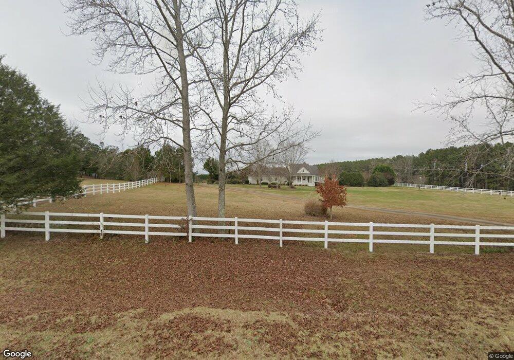
6470 Old West Point Rd Lagrange, GA 30240
Estimated Value: $381,000 - $426,000
3
Beds
3
Baths
2,749
Sq Ft
$149/Sq Ft
Est. Value
About This Home
This home is located at 6470 Old West Point Rd, Lagrange, GA 30240 and is currently estimated at $408,943, approximately $148 per square foot. 6470 Old West Point Rd is a home located in Troup County with nearby schools including Long Cane Elementary School, Whitesville Road Elementary School, and Berta Weathersbee Elementary School.
Ownership History
Date
Name
Owned For
Owner Type
Purchase Details
Closed on
Apr 6, 2011
Sold by
Grice Perry Glenn
Bought by
Grice Perry Glenn
Current Estimated Value
Purchase Details
Closed on
Sep 2, 2003
Sold by
Cumberland National Bank
Bought by
Grice Perry Glenn and Linda Gail
Purchase Details
Closed on
Jul 11, 2003
Sold by
Shannon Mark H
Bought by
Cumberland National Bank
Purchase Details
Closed on
Jul 27, 2000
Sold by
Dana M Langford
Bought by
Shannon Mark H
Purchase Details
Closed on
Feb 22, 1999
Sold by
Wm Arrington
Bought by
Dana M Langford
Purchase Details
Closed on
Aug 21, 1992
Sold by
Turner R
Bought by
Wm Arrington
Create a Home Valuation Report for This Property
The Home Valuation Report is an in-depth analysis detailing your home's value as well as a comparison with similar homes in the area
Purchase History
We collect this data history from publicly available records. To have your information removed, we recommend requesting removal directly through your county’s website.
| Date | Buyer | Sale Price | Title Company |
|---|---|---|---|
| Grice Perry Glenn | -- | -- | |
| Grice Perry Glenn | $210,000 | -- | |
| Cumberland National Bank | -- | -- | |
| Shannon Mark H | $230,000 | -- | |
| Dana M Langford | $188,000 | -- | |
| Wm Arrington | $24,300 | -- |
Source: Public Records
Tax History
| Year | Tax Paid | Tax Assessment Tax Assessment Total Assessment is a certain percentage of the fair market value that is determined by local assessors to be the total taxable value of land and additions on the property. | Land | Improvement |
|---|---|---|---|---|
| 2025 | $3,620 | $139,164 | $22,920 | $116,244 |
| 2024 | $3,401 | $126,680 | $22,920 | $103,760 |
| 2023 | $3,455 | $128,680 | $22,920 | $105,760 |
| 2022 | $3,314 | $120,720 | $22,920 | $97,800 |
| 2021 | $3,201 | $108,120 | $19,200 | $88,920 |
| 2020 | $3,201 | $108,120 | $19,200 | $88,920 |
| 2019 | $3,135 | $105,920 | $19,200 | $86,720 |
| 2018 | $2,898 | $98,080 | $19,200 | $78,880 |
| 2017 | $2,404 | $98,080 | $19,200 | $78,880 |
| 2016 | $2,372 | $97,098 | $19,203 | $77,895 |
| 2015 | $2,313 | $95,083 | $19,203 | $75,880 |
| 2014 | $2,315 | $95,083 | $19,203 | $75,880 |
| 2013 | -- | $95,083 | $19,203 | $75,880 |
Source: Public Records
Map
Nearby Homes
- 2663-2683 W Point Rd
- 5047 W Point Rd
- 3658 W Point Rd
- 102 Bridgewater Dr
- 105 Redwood Dr
- 801 Glass Bridge Rd
- 107 Waters Edge Dr
- 1054 Glass Bridge Rd
- 104 Independence Ct
- 22 Freeman Rd
- 311 Cumberland Dr
- 1358 Glass Bridge Rd
- 6 Hastings Ct
- 101 Ivy Springs Dr
- 300 Cumberland Dr
- 245 Teaver Rd
- 20 Hill Rd
- 36 Hill Rd
- 82 Newton Rd
- 5714 W Point Rd
- 6396 Old West Point Rd
- 6478 Old West Point Rd
- 6545 Old West Point Rd
- 4417 West Point Rd
- 4417 West Point Rd
- 6576 Old West Point Rd
- 6249 Old West Point Rd
- 6314 Old West Point Rd
- 6278 Old West Point Rd
- 6616 Old West Point Rd
- 4475 West Point Rd
- 6658 Old West Point Rd
- 6144 Old West Point Rd
- 4625 West Point Rd
- 6100 Old West Point Rd
- 6171 Old West Point Rd
- 4506 West Point Rd
- 4504 West Point Rd
- 107 acres Co Rd 222
- 1635 Cannonville Rd
Your Personal Tour Guide
Ask me questions while you tour the home.