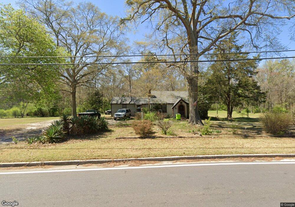
6470 S Gordon Rd Austell, GA 30168
Estimated Value: $296,000 - $555,931
3
Beds
1
Bath
2,308
Sq Ft
$175/Sq Ft
Est. Value
About This Home
This home is located at 6470 S Gordon Rd, Austell, GA 30168 and is currently estimated at $403,310, approximately $174 per square foot. 6470 S Gordon Rd is a home located in Cobb County with nearby schools including Bryant Elementary School, Lindley Middle School, and Pebblebrook High School.
Ownership History
Date
Name
Owned For
Owner Type
Purchase Details
Closed on
Mar 1, 2021
Sold by
Adams Michael
Bought by
Adams Rhonda and Adams Michael
Current Estimated Value
Purchase Details
Closed on
Jul 31, 2014
Sold by
Kronos Resources Llc
Bought by
Adams Michael
Home Financials for this Owner
Home Financials are based on the most recent Mortgage that was taken out on this home.
Original Mortgage
$71,677
Outstanding Balance
$54,596
Interest Rate
4.16%
Mortgage Type
FHA
Estimated Equity
$348,714
Purchase Details
Closed on
Feb 8, 2012
Sold by
Dodgen Roger E
Bought by
Estate Recoveries Llc
Purchase Details
Closed on
Jan 31, 2012
Sold by
Dodge Jon P
Bought by
Estate Recoveries Llc
Purchase Details
Closed on
Dec 7, 2010
Sold by
Tax Commissioner & Ex-Officio
Bought by
Kronos Resources Llc
Create a Home Valuation Report for This Property
The Home Valuation Report is an in-depth analysis detailing your home's value as well as a comparison with similar homes in the area
Home Values in the Area
Average Home Value in this Area
Purchase History
| Date | Buyer | Sale Price | Title Company |
|---|---|---|---|
| Adams Rhonda | -- | None Available | |
| Adams Michael | $73,000 | -- | |
| Estate Recoveries Llc | -- | -- | |
| Estate Recoveries Llc | -- | -- | |
| Kronos Resources Llc | $137,000 | -- |
Source: Public Records
Mortgage History
| Date | Status | Borrower | Loan Amount |
|---|---|---|---|
| Open | Adams Michael | $71,677 |
Source: Public Records
Tax History Compared to Growth
Tax History
| Year | Tax Paid | Tax Assessment Tax Assessment Total Assessment is a certain percentage of the fair market value that is determined by local assessors to be the total taxable value of land and additions on the property. | Land | Improvement |
|---|---|---|---|---|
| 2025 | $718 | $219,576 | $159,600 | $59,976 |
| 2024 | $722 | $219,576 | $159,600 | $59,976 |
| 2023 | $503 | $208,380 | $159,600 | $48,780 |
| 2022 | $486 | $140,676 | $100,800 | $39,876 |
| 2021 | $2,296 | $120,868 | $87,360 | $33,508 |
| 2020 | $2,249 | $100,708 | $67,200 | $33,508 |
| 2019 | $2,249 | $100,708 | $67,200 | $33,508 |
| 2018 | $1,545 | $68,568 | $38,640 | $29,928 |
| 2017 | $1,045 | $47,644 | $25,200 | $22,444 |
| 2016 | $1,047 | $47,644 | $25,200 | $22,444 |
| 2015 | $600 | $29,200 | $12,040 | $17,160 |
| 2014 | $1,116 | $37,552 | $0 | $0 |
Source: Public Records
Map
Nearby Homes
- 1151 S Gordon Rd
- 1972 Cox Dr Unit 5
- 1784 Brandemere Dr Unit 3
- 6445 Sherwood Trail
- 6581 Coventry Point Unit 1
- 2072 Woodbine Cir
- 6718 Roscommon Dr
- 6627 Coventry Point
- 1576 S Gordon Rd
- 6651 Malvin Dr
- 2023 Lee Dr
- 0 Maxham Rd Unit 10652291
- 6084 S Gordon Rd
- 1550 Greenbrook Dr
- 6083 Oak Hill Dr
- 6992 Ivy Pointe Row
- 1766 Blossom Ln
- 6243 David Ln SW
- 6736 Ivy Log Dr
- 1852 S Gordon Rd
- 1862 S Gordon Rd
- 1842 S Gordon Rd
- 6440 S Gordon Rd
- 1872 Cardell Rd
- 1860 Cardell Rd
- 1872 S Gordon Rd Unit 1
- 1888 Cardell Rd
- 1832 S Gordon Rd
- 6430 S Gordon Rd
- 1701 Cox Dr
- 0 Old Alabama Rd Cardell Rd Rd Unit 7414982
- 0 Old Alabama Rd Cardell Rd Rd Unit 7348045
- 0 Old Alabama Rd Cardell Rd Rd Unit 7269495
- 6310 Milo Dr
- 6306 Milo Dr
- 0.4A S Gordon Rd
- 0.7A S Gordon Rd
- 1311 S Gordon Rd
- 1900 Cardell Rd