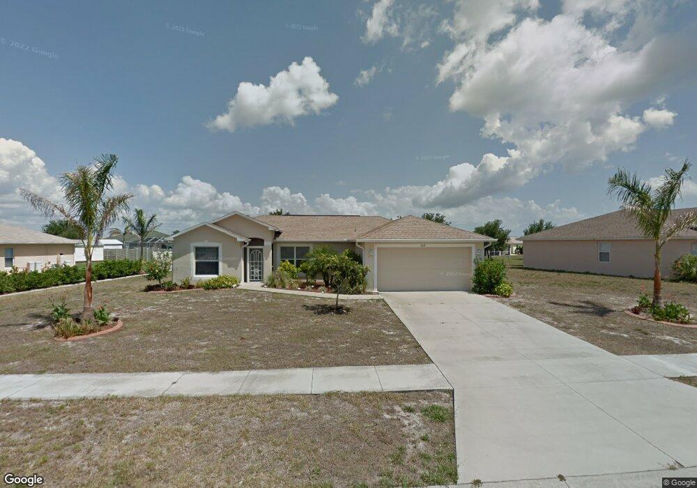
6471 Thorman Rd Port Charlotte, FL 33981
Gulf Cove NeighborhoodEstimated Value: $248,000 - $304,000
3
Beds
2
Baths
1,392
Sq Ft
$204/Sq Ft
Est. Value
About This Home
This home is located at 6471 Thorman Rd, Port Charlotte, FL 33981 and is currently estimated at $284,124, approximately $204 per square foot. 6471 Thorman Rd is a home located in Charlotte County with nearby schools including Myakka River Elementary School, L.A. Ainger Middle School, and Lemon Bay High School.
Ownership History
Date
Name
Owned For
Owner Type
Purchase Details
Closed on
Apr 24, 2025
Sold by
Smith Robert W
Bought by
Robert W And Kyla M Smith Revocable Trust and Smith
Current Estimated Value
Purchase Details
Closed on
Apr 16, 2020
Sold by
Chiesa Paula
Bought by
Smith Robert W
Home Financials for this Owner
Home Financials are based on the most recent Mortgage that was taken out on this home.
Original Mortgage
$189,000
Interest Rate
3.2%
Mortgage Type
New Conventional
Purchase Details
Closed on
Jul 28, 2005
Sold by
Halstead Martha E and Haltead Jerry E
Bought by
Chiesa Paula
Purchase Details
Closed on
May 11, 2004
Sold by
Holiday Builders Inc
Bought by
Halstead Martha E
Create a Home Valuation Report for This Property
The Home Valuation Report is an in-depth analysis detailing your home's value as well as a comparison with similar homes in the area
Home Values in the Area
Average Home Value in this Area
Purchase History
| Date | Buyer | Sale Price | Title Company |
|---|---|---|---|
| Robert W And Kyla M Smith Revocable Trust | $100 | None Listed On Document | |
| Smith Robert W | $219,000 | First International Ttl Inc | |
| Chiesa Paula | $239,900 | Lawyers Title Ins | |
| Halstead Martha E | $122,300 | Lawyers Title Insurance Corp |
Source: Public Records
Mortgage History
| Date | Status | Borrower | Loan Amount |
|---|---|---|---|
| Previous Owner | Smith Robert W | $189,000 |
Source: Public Records
Tax History Compared to Growth
Tax History
| Year | Tax Paid | Tax Assessment Tax Assessment Total Assessment is a certain percentage of the fair market value that is determined by local assessors to be the total taxable value of land and additions on the property. | Land | Improvement |
|---|---|---|---|---|
| 2024 | $2,680 | $183,364 | -- | -- |
| 2023 | $2,680 | $155,122 | $0 | $0 |
| 2022 | $2,994 | $172,838 | $0 | $0 |
| 2021 | $2,986 | $167,804 | $10,625 | $157,179 |
| 2020 | $3,485 | $158,127 | $10,200 | $147,927 |
| 2019 | $3,457 | $158,440 | $10,200 | $148,240 |
| 2018 | $2,894 | $153,986 | $10,200 | $143,786 |
| 2017 | $2,732 | $143,670 | $6,715 | $136,955 |
| 2016 | $2,551 | $117,346 | $0 | $0 |
| 2015 | $2,304 | $106,678 | $0 | $0 |
| 2014 | $2,418 | $110,857 | $0 | $0 |
Source: Public Records
Map
Nearby Homes
- 13284 Buckett Cir
- 6219 Coliseum Blvd
- 13316 Darnell Ave
- 13367 Darnell Ave
- 12475 Sunniland Ave
- 13301 Foresman Blvd
- 13309 Foresman Blvd
- 13264 Foresman Blvd
- 13208 Foresman Blvd
- 13280 Foresman Blvd
- 13144 Eureka Lot 18 Cir
- 13384 Darnell Ave
- 6322 Thorman Rd
- 6030 Broker Ct
- 13266 Drysdale Ave
- 6294 Thorman Rd
- 13366 Bronze Ave
- 13273 Fowler Ave
- 13360 Foresman Blvd
- 13363 Drysdale Ave
- 6481 Thorman Rd
- 13300 Buckett Cir
- 13308 Buckett Cir
- 6451 Thorman Rd
- 6491 Thorman Rd
- 13292 Buckett Cir
- 6101 Dime Ct
- 6482 Thorman Rd
- 6460 Thorman Rd
- 13316 Buckett Cir
- 6488 Thorman Rd
- 6100 Dime Ct
- 6441 Thorman Rd
- 6499 Thorman Rd
- 6452 Thorman Rd
- 6089 Dime Ct
- 13305 Buckett Cir
- 6494 Thorman Rd
- 6094 Dime Ct
- 6446 Thorman Rd