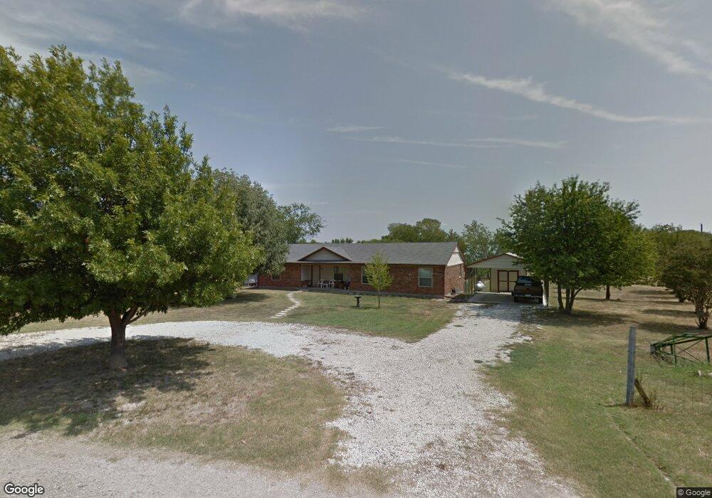
6474 Bear Run Dr Sanger, TX 76266
Estimated Value: $308,042 - $459,000
--
Bed
--
Bath
1,725
Sq Ft
$226/Sq Ft
Est. Value
About This Home
This home is located at 6474 Bear Run Dr, Sanger, TX 76266 and is currently estimated at $389,511, approximately $225 per square foot. 6474 Bear Run Dr is a home with nearby schools including Chisholm Trail Elementary School, Clear Creek Intermediate School, and Sanger Sixth Grade Campus.
Ownership History
Date
Name
Owned For
Owner Type
Purchase Details
Closed on
Oct 23, 2006
Sold by
Davis Craig A and Davis Adele
Bought by
Lee Billy R
Current Estimated Value
Home Financials for this Owner
Home Financials are based on the most recent Mortgage that was taken out on this home.
Original Mortgage
$63,092
Outstanding Balance
$37,544
Interest Rate
6.41%
Mortgage Type
Purchase Money Mortgage
Estimated Equity
$351,967
Purchase Details
Closed on
Jul 1, 1999
Sold by
Parten Quinten and Parten Sandra
Bought by
Davis Craig A and Davis Adele
Home Financials for this Owner
Home Financials are based on the most recent Mortgage that was taken out on this home.
Original Mortgage
$64,966
Interest Rate
7.21%
Mortgage Type
FHA
Create a Home Valuation Report for This Property
The Home Valuation Report is an in-depth analysis detailing your home's value as well as a comparison with similar homes in the area
Home Values in the Area
Average Home Value in this Area
Purchase History
| Date | Buyer | Sale Price | Title Company |
|---|---|---|---|
| Lee Billy R | -- | Denton Co Title Co | |
| Davis Craig A | -- | -- |
Source: Public Records
Mortgage History
| Date | Status | Borrower | Loan Amount |
|---|---|---|---|
| Open | Lee Billy R | $63,092 | |
| Previous Owner | Davis Craig A | $64,966 |
Source: Public Records
Tax History Compared to Growth
Tax History
| Year | Tax Paid | Tax Assessment Tax Assessment Total Assessment is a certain percentage of the fair market value that is determined by local assessors to be the total taxable value of land and additions on the property. | Land | Improvement |
|---|---|---|---|---|
| 2025 | $299 | $208,638 | $136,379 | $72,259 |
| 2024 | $2,705 | $199,290 | $0 | $0 |
| 2023 | $237 | $177,283 | $136,379 | $123,942 |
| 2022 | $2,684 | $161,822 | $61,005 | $102,763 |
| 2021 | $2,145 | $147,023 | $55,995 | $91,028 |
| 2020 | $2,264 | $144,129 | $55,995 | $88,593 |
| 2019 | $2,144 | $131,000 | $55,995 | $93,446 |
| 2018 | $1,964 | $119,124 | $29,121 | $90,003 |
| 2017 | $1,876 | $112,973 | $29,121 | $87,363 |
| 2016 | $588 | $102,738 | $29,121 | $80,763 |
| 2015 | $654 | $93,457 | $29,121 | $77,219 |
| 2013 | -- | $77,197 | $29,121 | $61,524 |
Source: Public Records
Map
Nearby Homes
- 6552 Private Rd 6601
- 8875 Fm 2450
- 14158 Crest View Rd
- TBD Michael Rd
- 6568 Michael Rd
- 6221 Deer Run Rd
- 6044 Mango Dr
- 6048 Mango Dr
- 6400 Ridgerock Dr
- 6033 Mango Dr
- 6807 Sam Bass Rd
- 7236 Davidson Rd
- . Fm 2450 & Indian Trail
- 6501 Indian Trail
- 6713 Mustang Trail
- 9191 Lamar St
- 10916 Fm 2450
- 8167 Houston
- 5990 Farm To Market 455 W
- 6000 Fm 455 W
- 6463 Bear Run Dr
- 21.3654 Acres Bear Run Dr
- 6500 Bear Run Dr
- TBD Bear Run Dr
- 6504 Bear Run Dr
- 8984 Fm 2450
- 26AC Davidson Rd
- 8873 Fm 2450
- 00 Private Road 6601
- 27AC Davidson Rd
- 8913 Fm 2450
- 8799 Fm 2450
- FM 2450
- 6458 Private Road 6601
- 6458 Pr6601
- 8773 Fm 2450
- 8841 Fm 2450
- 9015 Fm 2450
- 0 Davidson Rd Unit 20039474
- 9029 Fm 2450