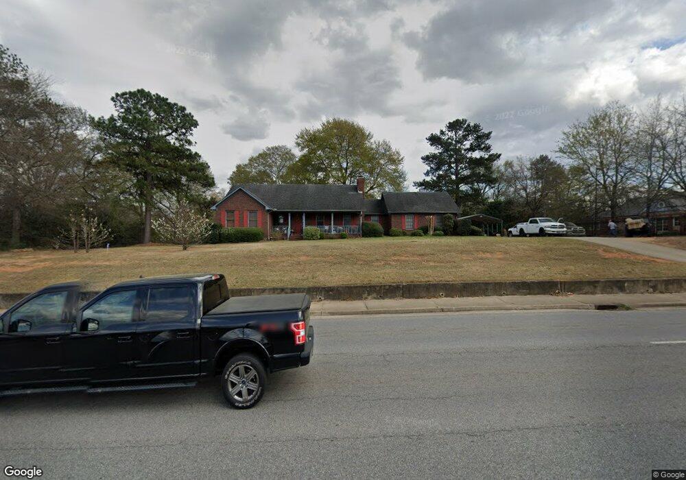
6474 Houston Rd Macon, GA 31216
Estimated Value: $259,655 - $297,000
3
Beds
2
Baths
2,047
Sq Ft
$132/Sq Ft
Est. Value
About This Home
This home is located at 6474 Houston Rd, Macon, GA 31216 and is currently estimated at $269,914, approximately $131 per square foot. 6474 Houston Rd is a home located in Bibb County with nearby schools including Heard Elementary School, Rutland Middle School, and Rutland High School.
Ownership History
Date
Name
Owned For
Owner Type
Purchase Details
Closed on
Dec 17, 2021
Sold by
H & H Properties
Bought by
Hulett Investment Properties Llc
Current Estimated Value
Purchase Details
Closed on
Aug 15, 2011
Sold by
Kirkpatrick Cynthia H
Bought by
H & H Properties
Purchase Details
Closed on
Aug 19, 2008
Sold by
Davenport Jerry J and Davenport Judy B
Bought by
Kirkpatrick Cynthia H
Purchase Details
Closed on
Jan 9, 1998
Bought by
Davenport Jerry J and Davenport Judy B
Create a Home Valuation Report for This Property
The Home Valuation Report is an in-depth analysis detailing your home's value as well as a comparison with similar homes in the area
Home Values in the Area
Average Home Value in this Area
Purchase History
| Date | Buyer | Sale Price | Title Company |
|---|---|---|---|
| Hulett Investment Properties Llc | -- | None Available | |
| H & H Properties | $50,000 | None Available | |
| Kirkpatrick Cynthia H | $140,000 | None Available | |
| Davenport Jerry J | $112,000 | -- |
Source: Public Records
Tax History Compared to Growth
Tax History
| Year | Tax Paid | Tax Assessment Tax Assessment Total Assessment is a certain percentage of the fair market value that is determined by local assessors to be the total taxable value of land and additions on the property. | Land | Improvement |
|---|---|---|---|---|
| 2025 | $2,266 | $92,231 | $4,843 | $87,388 |
| 2024 | $2,335 | $91,956 | $4,843 | $87,113 |
| 2023 | $2,335 | $91,956 | $4,843 | $87,113 |
| 2022 | $2,648 | $76,488 | $8,854 | $67,634 |
| 2021 | $2,369 | $62,328 | $8,854 | $53,474 |
| 2020 | $2,420 | $62,328 | $8,854 | $53,474 |
| 2019 | $2,341 | $59,800 | $8,854 | $50,946 |
| 2018 | $3,462 | $54,743 | $8,854 | $45,889 |
| 2017 | $2,051 | $54,743 | $8,854 | $45,889 |
| 2016 | $1,881 | $54,375 | $8,854 | $45,521 |
| 2015 | $2,663 | $54,375 | $8,854 | $45,521 |
| 2014 | $2,667 | $54,375 | $8,854 | $45,521 |
Source: Public Records
Map
Nearby Homes
- 0 Houston Rd Unit 10572705
- 3150 Holleman Dr
- 405 Stonecrest Ct
- 6530 Bevin Dr
- 326 Thoroughbred Ln
- 0 Ponderosa Dr
- 3676 Jones Rd
- 813 Ocala National Trail
- 00 Houston Rd
- 708 Coopers Lnd
- 3720 Dean Dr
- 361 Thoroughbred Ln
- 215 Stonefield Cir
- 6045 Cara Dr
- DUPONT Plan at Quail Ridge
- GARDNER Plan at Quail Ridge
- KINGSTON Plan at Quail Ridge
- 6431 Lanford Dr
- 6445 Lanford Dr
- 6486 Whitepine Dr
- 6465 Lanford Dr
- 3320 Liberty Church Rd
- 6450 Lanford Dr
- 6474 Whitepine Dr
- 6532 Houston Rd
- 3329 Rosa Dr
- 6487 Whitepine Dr
- 6423 Houston Rd
- 6464 Whitepine Dr
- 6464 Whitepine Dr Unit 12
- 6475 Whitepine Dr Unit 16
- 6475 Whitepine Dr
- 3304 Liberty Church Rd
- 3321 Liberty Church Rd
- 6450 Whitepine Dr
- 3468 Liberty Church Rd
- 3326 Rosa Dr