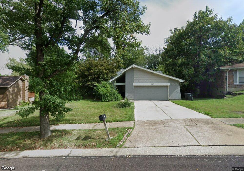
6474 Tide Water Dr Florissant, MO 63033
Estimated Value: $252,000 - $282,564
6
Beds
3
Baths
2,060
Sq Ft
$128/Sq Ft
Est. Value
About This Home
This home is located at 6474 Tide Water Dr, Florissant, MO 63033 and is currently estimated at $264,391, approximately $128 per square foot. 6474 Tide Water Dr is a home located in St. Louis County with nearby schools including Townsend Elementary School, Central Middle School, and Hazelwood Central High School.
Ownership History
Date
Name
Owned For
Owner Type
Purchase Details
Closed on
Oct 25, 2013
Sold by
Foremost Properties Llc
Bought by
Blocker Tiffany and Blocker Gilbert
Current Estimated Value
Home Financials for this Owner
Home Financials are based on the most recent Mortgage that was taken out on this home.
Original Mortgage
$184,496
Outstanding Balance
$137,277
Interest Rate
4.25%
Mortgage Type
FHA
Estimated Equity
$127,114
Purchase Details
Closed on
Apr 5, 2013
Sold by
Dehart Betty A
Bought by
Foremost Properties Llc
Purchase Details
Closed on
Oct 5, 1998
Sold by
Dehart Betty A
Bought by
Dehart Michelle Kim and Dehart Amy Nicole
Create a Home Valuation Report for This Property
The Home Valuation Report is an in-depth analysis detailing your home's value as well as a comparison with similar homes in the area
Home Values in the Area
Average Home Value in this Area
Purchase History
| Date | Buyer | Sale Price | Title Company |
|---|---|---|---|
| Blocker Tiffany | $187,900 | Community Title Services Llc | |
| Foremost Properties Llc | $36,500 | Us Title Main | |
| Dehart Michelle Kim | -- | -- |
Source: Public Records
Mortgage History
| Date | Status | Borrower | Loan Amount |
|---|---|---|---|
| Open | Blocker Tiffany | $184,496 |
Source: Public Records
Tax History Compared to Growth
Tax History
| Year | Tax Paid | Tax Assessment Tax Assessment Total Assessment is a certain percentage of the fair market value that is determined by local assessors to be the total taxable value of land and additions on the property. | Land | Improvement |
|---|---|---|---|---|
| 2025 | $4,084 | $46,680 | $4,160 | $42,520 |
| 2024 | $4,084 | $44,970 | $3,250 | $41,720 |
| 2023 | $4,069 | $44,970 | $3,250 | $41,720 |
| 2022 | $4,020 | $39,520 | $7,200 | $32,320 |
| 2021 | $3,804 | $39,520 | $7,200 | $32,320 |
| 2020 | $3,852 | $37,280 | $6,310 | $30,970 |
| 2019 | $3,790 | $37,280 | $6,310 | $30,970 |
| 2018 | $3,766 | $34,260 | $3,610 | $30,650 |
| 2017 | $3,762 | $34,260 | $3,610 | $30,650 |
| 2016 | $3,906 | $35,000 | $3,250 | $31,750 |
| 2015 | $3,816 | $35,000 | $3,250 | $31,750 |
| 2014 | $2,453 | $22,310 | $3,880 | $18,430 |
Source: Public Records
Map
Nearby Homes
- 6480 Hadden Bay Dr
- 6320 Hadden Bay Dr
- 12320 Missile Ln
- 6587 Dolphin Cir E Unit 110B
- 6595 Dolphin Cir E Unit 131A
- 12225 Tarpon Dr
- 6470 White Cap Ln Unit D
- 6250 Pennyrich Ct
- 12136 La Padera Ln
- 12750 Needle Point Ct
- 12455 Jerries Ln
- 12705 Stubwood Dr
- 12095 El Camara Dr
- 12292 Jerries Ln
- 12435 Sea Lane Dr Unit 5
- 12456 Sea Lane Dr Unit A
- 12065 El Camara Dr
- 5432 Trailbend Dr
- 12582 Springtrail Dr
- 5226 Suntrail Dr
- 6464 Tide Water Dr
- 6484 Tide Water Dr
- 6454 Tide Water Dr
- 6478 Lake Paddock Dr
- 6473 Tide Water Dr
- 6485 Hadden Bay Dr
- 6444 Tide Water Dr
- 6468 Lake Paddock Dr
- 12450 Rocket Dr
- 6443 Tide Water Dr
- 12035 Parker Estates Ct
- 6475 Hadden Bay Dr
- 12400 Rocket Dr
- 6457 Lake Paddock Dr
- 6458 Lake Paddock Dr
- 6470 Hadden Bay Dr
- 12039 Parker Estates Ct
- 6433 Tide Water Dr
- 12390 Rocket Dr
- 12031 Parker Estates Ct