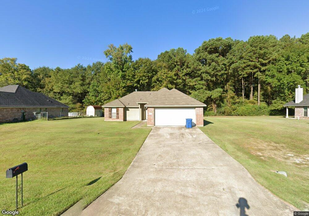
6479 Soda Point Dr Shreveport, LA 71107
Mooringsport-Brian NeighborhoodEstimated Value: $201,000 - $219,511
3
Beds
2
Baths
1,300
Sq Ft
$162/Sq Ft
Est. Value
About This Home
This home is located at 6479 Soda Point Dr, Shreveport, LA 71107 and is currently estimated at $210,878, approximately $162 per square foot. 6479 Soda Point Dr is a home with nearby schools including Mooringsport Elementary School, Judson Fundamental Elementary School, and Fairfield Magnet School.
Ownership History
Date
Name
Owned For
Owner Type
Purchase Details
Closed on
Jul 27, 2010
Sold by
E & L Development Inc
Bought by
White Kevin
Current Estimated Value
Home Financials for this Owner
Home Financials are based on the most recent Mortgage that was taken out on this home.
Original Mortgage
$146,920
Outstanding Balance
$98,203
Interest Rate
4.76%
Mortgage Type
FHA
Estimated Equity
$112,675
Create a Home Valuation Report for This Property
The Home Valuation Report is an in-depth analysis detailing your home's value as well as a comparison with similar homes in the area
Home Values in the Area
Average Home Value in this Area
Purchase History
| Date | Buyer | Sale Price | Title Company |
|---|---|---|---|
| White Kevin | $148,900 | None Available |
Source: Public Records
Mortgage History
| Date | Status | Borrower | Loan Amount |
|---|---|---|---|
| Open | White Kevin | $146,920 |
Source: Public Records
Tax History Compared to Growth
Tax History
| Year | Tax Paid | Tax Assessment Tax Assessment Total Assessment is a certain percentage of the fair market value that is determined by local assessors to be the total taxable value of land and additions on the property. | Land | Improvement |
|---|---|---|---|---|
| 2024 | $2,640 | $16,655 | $2,933 | $13,722 |
| 2023 | $2,533 | $15,558 | $2,793 | $12,765 |
| 2022 | $2,533 | $15,558 | $2,793 | $12,765 |
| 2021 | $2,535 | $15,558 | $2,793 | $12,765 |
| 2020 | $2,535 | $15,558 | $2,793 | $12,765 |
| 2019 | $2,438 | $15,070 | $2,793 | $12,277 |
| 2018 | $1,179 | $15,070 | $2,793 | $12,277 |
| 2017 | $2,408 | $15,070 | $2,793 | $12,277 |
| 2015 | $1,193 | $15,040 | $2,790 | $12,250 |
| 2014 | $1,200 | $15,040 | $2,790 | $12,250 |
| 2013 | -- | $15,040 | $2,790 | $12,250 |
Source: Public Records
Map
Nearby Homes
- 2257 Soda Lake Cir
- 4820 Bogey Ln
- 2271 Soda Lake Cir
- 8050 Highway 1
- 0 Morrow Rd
- 2286 J And j Trail
- 6980 Regatta Dr
- 6964 Emerald Bay Loop
- 6186 Pine Tree Loop
- 00 Highway 1
- 29 W Henderson Gin Rd
- 6948 N Colony Dr
- 7478 Henderson Gin Rd
- 5589 Grace Ann Ln
- 0 Mirkwood Unit 97 20698306
- 0 Mirkwood Unit 96 20698300
- 0 Mirkwood Unit 94 20698275
- 009 Castle Dale Loop
- 5577 Crystal Dr
- 8340 Old Mooringsport Rd
- 6475 Soda Point Dr
- 6483 Soda Point Dr
- 6480 Soda Point Dr
- 6487 Soda Point Dr
- 6484 Soda Point Dr
- 6488 Soda Point Dr
- 6491 Soda Point Dr
- 6492 Soda Point Dr
- 6466 Soda Point Dr
- 6938 LIV Anne Cir
- 6857 Soda Point Dr
- 6465 Soda Point Dr
- 6462 Soda Point Dr
- 6942 LIV Anne Cir
- 6860 Soda Point Dr
- 6969 Wood Duck Cir
- 6461 Soda Point Dr
- 6458 Soda Point Dr
- 6920 Bethany Reed
- 6914 Bethany Reed