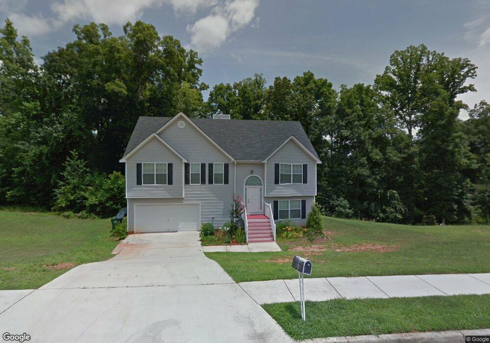
648 Michael Cir Monroe, GA 30655
Estimated Value: $329,000 - $360,000
6
Beds
3
Baths
2,546
Sq Ft
$134/Sq Ft
Est. Value
About This Home
This home is located at 648 Michael Cir, Monroe, GA 30655 and is currently estimated at $341,922, approximately $134 per square foot. 648 Michael Cir is a home located in Walton County with nearby schools including Atha Road Elementary School, Youth Middle School, and Walnut Grove High School.
Ownership History
Date
Name
Owned For
Owner Type
Purchase Details
Closed on
Jul 6, 2015
Sold by
Smith Eunice
Bought by
Ottey Maxine A
Current Estimated Value
Purchase Details
Closed on
Jul 6, 2007
Sold by
Ottey Maxine A
Bought by
Ottey Maxine A and Smith Eunice
Home Financials for this Owner
Home Financials are based on the most recent Mortgage that was taken out on this home.
Original Mortgage
$152,910
Interest Rate
8.52%
Mortgage Type
New Conventional
Purchase Details
Closed on
Jan 20, 2006
Sold by
M & M Comtys Inc
Bought by
M & M Custom Hms Inc
Home Financials for this Owner
Home Financials are based on the most recent Mortgage that was taken out on this home.
Original Mortgage
$859,200
Interest Rate
6.14%
Mortgage Type
Purchase Money Mortgage
Create a Home Valuation Report for This Property
The Home Valuation Report is an in-depth analysis detailing your home's value as well as a comparison with similar homes in the area
Home Values in the Area
Average Home Value in this Area
Purchase History
| Date | Buyer | Sale Price | Title Company |
|---|---|---|---|
| Ottey Maxine A | -- | -- | |
| Ottey Maxine A | -- | -- | |
| Ottey Maxine A | $169,900 | -- | |
| M & M Custom Hms Inc | $245,000 | -- | |
| M & M Comtys Inc | $1,050,000 | -- |
Source: Public Records
Mortgage History
| Date | Status | Borrower | Loan Amount |
|---|---|---|---|
| Previous Owner | Ottey Maxine A | $152,910 | |
| Previous Owner | M & M Comtys Inc | $859,200 |
Source: Public Records
Tax History
| Year | Tax Paid | Tax Assessment Tax Assessment Total Assessment is a certain percentage of the fair market value that is determined by local assessors to be the total taxable value of land and additions on the property. | Land | Improvement |
|---|---|---|---|---|
| 2025 | $4,467 | $131,400 | $22,000 | $109,400 |
| 2024 | $4,217 | $126,400 | $22,000 | $104,400 |
| 2023 | $4,382 | $125,320 | $22,000 | $103,320 |
| 2022 | $3,797 | $101,680 | $17,200 | $84,480 |
| 2021 | $2,764 | $71,520 | $13,200 | $58,320 |
| 2020 | $2,627 | $66,240 | $12,400 | $53,840 |
| 2019 | $2,538 | $57,600 | $12,000 | $45,600 |
| 2018 | $2,268 | $57,600 | $12,000 | $45,600 |
| 2017 | $2,045 | $48,800 | $8,000 | $40,800 |
| 2016 | $2,005 | $48,640 | $8,000 | $40,640 |
| 2015 | $1,786 | $42,560 | $8,000 | $34,560 |
| 2014 | $1,478 | $34,200 | $0 | $0 |
Source: Public Records
Map
Nearby Homes
- 661 Michael Cir
- 720 Overlook Crest
- 675 Michael Cir
- 679 Michael Cir
- 943 Masters Dr Unit 2
- 925 Tigers Way
- 509 Mill Farm Ln
- 921 Horizon Ct
- 631 St Ives Walk
- 810 Hampton
- 911 Woodchase Dr
- 299 Claiborne Way
- 506 Breedlove Dr
- 505 Breedlove Dr
- 823 Legends Dr
- 306 Calumet Ln
- 250 Martin Luther King Junior Blvd
- 0 Pine View Dr Unit CL350808
- 0 Pine View Dr Unit 10706074
- 0 Pine View Dr Unit 7731449
- 650 Michael Cir
- 644 Michael Cir
- 906 Amber Trail
- 652 Michael Cir
- 649 Michael Cir
- 645 Michael Cir
- 904 Amber Trail
- 910 Amber Trail
- 651 Michael Cir
- 654 Michael Cir
- 902 Amber Trail
- 642 Michael Cir
- 653 Michael Cir
- 907 Amber Trail
- 658 Michael Cir
- 807 Heritage Trace
- 805 Heritage Trace
- 903 Amber Trail
- 507 Heritage Ridge Dr
- 914 Amber Trail
Your Personal Tour Guide
Ask me questions while you tour the home.