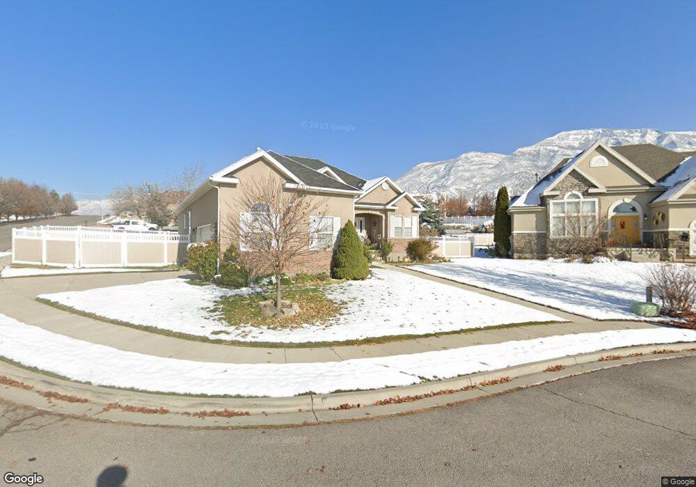
648 N 1280 E American Fork, UT 84003
Estimated Value: $633,000 - $827,000
3
Beds
2
Baths
3,060
Sq Ft
$231/Sq Ft
Est. Value
About This Home
This home is located at 648 N 1280 E, American Fork, UT 84003 and is currently estimated at $705,644, approximately $230 per square foot. 648 N 1280 E is a home located in Utah County with nearby schools including Barratt Elementary School, American Fork Junior High School, and American Fork High School.
Ownership History
Date
Name
Owned For
Owner Type
Purchase Details
Closed on
Jan 11, 2010
Sold by
Nuttall Gordan L and Nuttall Ellen L
Bought by
Nuttall Gordon Lyon and Laree Nuttall E
Current Estimated Value
Purchase Details
Closed on
Nov 24, 2004
Sold by
Summers Jonathan C
Bought by
Nuttall Gordan L and Nuttall Ellen L
Purchase Details
Closed on
May 16, 2003
Sold by
Summers Jonathan C
Bought by
Summers Jonathan C
Home Financials for this Owner
Home Financials are based on the most recent Mortgage that was taken out on this home.
Original Mortgage
$155,500
Interest Rate
5.77%
Mortgage Type
Purchase Money Mortgage
Purchase Details
Closed on
Feb 6, 2001
Sold by
D R Horton Inc
Bought by
Summers Jonathan C
Home Financials for this Owner
Home Financials are based on the most recent Mortgage that was taken out on this home.
Original Mortgage
$158,300
Interest Rate
7.13%
Create a Home Valuation Report for This Property
The Home Valuation Report is an in-depth analysis detailing your home's value as well as a comparison with similar homes in the area
Home Values in the Area
Average Home Value in this Area
Purchase History
| Date | Buyer | Sale Price | Title Company |
|---|---|---|---|
| Nuttall Gordon Lyon | -- | Accommodation | |
| Nuttall Gordan L | -- | Equity Title Agency Inc | |
| Summers Jonathan C | -- | -- | |
| Summers Jonathan C | -- | First American Title Ins Age |
Source: Public Records
Mortgage History
| Date | Status | Borrower | Loan Amount |
|---|---|---|---|
| Previous Owner | Summers Jonathan C | $155,500 | |
| Previous Owner | Summers Jonathan C | $158,300 | |
| Closed | Summers Jonathan C | $29,682 |
Source: Public Records
Tax History
| Year | Tax Paid | Tax Assessment Tax Assessment Total Assessment is a certain percentage of the fair market value that is determined by local assessors to be the total taxable value of land and additions on the property. | Land | Improvement |
|---|---|---|---|---|
| 2025 | $2,907 | $340,835 | -- | -- |
| 2024 | $2,717 | $322,960 | $0 | $0 |
| 2023 | $2,717 | $320,045 | $0 | $0 |
| 2022 | $2,846 | $330,825 | $0 | $0 |
| 2021 | $2,502 | $454,400 | $183,800 | $270,600 |
| 2020 | $2,430 | $427,900 | $170,200 | $257,700 |
| 2019 | $2,310 | $420,700 | $163,000 | $257,700 |
| 2018 | $2,142 | $373,100 | $148,500 | $224,600 |
| 2017 | $2,141 | $201,245 | $0 | $0 |
| 2016 | $2,053 | $179,245 | $0 | $0 |
| 2015 | $1,948 | $161,425 | $0 | $0 |
| 2014 | $1,853 | $151,470 | $0 | $0 |
Source: Public Records
Map
Nearby Homes
- 1121 E 580 N
- 462 N 950 E Unit 5
- 912 E Ellens St Unit 1
- 1125 N 1270 E
- 1045 N 930 E Unit 58
- 1289 W 1670 N
- 837 E 475 N
- 322 N 900 E
- 1897 N 900 W
- 1058 N 930 E Unit 64
- 980 W 1800 N
- 681 W 2760 N
- 1077 N 950 E
- 1089 N 950 E
- 1609 N 900 W
- 1427 Narra Place
- 472 W 2760 N
- 674 W 1590 N Unit 11
- 1365 N 990 W
- 1578 N 750 W Unit 15
- 646 N 1280 E
- 638 N 1280 E
- 624 N 1280 E
- 624 N 1280 E Unit 4
- 664 N 1280 E
- 1268 E 650 N
- 1279 E 600 North Cir
- 1277 E 600 North Cir
- 612 N 1280 E
- 1275 E 600 North Cir
- 1275 E 650 N
- 1275 E 650 N Unit 1
- 1273 E 600 North Cir
- 1264 E 650 N
- 1276 E 650 N
- 1262 E 650 N
- 545 N 1280 E
- 1263 E 650 N
- 2424 Renaissance Ct
- 2503 Renaissance Ct
Your Personal Tour Guide
Ask me questions while you tour the home.