Estimated Value: $227,867 - $287,000
Studio
--
Bath
1,107
Sq Ft
$238/Sq Ft
Est. Value
About This Home
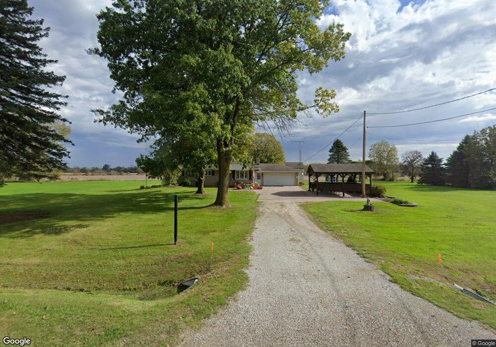
This home is located at 64800 Hartway Rd, Ray, MI 48096 and is currently estimated at $263,717, approximately $238 per square foot. 64800 Hartway Rd is a home located in Macomb County with nearby schools including Orville C. Krause Elementary School, Armada Middle School, and Armada High School.
Ownership History
Date
Name
Owned For
Owner Type
Purchase Details
Closed on
Sep 12, 2025
Sold by
Whiting Dolores L
Bought by
Dolores L Whiting Living Trust
Current Estimated Value
Purchase Details
Closed on
Aug 25, 2025
Sold by
Brunsman Lea Anna
Bought by
Brunsman Family Trust
Purchase Details
Closed on
May 30, 2003
Sold by
Whiting Dolores L and Whiting Thomas W
Bought by
Dolores L Whiting Living Trust
Purchase Details
Closed on
Dec 7, 1982
Sold by
Ternes Frank J and Ternes Mabel E
Bought by
Whiting Thomas W and Whiting Dolores L
Create a Home Valuation Report for This Property
The Home Valuation Report is an in-depth analysis detailing your home's value as well as a comparison with similar homes in the area
Home Values in the Area
Average Home Value in this Area
Purchase History
| Date | Buyer | Sale Price | Title Company |
|---|---|---|---|
| Dolores L Whiting Living Trust | -- | None Listed On Document | |
| Whiting Dolores L | -- | None Listed On Document | |
| Brunsman Family Trust | -- | None Listed On Document | |
| Brunsman Lea Anna | -- | None Listed On Document | |
| Dolores L Whiting Living Trust | -- | -- | |
| Whiting Thomas W | -- | Philip F Greco Title Company |
Source: Public Records
Tax History
| Year | Tax Paid | Tax Assessment Tax Assessment Total Assessment is a certain percentage of the fair market value that is determined by local assessors to be the total taxable value of land and additions on the property. | Land | Improvement |
|---|---|---|---|---|
| 2025 | $2,321 | $118,800 | $0 | $0 |
| 2024 | $16 | $111,900 | $0 | $0 |
| 2023 | $2,030 | $101,800 | $0 | $0 |
| 2022 | $2,030 | $93,300 | $0 | $0 |
| 2021 | $1,978 | $87,700 | $0 | $0 |
| 2020 | $1,797 | $79,800 | $0 | $0 |
| 2019 | $1,797 | $77,800 | $0 | $0 |
| 2018 | $1,761 | $75,900 | $0 | $0 |
| 2017 | $1,724 | $73,500 | $19,300 | $54,200 |
| 2016 | $1,705 | $73,500 | $0 | $0 |
| 2015 | -- | $71,417 | $0 | $0 |
| 2012 | -- | $57,497 | $0 | $0 |
Source: Public Records
Map
Nearby Homes
- 64341 Hartway Rd
- 62915 Chubb Rd
- 22222 29 Mile Rd
- 21901 31 Mile Rd
- 0 Vacant 4 - 28 Mile Rd Unit 20261006634
- 24437 Murray Lot B Dr
- VACANT 1 - 28 Mile Rd
- 24555 Murray Lot C Dr
- 000 26 Mile Rd E
- 24701 Murray Lot D Dr
- VACANT 2 - Mile Rd
- 0 31 Mile Rd Parcel 3
- 0 31 Mile Rd Unit 50156618
- 23401 29 Mile Rd
- 61776 Indian Trail
- 20144 32 Mile Rd
- 0 32 Mile Rd Unit 50104250
- Lot #12 Kunstman Rd
- 0011 Kunstman Rd
- 0006 Kunstman Rd
- 64900 Hartway Rd
- Hartway Rd
- 64650 Hartway Rd
- 64907 Hartway Rd
- 64701 Hartway Rd
- 64805 Hartway Rd
- 21930 30 Mile Rd
- 64510 Hartway Rd
- 21640 30 Mile Rd
- 64511 Hartway Rd Unit Bldg-Unit
- 64511 Hartway Rd
- 64450 Hartway Rd
- 64350 Hartway Rd
- 21639 30 Mile Rd
- 64455 Hartway Rd
- 65281 Hartway Rd
- 64320 Hartway Rd
- 64433 Hartway Rd
- 65330 Hartway Rd
- 21560 30 Mile Rd
Your Personal Tour Guide
Ask me questions while you tour the home.