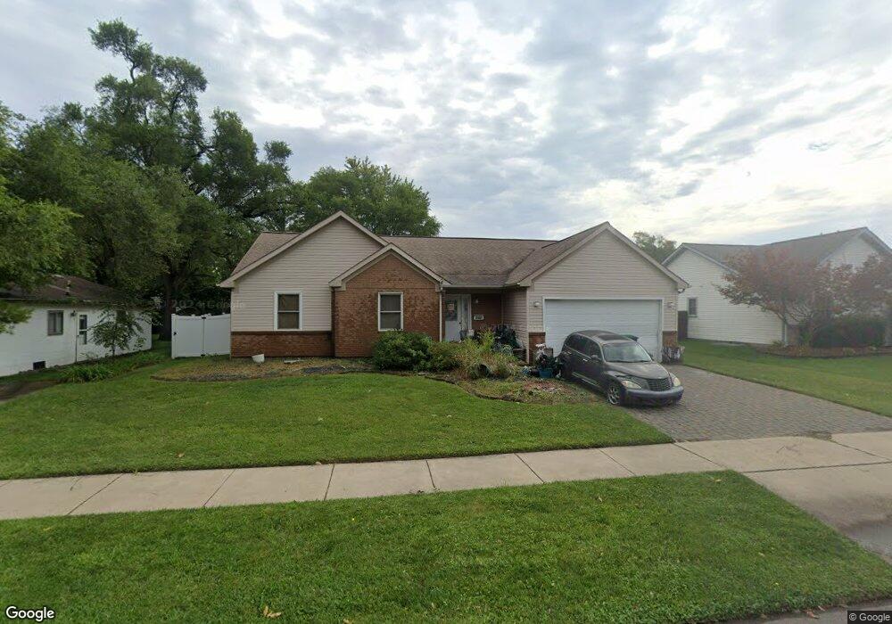
6481 Oak St Taylor, MI 48180
Estimated Value: $213,000 - $259,000
--
Bed
--
Bath
1,881
Sq Ft
$123/Sq Ft
Est. Value
About This Home
This home is located at 6481 Oak St, Taylor, MI 48180 and is currently estimated at $230,614, approximately $122 per square foot. 6481 Oak St is a home located in Wayne County with nearby schools including Clarence Randall Elementary School, Hoover Middle School, and Quest Charter Academy.
Ownership History
Date
Name
Owned For
Owner Type
Purchase Details
Closed on
Sep 9, 2005
Sold by
School Board Of District #5
Bought by
Powell Lamont G
Current Estimated Value
Home Financials for this Owner
Home Financials are based on the most recent Mortgage that was taken out on this home.
Original Mortgage
$164,247
Outstanding Balance
$88,038
Interest Rate
5.88%
Mortgage Type
VA
Estimated Equity
$142,576
Create a Home Valuation Report for This Property
The Home Valuation Report is an in-depth analysis detailing your home's value as well as a comparison with similar homes in the area
Home Values in the Area
Average Home Value in this Area
Purchase History
| Date | Buyer | Sale Price | Title Company |
|---|---|---|---|
| Powell Lamont G | $159,000 | None Available |
Source: Public Records
Mortgage History
| Date | Status | Borrower | Loan Amount |
|---|---|---|---|
| Open | Powell Lamont G | $164,247 |
Source: Public Records
Tax History Compared to Growth
Tax History
| Year | Tax Paid | Tax Assessment Tax Assessment Total Assessment is a certain percentage of the fair market value that is determined by local assessors to be the total taxable value of land and additions on the property. | Land | Improvement |
|---|---|---|---|---|
| 2025 | $2,371 | $124,600 | $0 | $0 |
| 2024 | $2,371 | $110,900 | $0 | $0 |
| 2023 | $2,843 | $99,300 | $0 | $0 |
| 2022 | $2,263 | $90,900 | $0 | $0 |
| 2021 | $2,500 | $82,900 | $0 | $0 |
| 2020 | $2,677 | $75,500 | $0 | $0 |
| 2019 | $257,355 | $61,500 | $0 | $0 |
| 2018 | $1,943 | $46,800 | $0 | $0 |
| 2017 | $1,076 | $47,200 | $0 | $0 |
| 2016 | $2,416 | $45,900 | $0 | $0 |
| 2015 | $4,390 | $43,900 | $0 | $0 |
| 2013 | $4,420 | $45,900 | $0 | $0 |
| 2012 | $1,939 | $45,000 | $15,000 | $30,000 |
Source: Public Records
Map
Nearby Homes