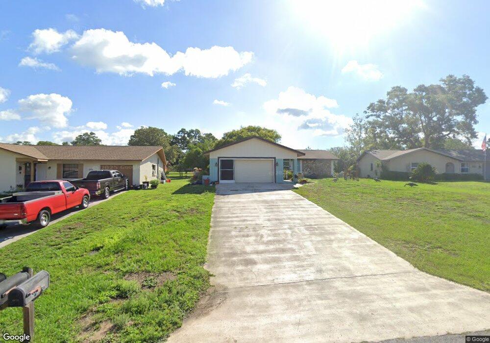
6482 Amber Ridge Cir Brooksville, FL 34602
Estimated Value: $223,000 - $276,000
2
Beds
2
Baths
1,325
Sq Ft
$184/Sq Ft
Est. Value
About This Home
This home is located at 6482 Amber Ridge Cir, Brooksville, FL 34602 and is currently estimated at $244,336, approximately $184 per square foot. 6482 Amber Ridge Cir is a home located in Hernando County with nearby schools including Eastside Elementary School, Hernando High School, and D. S. Parrott Middle School.
Ownership History
Date
Name
Owned For
Owner Type
Purchase Details
Closed on
Mar 12, 2021
Sold by
Mccullough Noemi Elizabeth Dimas
Bought by
Mccullough Noemi Elizabeth Dimas and Abernathy James Randal
Current Estimated Value
Purchase Details
Closed on
Sep 24, 2020
Sold by
Nelson Mary L
Bought by
Mccullough Noemi Elizabeth Dimas
Purchase Details
Closed on
May 13, 1999
Sold by
Ford William W and Ford Bernice
Bought by
Nelson James L and Nelson Mary L
Create a Home Valuation Report for This Property
The Home Valuation Report is an in-depth analysis detailing your home's value as well as a comparison with similar homes in the area
Home Values in the Area
Average Home Value in this Area
Purchase History
| Date | Buyer | Sale Price | Title Company |
|---|---|---|---|
| Mccullough Noemi Elizabeth Dimas | -- | Accommodation | |
| Mccullough Noemi Elizabeth Dimas | $50,000 | None Available | |
| Mccullough Noemi Elizabeth Di | $50,000 | Brown Angie | |
| Nelson James L | $70,000 | -- |
Source: Public Records
Tax History Compared to Growth
Tax History
| Year | Tax Paid | Tax Assessment Tax Assessment Total Assessment is a certain percentage of the fair market value that is determined by local assessors to be the total taxable value of land and additions on the property. | Land | Improvement |
|---|---|---|---|---|
| 2024 | $941 | $107,369 | -- | -- |
| 2023 | $941 | $104,242 | $0 | $0 |
| 2022 | $895 | $101,206 | $0 | $0 |
| 2021 | $505 | $98,258 | $0 | $0 |
| 2020 | $1,050 | $64,922 | $0 | $0 |
| 2019 | -- | $63,462 | $0 | $0 |
| 2018 | -- | $62,279 | $0 | $0 |
| 2017 | -- | $60,998 | $0 | $0 |
| 2016 | -- | $59,743 | $0 | $0 |
| 2015 | -- | $59,328 | $0 | $0 |
Source: Public Records
Map
Nearby Homes
- 6488 Robinswood Ave
- 7046 Windmere Rd
- 6447 Ashmont Ave
- 30813 Wild Juniper Ct
- 6479 Barcelona Blvd
- 30823 Wild Juniper Ct
- 30804 Wild Juniper Ct
- 30810 Wild Juniper Ct
- 31097 Silver Stage Dr
- HARPER Plan at Sherman Oaks
- Allex Plan at Sherman Oaks
- Robie Plan at Sherman Oaks
- Elston Plan at Sherman Oaks
- 30838 Wild Juniper Ct
- 30846 Wild Juniper Ct
- 31104 Silver Stage Dr
- 30908 Wild Juniper Ct
- 6476 Amber Ridge Cir
- 6490 Amber Ridge Cir
- 6490 Amber Ridge Dr
- 7006 Windmere Rd
- 6498 Amber Ridge Cir
- 6472 Amber Ridge Cir
- 6461 Robinswood Ave
- 6467 Robinswood Ave
- 6481 Amber Ridge Cir
- 7012 Windmere Rd
- 6489 Amber Ridge Cir
- 6455 Robinswood Ave
- 6473 Robinswood Ave
- 6497 Amber Ridge Cir
- 6497 6497 Amber Ridge Cir
- 6468 Amber Ridge Cir
- 6447 Robinswood Ave
- 7018 Windmere Rd
- 6469 Amber Ridge Cir
- 7002 Amber Ridge Dr