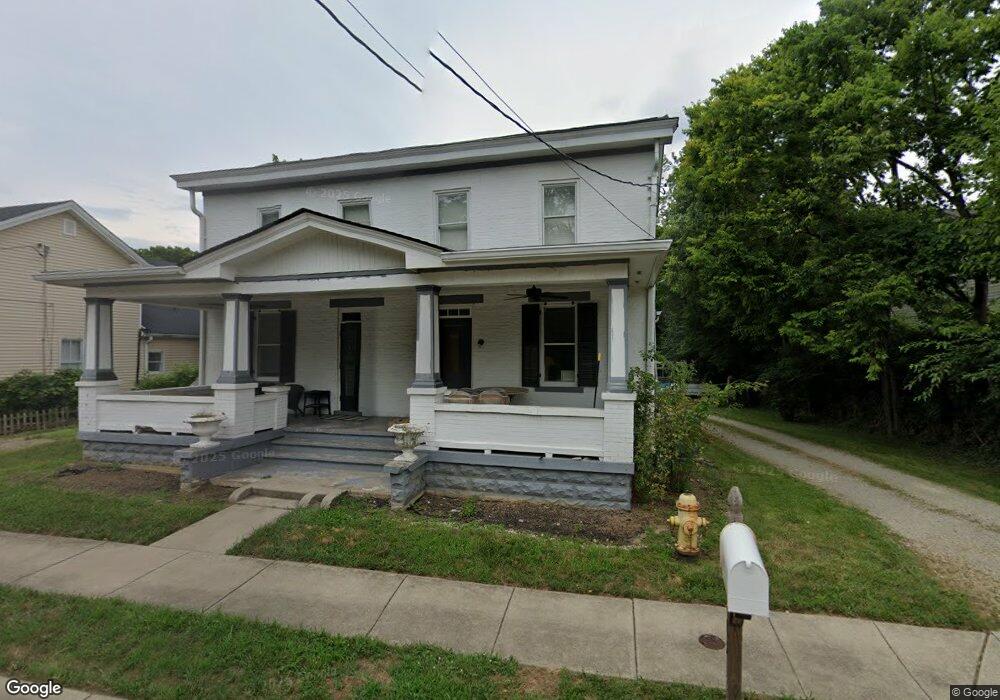
6483 Cincinnati Dayton Rd Liberty Township, OH 45044
Estimated Value: $142,561 - $418,000
3
Beds
2
Baths
1,944
Sq Ft
$152/Sq Ft
Est. Value
About This Home
This home is located at 6483 Cincinnati Dayton Rd, Liberty Township, OH 45044 and is currently estimated at $295,890, approximately $152 per square foot. 6483 Cincinnati Dayton Rd is a home located in Butler County with nearby schools including Woodland Elementary School, Liberty Junior School, and Lakota East High School.
Ownership History
Date
Name
Owned For
Owner Type
Purchase Details
Closed on
May 7, 2021
Sold by
Bethany Exchange Corporation
Bought by
Kraft Christopher J
Current Estimated Value
Purchase Details
Closed on
Jun 23, 2016
Sold by
Kraft Christopher J
Bought by
Bethany Exchange Corp
Purchase Details
Closed on
Mar 29, 2012
Sold by
Moore Rocky A
Bought by
Kraft Christopher J
Purchase Details
Closed on
Jul 13, 2002
Sold by
Barnes Tanya J and Barnes Albert L
Bought by
Moore Rocky A
Home Financials for this Owner
Home Financials are based on the most recent Mortgage that was taken out on this home.
Original Mortgage
$64,500
Interest Rate
6.64%
Mortgage Type
Purchase Money Mortgage
Purchase Details
Closed on
Mar 1, 1992
Purchase Details
Closed on
May 1, 1988
Create a Home Valuation Report for This Property
The Home Valuation Report is an in-depth analysis detailing your home's value as well as a comparison with similar homes in the area
Home Values in the Area
Average Home Value in this Area
Purchase History
| Date | Buyer | Sale Price | Title Company |
|---|---|---|---|
| Kraft Christopher J | -- | None Available | |
| Bethany Exchange Corp | -- | American Homeland Title | |
| Kraft Christopher J | $57,500 | None Available | |
| Moore Rocky A | -- | -- | |
| -- | $75,500 | -- | |
| -- | $68,000 | -- |
Source: Public Records
Mortgage History
| Date | Status | Borrower | Loan Amount |
|---|---|---|---|
| Previous Owner | Moore Rocky A | $64,500 |
Source: Public Records
Tax History Compared to Growth
Tax History
| Year | Tax Paid | Tax Assessment Tax Assessment Total Assessment is a certain percentage of the fair market value that is determined by local assessors to be the total taxable value of land and additions on the property. | Land | Improvement |
|---|---|---|---|---|
| 2024 | $1,565 | $39,490 | $5,550 | $33,940 |
| 2023 | $1,546 | $39,490 | $5,550 | $33,940 |
| 2022 | $1,445 | $28,880 | $5,550 | $23,330 |
| 2021 | $1,468 | $28,880 | $5,550 | $23,330 |
| 2020 | $1,506 | $28,880 | $5,550 | $23,330 |
| 2019 | $1,274 | $22,220 | $5,660 | $16,560 |
| 2018 | $1,297 | $22,220 | $5,660 | $16,560 |
| 2017 | $1,309 | $22,220 | $5,660 | $16,560 |
| 2016 | $1,237 | $21,300 | $5,660 | $15,640 |
| 2015 | $1,242 | $21,300 | $5,660 | $15,640 |
| 2014 | $5,177 | $21,300 | $5,660 | $15,640 |
| 2013 | $5,177 | $26,700 | $5,660 | $21,040 |
Source: Public Records
Map
Nearby Homes
- 6405 Cincinnati Dayton Rd
- 6681 Cincinnati Dayton Rd
- 6335 Gem Stone Dr
- 6703 Cincinnati Dayton Rd
- 7241 Stonebrook Ct
- 7232 Eaglestone Ct
- 7162 Wyandot Ln
- 6821 Cincinnati Dayton Rd
- 7109 Maple Creek Dr
- 7147 Wilhelmina Dr
- 7644 Millikin Rd
- 6951 Ash Creek Ct
- 8091 Green Lake Dr
- 5933 Old Pebble Path
- 6300 Lindsey Ct
- 5913 Stones Throw Way
- 7120 Shady Brook Bend
- 7798 Derbyshire Ct
- 7113 Shady Brook Bend
- 7108 Shady Brook Bend
- 6491 Cincinnati Dayton Rd
- 6471 Cincinnati Dayton Rd
- 6471 Cincinnati Dayton Rd
- 6473 Cincinnati Dayton Rd
- 6501 Cincinnati Dayton Rd
- 6461 Cincinnati Dayton Rd
- 6503 Cincinnati Dayton Rd
- 6494 Cincinnati Dayton Rd
- 6464 Cincinnati Dayton Rd
- 6512 Cincinnati Dayton Rd
- 6439 Cincinnati Dayton Rd
- 6520 Cincinnati Dayton Rd
- 6527 Cincinnati Dayton Rd
- 6433 Cincinnati Dayton Rd
- 6533 Cincinnati Dayton Rd
- 6528 Cincinnati Dayton Rd
- 6440 Cincinnati Dayton Rd
- 6541 Cincinnati Dayton Rd
- 6429 Cincinnati Dayton Rd
- 6511 Gem Stone Dr