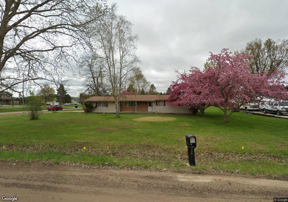
6485 W Rolston Rd Linden, MI 48451
Estimated Value: $246,752 - $320,000
3
Beds
2
Baths
1,254
Sq Ft
$224/Sq Ft
Est. Value
About This Home
This home is located at 6485 W Rolston Rd, Linden, MI 48451 and is currently estimated at $280,688, approximately $223 per square foot. 6485 W Rolston Rd is a home located in Genesee County with nearby schools including Central Elementary School and Linden High School.
Ownership History
Date
Name
Owned For
Owner Type
Purchase Details
Closed on
Feb 5, 2004
Sold by
Rouleau Matthew A and Rouleau Tiffany A
Bought by
Robinson William A and Robinson Vicki L
Current Estimated Value
Purchase Details
Closed on
Aug 16, 2000
Sold by
Bauer Ralph A
Bought by
Rouleau Matthew A and Rouleau Tiffany A
Home Financials for this Owner
Home Financials are based on the most recent Mortgage that was taken out on this home.
Original Mortgage
$133,000
Interest Rate
8.12%
Mortgage Type
Purchase Money Mortgage
Purchase Details
Closed on
Aug 17, 1999
Sold by
Bauer Ralph A and Mcguire Leonore E
Bought by
Baur Ralph A
Create a Home Valuation Report for This Property
The Home Valuation Report is an in-depth analysis detailing your home's value as well as a comparison with similar homes in the area
Home Values in the Area
Average Home Value in this Area
Purchase History
| Date | Buyer | Sale Price | Title Company |
|---|---|---|---|
| Robinson William A | $151,000 | Cislo Title Company | |
| Rouleau Matthew A | $140,000 | Lawyers Title Insurance Corp | |
| Baur Ralph A | -- | -- |
Source: Public Records
Mortgage History
| Date | Status | Borrower | Loan Amount |
|---|---|---|---|
| Previous Owner | Rouleau Matthew A | $133,000 |
Source: Public Records
Tax History Compared to Growth
Tax History
| Year | Tax Paid | Tax Assessment Tax Assessment Total Assessment is a certain percentage of the fair market value that is determined by local assessors to be the total taxable value of land and additions on the property. | Land | Improvement |
|---|---|---|---|---|
| 2025 | $2,355 | $91,600 | $0 | $0 |
| 2024 | $1,030 | $82,000 | $0 | $0 |
| 2023 | $983 | $81,600 | $0 | $0 |
| 2022 | $2,081 | $70,900 | $0 | $0 |
| 2021 | $2,070 | $71,400 | $0 | $0 |
| 2020 | $872 | $68,700 | $0 | $0 |
| 2019 | $876 | $65,200 | $0 | $0 |
| 2018 | $1,939 | $65,300 | $0 | $0 |
| 2017 | $1,812 | $65,800 | $0 | $0 |
| 2016 | $1,845 | $61,400 | $0 | $0 |
| 2015 | $1,816 | $55,800 | $0 | $0 |
| 2014 | $811 | $51,900 | $0 | $0 |
| 2012 | -- | $48,800 | $48,800 | $0 |
Source: Public Records
Map
Nearby Homes
- 1590 W Rolston Rd
- Parcel E Hogan Rd
- 437 Sweet Briar Ridge Unit 70
- 13158 Stony Brook Pass
- 12715 Ivy Ln
- 12711 Ivy Ln
- 13017 River Rock Pass
- 13026 River Rock Pass
- 13025 River Rock Pass
- 13067 River Rock Pass
- 13029 River Rock Pass
- 13070 River Rock Pass
- 13150 Westwinds Dr
- 13180 Westwinds Dr
- 13204 Westwinds Dr
- 13168 Westwinds Dr
- 13186 Westwinds Dr
- 13138 Westwinds Dr
- 13144 Westwinds Dr
- 13102 Westwinds Dr
- 6495 W Rolston Rd
- 6507 W Rolston Rd
- 14021 Hogan Rd
- 14038 Hogan Rd
- 14037 Hogan Rd
- 6521 W Rolston Rd
- 14051 Hogan Rd
- 14050 Hogan Rd
- 6527 W Rolston Rd
- 6563 W Rolston Rd
- 6551 W Rolston Rd
- 14083 Hogan Rd
- 14007 Hogan Rd
- 6575 W Rolston Rd
- 13506 Hogan Rd
- 14109 Hogan Rd
- 14118 Hogan Rd
- 6581 W Rolston Rd
- 14121 Hogan Rd
- 14097 Hogan Rd