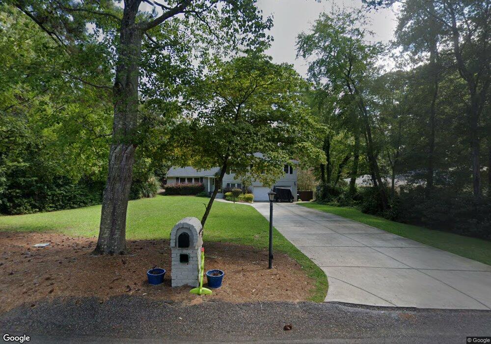
6486 Bridgewood Rd Columbia, SC 29206
Estimated Value: $349,000 - $456,882
5
Beds
3
Baths
2,304
Sq Ft
$179/Sq Ft
Est. Value
About This Home
This home is located at 6486 Bridgewood Rd, Columbia, SC 29206 and is currently estimated at $412,221, approximately $178 per square foot. 6486 Bridgewood Rd is a home located in Richland County with nearby schools including Forest Lake Elementary School, Dent Middle School, and Richland Northeast High School.
Ownership History
Date
Name
Owned For
Owner Type
Purchase Details
Closed on
May 27, 2004
Sold by
Lee Marjorie M
Bought by
Walls Robert E and Walls Laura D
Current Estimated Value
Home Financials for this Owner
Home Financials are based on the most recent Mortgage that was taken out on this home.
Original Mortgage
$191,600
Outstanding Balance
$92,970
Interest Rate
5.89%
Mortgage Type
Purchase Money Mortgage
Estimated Equity
$319,251
Purchase Details
Closed on
Jan 17, 2002
Sold by
Lee Gary Alonzo
Bought by
Lee Marjorie M
Create a Home Valuation Report for This Property
The Home Valuation Report is an in-depth analysis detailing your home's value as well as a comparison with similar homes in the area
Home Values in the Area
Average Home Value in this Area
Purchase History
| Date | Buyer | Sale Price | Title Company |
|---|---|---|---|
| Walls Robert E | $239,500 | -- | |
| Lee Marjorie M | -- | -- |
Source: Public Records
Mortgage History
| Date | Status | Borrower | Loan Amount |
|---|---|---|---|
| Open | Walls Robert E | $191,600 | |
| Closed | Walls Robert E | $23,950 |
Source: Public Records
Tax History Compared to Growth
Tax History
| Year | Tax Paid | Tax Assessment Tax Assessment Total Assessment is a certain percentage of the fair market value that is determined by local assessors to be the total taxable value of land and additions on the property. | Land | Improvement |
|---|---|---|---|---|
| 2024 | $2,087 | $279,100 | $0 | $0 |
| 2023 | $2,087 | $9,708 | $0 | $0 |
| 2022 | $2,374 | $242,700 | $60,200 | $182,500 |
| 2021 | $2,395 | $9,710 | $0 | $0 |
| 2020 | $2,432 | $9,710 | $0 | $0 |
| 2019 | $2,418 | $9,710 | $0 | $0 |
| 2018 | $2,172 | $8,440 | $0 | $0 |
| 2017 | $2,129 | $8,440 | $0 | $0 |
| 2016 | $2,121 | $8,440 | $0 | $0 |
| 2015 | $7,042 | $12,660 | $0 | $0 |
| 2014 | $6,954 | $211,000 | $0 | $0 |
| 2013 | -- | $12,660 | $0 | $0 |
Source: Public Records
Map
Nearby Homes
- 0 Mayhaw Dr
- 6342 Westshore Rd
- 116 Mayhaw Dr
- 124 Mayhaw Dr
- 6409 N Trenholm Rd
- 129 Mayhaw Dr
- 330 Arcadia Lakes Dr E
- 6329 Pinefield Rd
- 6346 Goldbranch Rd
- 6315 Goldbranch Rd
- 6515 Whiteoak Rd
- 4512 Mosshill Rd
- 3910 Glenfield Rd
- 6715 Eastbrook Rd
- 4 Brandywine Ln
- 3611 Boundbrook Ln
- 6715 N Trenholm Rd
- 6319 Briarwood Rd
- 6427 Briarwood Rd
- 4664 Sylvan Dr
- 6482 Bridgewood Rd
- 6490 Bridgewood Rd
- 6417 Westshore Rd
- 6494 Bridgewood Rd
- 6485 Bridgewood Rd
- 6489 Bridgewood Rd
- 6433 Westshore Rd
- 6478 Bridgewood Rd
- 6477 Bridgewood Rd
- 6493 Bridgewood Rd
- 6353 Westshore Rd
- 6497 Bridgewood Rd
- 6498 Bridgewood Rd
- 6441 Westshore Rd
- 6473 Bridgewood Rd
- 6470 Bridgewood Rd
- 4310 Rockbridge Rd
- 6424 Westshore Rd
- 6409 Bridgewood Rd
- 6405 Bridgewood Rd