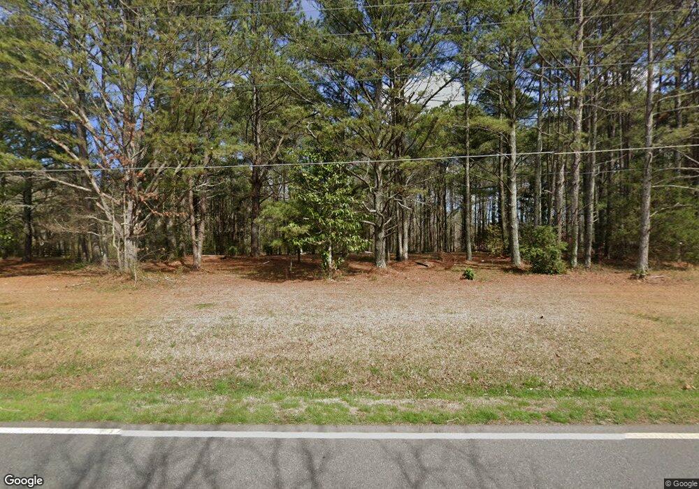
6486 Campground Rd Cumming, GA 30040
Estimated Value: $238,970 - $585,000
3
Beds
2
Baths
960
Sq Ft
$389/Sq Ft
Est. Value
About This Home
This home is located at 6486 Campground Rd, Cumming, GA 30040 and is currently estimated at $373,323, approximately $388 per square foot. 6486 Campground Rd is a home located in Forsyth County with nearby schools including Vickery Creek Middle School, West Forsyth High School, and Covenant Christian Academy.
Ownership History
Date
Name
Owned For
Owner Type
Purchase Details
Closed on
Oct 16, 2017
Sold by
Chester James Edward
Bought by
Chester Dorothy Jean
Current Estimated Value
Purchase Details
Closed on
May 29, 2008
Sold by
Stolzmann Reita C
Bought by
Chester James E
Home Financials for this Owner
Home Financials are based on the most recent Mortgage that was taken out on this home.
Original Mortgage
$85,000
Interest Rate
5.86%
Mortgage Type
New Conventional
Create a Home Valuation Report for This Property
The Home Valuation Report is an in-depth analysis detailing your home's value as well as a comparison with similar homes in the area
Home Values in the Area
Average Home Value in this Area
Purchase History
| Date | Buyer | Sale Price | Title Company |
|---|---|---|---|
| Chester Dorothy Jean | -- | -- | |
| Chester James E | $100,000 | -- |
Source: Public Records
Mortgage History
| Date | Status | Borrower | Loan Amount |
|---|---|---|---|
| Previous Owner | Chester James E | $85,000 |
Source: Public Records
Tax History Compared to Growth
Tax History
| Year | Tax Paid | Tax Assessment Tax Assessment Total Assessment is a certain percentage of the fair market value that is determined by local assessors to be the total taxable value of land and additions on the property. | Land | Improvement |
|---|---|---|---|---|
| 2025 | $1,682 | $77,720 | $77,720 | -- |
| 2024 | $1,682 | $68,576 | $68,576 | -- |
| 2023 | $1,857 | $75,436 | $75,436 | $0 |
| 2022 | $1,673 | $32,780 | $32,780 | $0 |
| 2021 | $905 | $32,780 | $32,780 | $0 |
| 2020 | $905 | $32,780 | $32,780 | $0 |
| 2019 | $816 | $29,504 | $29,504 | $0 |
| 2018 | $816 | $29,504 | $29,504 | $0 |
| 2017 | $758 | $27,320 | $27,320 | $0 |
| 2016 | $607 | $21,856 | $21,856 | $0 |
| 2015 | $608 | $21,856 | $21,856 | $0 |
| 2014 | $579 | $21,856 | $0 | $0 |
Source: Public Records
Map
Nearby Homes
- 6610 Major Dr
- 7235 Compton Cir
- 6797 Campground Rd
- 7020 Weybridge Dr
- 6810 Black Fox Ln
- 6935 Black Fox Ln
- 7895 Wynfield Dr Unit 3
- 7105 Weybridge Dr
- 7830 Wynfield Cir
- 6705 Fox Creek Dr
- 7640 Old Camp Landing
- 3755 Gardenside Ct
- 6355 Westfallen Overlook
- Palazzo Plan at The Courtyards by The Manor
- Promenade Plan at The Courtyards by The Manor
- Provenance Plan at The Courtyards by The Manor
- Portico Plan at The Courtyards by The Manor
- 3590 Manor Court Dr
- 3580 Manor Court Dr
- Hendrickson w Bsmt Plan at Bridlefield - Highlands Collection
- 6510 Campground Rd
- 6485 Campground Rd
- 6460 Campground Rd
- 6650 Major Dr
- 6680 Major Dr
- 6660 Major Dr
- 6455 Campground Rd
- 6495 Campground Rd
- 6670 Major Dr
- 6641 Major Dr
- 6690 Major Dr
- 6442 Campground Rd
- 6650 Campground Rd
- 6407 Campground Rd
- 6696 Major Dr Unit 184&249
- 6696 Major Dr
- 6647 Major Dr
- 7110 Dickerson Rd
- 6708 Campground Rd
- 6707 Campground Rd
