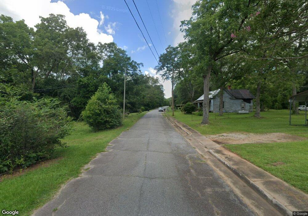
6489 Ga Highway 354 Pine Mountain, GA 31822
Estimated Value: $274,000 - $464,000
3
Beds
3
Baths
2,448
Sq Ft
$148/Sq Ft
Est. Value
About This Home
This home is located at 6489 Ga Highway 354, Pine Mountain, GA 31822 and is currently estimated at $362,806, approximately $148 per square foot. 6489 Ga Highway 354 is a home with nearby schools including Park Elementary School, Harris County Carver Middle School, and Harris County High School.
Ownership History
Date
Name
Owned For
Owner Type
Purchase Details
Closed on
Nov 12, 2018
Sold by
Parsons Donald William Estate
Bought by
Pierce Lloyd B
Current Estimated Value
Purchase Details
Closed on
Aug 26, 2015
Sold by
Parsons Linda Jean
Bought by
Parsons Donald William
Purchase Details
Closed on
Aug 28, 2003
Sold by
Boyd Alfred and Boyd Winnifred P
Bought by
Parsons Donald and Parsons Linda
Create a Home Valuation Report for This Property
The Home Valuation Report is an in-depth analysis detailing your home's value as well as a comparison with similar homes in the area
Home Values in the Area
Average Home Value in this Area
Purchase History
| Date | Buyer | Sale Price | Title Company |
|---|---|---|---|
| Pierce Lloyd B | $175,000 | -- | |
| Parsons Donald William | -- | -- | |
| Parsons Donald | -- | -- |
Source: Public Records
Tax History Compared to Growth
Tax History
| Year | Tax Paid | Tax Assessment Tax Assessment Total Assessment is a certain percentage of the fair market value that is determined by local assessors to be the total taxable value of land and additions on the property. | Land | Improvement |
|---|---|---|---|---|
| 2024 | $2,829 | $104,504 | $14,768 | $89,736 |
| 2023 | $2,362 | $104,295 | $14,768 | $89,527 |
| 2022 | $2,689 | $99,214 | $14,049 | $85,165 |
| 2021 | $2,785 | $99,214 | $14,768 | $84,446 |
| 2020 | $2,785 | $99,214 | $14,768 | $84,446 |
| 2019 | $1,907 | $103,280 | $14,768 | $88,512 |
| 2018 | $2,851 | $103,280 | $14,768 | $88,512 |
| 2017 | $2,852 | $103,280 | $14,768 | $88,512 |
| 2016 | $2,554 | $101,276 | $14,768 | $86,508 |
| 2015 | $1,306 | $101,276 | $14,768 | $86,508 |
| 2014 | $2,564 | $101,276 | $14,768 | $86,508 |
| 2013 | -- | $101,276 | $14,768 | $86,508 |
Source: Public Records
Map
Nearby Homes
- 283 White Oak Rd
- 279 White Oak Rd
- 304 Loblolly Ct
- 2385 Cedar Ln
- 203 Longleaf Way
- LOT 22 Chinaberry St
- LOT 28 Chinaberry St
- LOT 29 Chinaberry St
- LOT 21 Chinaberry St
- LOT 23 Chinaberry St
- LOT 18 Chinaberry St
- LOT 20 Chinaberry St
- LOT 19 Chinaberry St
- LOT 17 Chinaberry St
- 0 McGee Rd Unit 1 ACRE LOT 10611124
- 302 Burns Ave
- 306 Burns Ave
- 304 Burns Ave
- 0 (Lot 3A) State Route 18
- 0 (Lot 3B) State Route 18
- 168 Maple Trace
- 166 Maple Trace
- 170 Maple Trace
- 164 Maple Trace
- 172 Maple Trace
- 162 Maple Trace
- 160 Maple Trace
- 200 Longleaf Way
- 174 Maple Trace
- 2279 Mulberry Ln
- 141 Maple Trace
- 508 King Ave
- 143 Maple Trace
- 137 Maple Trace
- 158 Maple Trace
- 2275 Mulberry Ln
- 2273 Mulberry Ln
- 2277 Mulberry Ln
- 293 White Oak Rd
- 295 White Oak Rd
