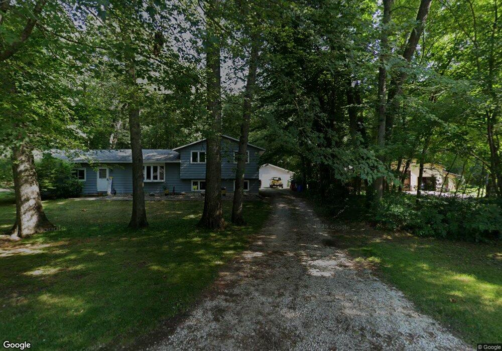
6489 N 450 W La Porte, IN 46350
Estimated Value: $265,812 - $367,000
4
Beds
2
Baths
2,064
Sq Ft
$153/Sq Ft
Est. Value
About This Home
This home is located at 6489 N 450 W, La Porte, IN 46350 and is currently estimated at $314,953, approximately $152 per square foot. 6489 N 450 W is a home located in LaPorte County with nearby schools including Springfield Elementary School, Martin T. Krueger Middle School, and Michigan City High School.
Ownership History
Date
Name
Owned For
Owner Type
Purchase Details
Closed on
May 2, 2007
Sold by
Fifth Third Bank
Bought by
Kalk Gretchen A and Castro Robert
Current Estimated Value
Home Financials for this Owner
Home Financials are based on the most recent Mortgage that was taken out on this home.
Original Mortgage
$103,200
Outstanding Balance
$62,876
Interest Rate
6.2%
Mortgage Type
Unknown
Estimated Equity
$252,077
Purchase Details
Closed on
Feb 21, 2006
Sold by
Federal Home Loan Mortgage Corporation
Bought by
Fifth Third Bank
Purchase Details
Closed on
Mar 16, 2005
Sold by
Norris Terrill D
Bought by
Federal Home Loan Mortgage Corporation
Create a Home Valuation Report for This Property
The Home Valuation Report is an in-depth analysis detailing your home's value as well as a comparison with similar homes in the area
Home Values in the Area
Average Home Value in this Area
Purchase History
| Date | Buyer | Sale Price | Title Company |
|---|---|---|---|
| Kalk Gretchen A | -- | Royal Title Services Inc | |
| Fifth Third Bank | -- | Royal Title Serv | |
| Federal Home Loan Mortgage Corporation | $165,539 | -- |
Source: Public Records
Mortgage History
| Date | Status | Borrower | Loan Amount |
|---|---|---|---|
| Open | Kalk Gretchen A | $103,200 |
Source: Public Records
Tax History Compared to Growth
Tax History
| Year | Tax Paid | Tax Assessment Tax Assessment Total Assessment is a certain percentage of the fair market value that is determined by local assessors to be the total taxable value of land and additions on the property. | Land | Improvement |
|---|---|---|---|---|
| 2024 | $1,147 | $150,000 | $22,900 | $127,100 |
| 2022 | $1,149 | $147,000 | $22,900 | $124,100 |
| 2021 | $1,066 | $139,000 | $22,900 | $116,100 |
| 2020 | $1,090 | $139,000 | $22,900 | $116,100 |
| 2019 | $1,035 | $132,000 | $19,100 | $112,900 |
| 2018 | $923 | $122,900 | $19,100 | $103,800 |
| 2017 | $826 | $113,000 | $19,100 | $93,900 |
| 2016 | $821 | $118,700 | $15,300 | $103,400 |
| 2014 | $827 | $114,200 | $15,500 | $98,700 |
Source: Public Records
Map
Nearby Homes
- N 450 W
- 0 W Us Hwy 20
- 5143 U S 20
- 4852 W Us Highway 20
- 6862 NE Suburban Dr
- 00 Pawnee Trail
- 000 Pawnee Trail
- 0 Nicomus Path
- 5188 W Laxita Dr
- 5034 N 400 W
- 7335 N 300 W
- V/L N 600 W
- 0 Harvey Ct
- 990 Indiana 212
- 4291 U S 35
- 800 Indiana 212 Unit C5N
- 9851 N 500 W
- 5611 W Vintage Hills Trail
- Integrity 1880 Plan at Woodland Ridge - Integrity
- Elements 2390 Plan at Woodland Ridge