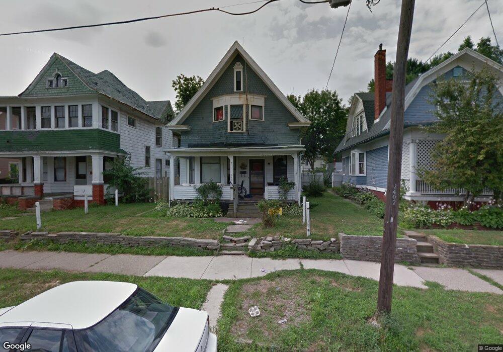
649 Boalt St Toledo, OH 43609
Southside NeighborhoodEstimated Value: $65,000 - $97,000
4
Beds
1
Bath
2,041
Sq Ft
$38/Sq Ft
Est. Value
About This Home
This home is located at 649 Boalt St, Toledo, OH 43609 and is currently estimated at $77,977, approximately $38 per square foot. 649 Boalt St is a home located in Lucas County with nearby schools including Marshall Stemm Academy, Jesup W. Scott High School, and Summit Academy - Toledo.
Ownership History
Date
Name
Owned For
Owner Type
Purchase Details
Closed on
May 23, 2016
Sold by
Cantrill Colleen Anne
Bought by
Perez Edgar
Current Estimated Value
Purchase Details
Closed on
Jul 22, 2010
Sold by
Rankin Megan
Bought by
Cantrill Colleen
Purchase Details
Closed on
Mar 8, 2010
Sold by
Cantrill Myron and Cantrill Colleen
Bought by
Rankin Megan
Purchase Details
Closed on
Mar 8, 2006
Sold by
Cantrill Karen
Bought by
Cantrill Myron
Purchase Details
Closed on
Jul 27, 2005
Sold by
Grey Douglas J
Bought by
Cantrill Myron and Cantrill Karen
Purchase Details
Closed on
Jul 20, 1989
Sold by
Grey D W and G W
Create a Home Valuation Report for This Property
The Home Valuation Report is an in-depth analysis detailing your home's value as well as a comparison with similar homes in the area
Home Values in the Area
Average Home Value in this Area
Purchase History
| Date | Buyer | Sale Price | Title Company |
|---|---|---|---|
| Perez Edgar | $11,000 | None Available | |
| Cantrill Colleen | $25,000 | None Available | |
| Rankin Megan | $49,400 | None Available | |
| Cantrill Myron | -- | None Available | |
| Cantrill Myron | -- | -- | |
| -- | $25,000 | -- |
Source: Public Records
Tax History
| Year | Tax Paid | Tax Assessment Tax Assessment Total Assessment is a certain percentage of the fair market value that is determined by local assessors to be the total taxable value of land and additions on the property. | Land | Improvement |
|---|---|---|---|---|
| 2025 | -- | $17,395 | $2,590 | $14,805 |
| 2024 | $1,410 | $17,395 | $2,590 | $14,805 |
| 2023 | $1,392 | $17,675 | $1,645 | $16,030 |
| 2022 | $1,410 | $17,675 | $1,645 | $16,030 |
| 2021 | $1,414 | $17,675 | $1,645 | $16,030 |
| 2020 | $1,528 | $17,290 | $1,575 | $15,715 |
| 2019 | $1,330 | $17,150 | $1,435 | $15,715 |
| 2018 | $1,341 | $17,150 | $1,435 | $15,715 |
| 2017 | $3,224 | $16,765 | $1,400 | $15,365 |
| 2016 | $3,325 | $47,900 | $4,000 | $43,900 |
| 2015 | $1,363 | $47,900 | $4,000 | $43,900 |
| 2014 | $1,626 | $16,770 | $1,400 | $15,370 |
| 2013 | $1,084 | $16,770 | $1,400 | $15,370 |
Source: Public Records
Map
Nearby Homes
- 323 Langdon St
- 410 Langdon St
- 325 Chapin St
- 717 Segur Ave
- 578 Prouty Ave
- 581 Prouty Ave
- 318 Courtland Ave
- 860 Prouty Ave
- 710 Redwood Ave
- 285 Walbridge Ave
- 317 Western Ave
- 650 Curtis St
- 765 Redwood Ave
- 205 Courtland Ave
- 708 Bowman St
- 616 Thayer St
- 905 Orchard St
- 712 Balfe St
- 937 Prouty Ave
- 221 South Ave
- 653 Boalt St
- 645 Boalt St
- 657 Boalt St
- 641 Boalt St
- 637 Boalt St
- 663 Boalt St
- 670 Walbridge Ave
- 668 Walbridge Ave
- 662 Walbridge Ave
- 633 Boalt St
- 660 Walbridge Ave
- 652 Boalt St
- 644 Boalt St
- 658 Walbridge Ave
- 658 Boalt St
- 676 Walbridge Ave
- 676 Walbridge Ave Unit 2
- 642 Boalt St
- 342 Field Ave
- 705 Boalt St
Your Personal Tour Guide
Ask me questions while you tour the home.