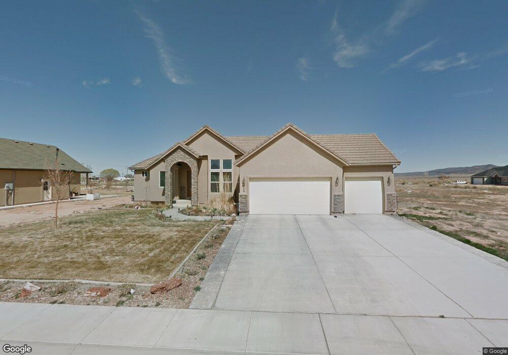
649 E 5080 N Unit Flex feed error dupl Cedar City, UT 84721
Estimated Value: $510,594 - $732,000
Studio
2
Baths
--
Sq Ft
17,860
Sq Ft Lot
About This Home
This home is located at 649 E 5080 N Unit Flex feed error dupl, Cedar City, UT 84721 and is currently estimated at $606,899. 649 E 5080 N Unit Flex feed error dupl is a home located in Iron County with nearby schools including Three Peaks School, Cedar Middle School, and Cedar City High School.
Ownership History
Date
Name
Owned For
Owner Type
Purchase Details
Closed on
Sep 2, 2009
Sold by
Federal Home Loan Mortgage Corporation
Bought by
Gerleman James P and Klipfel Kathryn L
Current Estimated Value
Home Financials for this Owner
Home Financials are based on the most recent Mortgage that was taken out on this home.
Original Mortgage
$193,877
Outstanding Balance
$126,859
Interest Rate
5.2%
Mortgage Type
New Conventional
Estimated Equity
$480,040
Purchase Details
Closed on
Apr 13, 2009
Sold by
Mrrill Derrick
Bought by
Federal Home Loan Mortgage Corporation
Purchase Details
Closed on
Aug 7, 2006
Sold by
Cottonwood Properties Group Inc
Bought by
Marrill Derrick
Purchase Details
Closed on
Jan 19, 2006
Sold by
A & G Llc
Bought by
Cottonwood Properties Group Inc
Create a Home Valuation Report for This Property
The Home Valuation Report is an in-depth analysis detailing your home's value as well as a comparison with similar homes in the area
Home Values in the Area
Average Home Value in this Area
Purchase History
| Date | Buyer | Sale Price | Title Company |
|---|---|---|---|
| Gerleman James P | -- | -- | |
| Federal Home Loan Mortgage Corporation | $300,000 | -- | |
| Marrill Derrick | -- | -- | |
| Cottonwood Properties Group Inc | -- | -- |
Source: Public Records
Mortgage History
| Date | Status | Borrower | Loan Amount |
|---|---|---|---|
| Open | Gerleman James P | $193,877 |
Source: Public Records
Tax History
| Year | Tax Paid | Tax Assessment Tax Assessment Total Assessment is a certain percentage of the fair market value that is determined by local assessors to be the total taxable value of land and additions on the property. | Land | Improvement |
|---|---|---|---|---|
| 2025 | $2,173 | $297,660 | $45,650 | $252,010 |
| 2023 | $2,185 | $291,970 | $40,600 | $251,370 |
| 2022 | $2,286 | $267,185 | $38,665 | $228,520 |
| 2021 | $1,824 | $213,180 | $22,745 | $190,435 |
| 2020 | $1,825 | $187,465 | $14,665 | $172,800 |
| 2019 | $1,747 | $170,335 | $13,245 | $157,090 |
| 2018 | $1,761 | $166,850 | $13,245 | $153,605 |
| 2017 | $1,477 | $146,815 | $13,245 | $133,570 |
| 2016 | $1,410 | $130,540 | $11,110 | $119,430 |
| 2015 | $1,400 | $122,450 | $0 | $0 |
| 2014 | $1,415 | $116,430 | $0 | $0 |
Source: Public Records
Map
Nearby Homes
- 647 E 5140 N Unit Lot34 Legacy Estates
- 0 1 Acre Ft of Water Rights Unit North of Hwy 56
- 800 E 5200 N
- 4953 N Winchester Dr
- 4937 N Winchester Dr
- 4960 N Minersville Hwy Approx
- 4889 N Springfield Cir
- 4968 N Remington Rd
- 4972 N 925 E Unit Lot 86
- 4973 N 900 E
- 4954 N Remington Rd
- Lot 53 Valley Gate Estates
- Lot 54 N Valley Gate Estates Rd
- 590 E Midvalley Rd
- 4956 N 925 E Unit Lot 87
- 4887 N 600 E
- 4887 N 600 E Unit 84
- 4944 N 925 E Unit Lot 88
- 4992 N 970 E
- 4972 N 970 E
- 649 E 5080 N
- 617 5080 N
- 634 5080 N
- 617 5080 N Unit Legacy Estates Ph 2
- 634 5080 N Unit 2
- 665 E 5080 N
- 633 E 5080 N
- 650 E 5080 N
- 650 E 5080 N Unit 15
- 648 E 5140 N
- 648 E 5140 N Unit 27
- 670 E 5080 N
- 632 E 5140 N
- 616 E 5140
- Lot 25 Legacy Estates
- 616 E 5140 N Unit 2
- 616 E 5140 N Unit Lot 25
- 616 E 5140 N
- 678 E 5080 N
- 689 E 5080 N
Your Personal Tour Guide
Ask me questions while you tour the home.