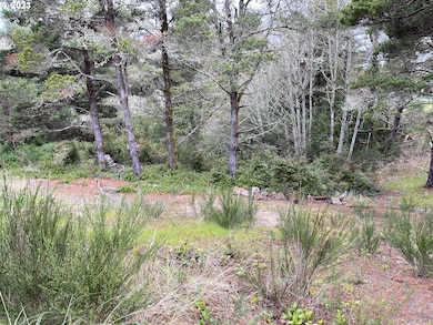
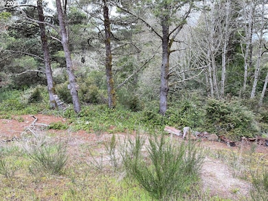
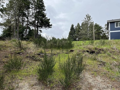
649 Ibolt Ct Florence, OR 97439
Estimated payment $363/month
Total Views
57,426
0.15
Acre
$423,333
Price per Acre
6,534
Sq Ft Lot
Highlights
- Territorial View
- Cul-De-Sac
- No Heating
- No HOA
About This Lot
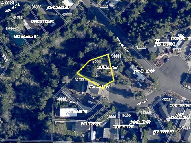
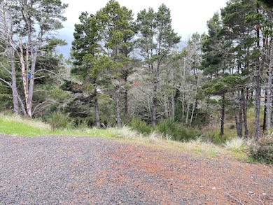
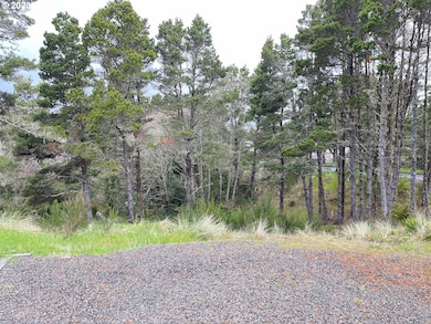
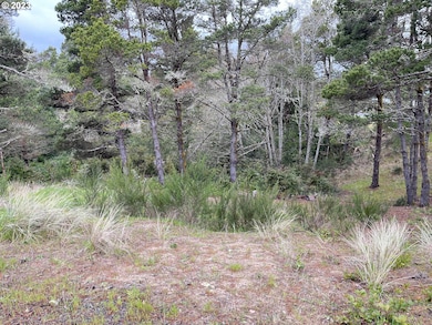
Build your custom home or place your manufactured home on this .15 acre lot. Located in a cul-de-sac in the heart of Florence. Topography maps on file. Floor plans available at listing office. City water & sewer. Come out & take a look today!
Listing Agent
West Coast Real Estate Service Brokerage Email: sales@wcresi.com License #880700052 Listed on: 04/18/2023
Property Details
Property Type
- Land
Est. Annual Taxes
- $376
Lot Details
- 6,534 Sq Ft Lot
- Cul-De-Sac
- Sloped Lot
- Property is zoned MH
Property Views
- Territorial Views
Schools
- Siuslaw Elementary And Middle School
- Siuslaw High School
Community Details
- No Home Owners Association
- Siuslaw Village Subdivision
Listing and Financial Details
- Assessor Parcel Number 1131489
Map
Create a Home Valuation Report for This Property
The Home Valuation Report is an in-depth analysis detailing your home's value as well as a comparison with similar homes in the area
Home Values in the Area
Average Home Value in this Area
Tax History
| Year | Tax Paid | Tax Assessment Tax Assessment Total Assessment is a certain percentage of the fair market value that is determined by local assessors to be the total taxable value of land and additions on the property. | Land | Improvement |
|---|---|---|---|---|
| 2025 | $376 | $27,523 | -- | -- |
| 2024 | $365 | $26,722 | -- | -- |
| 2023 | $365 | $25,944 | -- | -- |
| 2022 | $340 | $25,189 | $0 | $0 |
| 2021 | $333 | $24,456 | $0 | $0 |
| 2020 | $325 | $23,744 | $0 | $0 |
| 2019 | $312 | $23,053 | $0 | $0 |
| 2018 | $313 | $21,730 | $0 | $0 |
| 2017 | $302 | $21,730 | $0 | $0 |
| 2016 | $293 | $21,097 | $0 | $0 |
| 2015 | $287 | $20,483 | $0 | $0 |
| 2014 | $284 | $19,886 | $0 | $0 |
Source: Public Records
Property History
| Date | Event | Price | List to Sale | Price per Sq Ft |
|---|---|---|---|---|
| 09/26/2025 09/26/25 | Price Changed | $63,500 | -7.3% | -- |
| 07/15/2025 07/15/25 | For Sale | $68,500 | 0.0% | -- |
| 06/26/2024 06/26/24 | For Sale | $68,500 | 0.0% | -- |
| 06/26/2024 06/26/24 | Off Market | $68,500 | -- | -- |
| 06/22/2024 06/22/24 | Off Market | $68,500 | -- | -- |
| 03/27/2024 03/27/24 | Price Changed | $68,500 | -8.7% | -- |
| 11/21/2023 11/21/23 | For Sale | $75,000 | 0.0% | -- |
| 11/18/2023 11/18/23 | Off Market | $75,000 | -- | -- |
| 10/17/2023 10/17/23 | Price Changed | $75,000 | -16.2% | -- |
| 04/19/2023 04/19/23 | For Sale | $89,500 | -- | -- |
Source: Regional Multiple Listing Service (RMLS)
Purchase History
| Date | Type | Sale Price | Title Company |
|---|---|---|---|
| Warranty Deed | $57,000 | Cascade Title Co | |
| Warranty Deed | $64,500 | Western Title & Escrow Co | |
| Interfamily Deed Transfer | -- | Western Title & Escrow Compa | |
| Warranty Deed | -- | First Amer Title Ins Co Or | |
| Individual Deed | -- | -- |
Source: Public Records
Source: Regional Multiple Listing Service (RMLS)
MLS Number: 23622889
APN: 1131489
Nearby Homes
- 711 Quanagh Ct
- 433 Myeena Loop
- 0 Pacific View Dr Unit 700 23155611
- 3315 Rhododendron Dr
- 2014 Royal Saint Georges Dr
- 2157 Royal Saint Georges Dr
- 26 Coast Guard Rd
- 87636 Rhododendron Dr
- 3397 Oak St
- 1577 37th St
- 1587 37th St
- 1571 37th St
- 1591 37th St
- 1583 37th St
- 1593 37th St
- 1573 37th St
- 1585 37th St
- 1581 37th St
- 1595 37th St
- 1575 37th St
