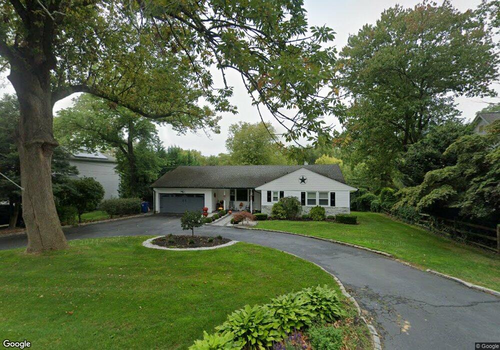
649 Locust Point Rd Rumson, NJ 07760
Estimated Value: $685,000 - $1,207,000
3
Beds
3
Baths
1,380
Sq Ft
$669/Sq Ft
Est. Value
About This Home
This home is located at 649 Locust Point Rd, Rumson, NJ 07760 and is currently estimated at $923,550, approximately $669 per square foot. 649 Locust Point Rd is a home located in Monmouth County with nearby schools including Navesink Elementary School, Bayshore Middle School, and Middletown - South High School.
Ownership History
Date
Name
Owned For
Owner Type
Purchase Details
Closed on
Jul 6, 2017
Sold by
Donovan Timothy J and Donovan Elizabeth N
Bought by
Jonosko Nancy K
Current Estimated Value
Home Financials for this Owner
Home Financials are based on the most recent Mortgage that was taken out on this home.
Original Mortgage
$381,562
Interest Rate
3.87%
Mortgage Type
FHA
Purchase Details
Closed on
Jan 9, 2014
Sold by
Janosko Nancy K
Bought by
Donovan Timothy J and Donovan Elizabeth N
Purchase Details
Closed on
Dec 21, 2006
Sold by
Nancy K Janosko Individually A
Bought by
Janosko Nancy K
Create a Home Valuation Report for This Property
The Home Valuation Report is an in-depth analysis detailing your home's value as well as a comparison with similar homes in the area
Home Values in the Area
Average Home Value in this Area
Purchase History
| Date | Buyer | Sale Price | Title Company |
|---|---|---|---|
| Jonosko Nancy K | -- | -- | |
| Donovan Timothy J | $250,000 | None Available | |
| Janosko Nancy K | -- | -- |
Source: Public Records
Mortgage History
| Date | Status | Borrower | Loan Amount |
|---|---|---|---|
| Previous Owner | Jonosko Nancy K | $381,562 |
Source: Public Records
Tax History
| Year | Tax Paid | Tax Assessment Tax Assessment Total Assessment is a certain percentage of the fair market value that is determined by local assessors to be the total taxable value of land and additions on the property. | Land | Improvement |
|---|---|---|---|---|
| 2025 | $10,604 | $785,800 | $562,300 | $223,500 |
| 2024 | $9,458 | $644,600 | $425,200 | $219,400 |
| 2023 | $9,458 | $544,200 | $352,300 | $191,900 |
| 2022 | $7,960 | $402,900 | $220,200 | $182,700 |
| 2021 | $7,960 | $382,700 | $220,200 | $162,500 |
| 2020 | $7,960 | $372,300 | $213,400 | $158,900 |
| 2019 | $7,842 | $371,300 | $213,400 | $157,900 |
| 2018 | $8,620 | $397,800 | $247,200 | $150,600 |
| 2017 | $8,690 | $397,000 | $247,200 | $149,800 |
| 2016 | $8,094 | $379,800 | $233,700 | $146,100 |
| 2015 | $8,371 | $379,300 | $233,700 | $145,600 |
| 2014 | $7,802 | $355,800 | $211,200 | $144,600 |
Source: Public Records
Map
Nearby Homes
- 96 East Ave Unit 82
- 96 East Ave Unit 76
- 96 East Ave Unit 97
- 498 Central Ave
- 502 Central Ave
- 26 King James Ln
- 500 Central Ave
- 96 E East Ave Unit 37
- 7100 Prospect Ave
- 6998 Prospect Ave
- 114 Memorial Pkwy
- 254 1st Ave
- 50 Memorial Pkwy
- 19 Summit Ave
- 48 Starr Ct
- 119 Chestnut Ave
- 104 E Washington Ave
- 16 E Garfield Ave
- 12 E Garfield Ave
- 20 Brianna Ct Unit 20
- 645 Locust Point Rd
- 653 Locust Point Rd
- 641 Locust Point Rd
- 657 Locust Point Rd
- 650 Locust Point Rd
- 654 Locust Point Rd
- 637 Locust Point Rd
- 642 Locust Point Rd
- 661 Locust Point Rd
- 638 Locust Point Rd
- 658 Locust Point Rd
- 32 Meadowbrook Ave
- 0 Stearns Ave Unit 22226493
- 0 Stearns Ave Unit 22217909
- 32 Meadowbrook Ave
- 28 Meadowbrook Ave
- 633 Locust Point Rd
- 35 Latham Ave
- 21 Stearns Ave
- 20 Stearns Ave
Your Personal Tour Guide
Ask me questions while you tour the home.