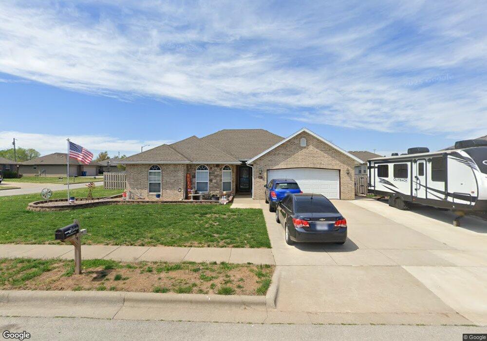
649 S Ashton Ave Republic, MO 65738
Estimated Value: $283,000 - $301,000
4
Beds
2
Baths
1,600
Sq Ft
$183/Sq Ft
Est. Value
About This Home
This home is located at 649 S Ashton Ave, Republic, MO 65738 and is currently estimated at $292,913, approximately $183 per square foot. 649 S Ashton Ave is a home located in Greene County with nearby schools including Lyon Elementary School, Republic Middle School, and Republic High School.
Ownership History
Date
Name
Owned For
Owner Type
Purchase Details
Closed on
Jan 16, 2015
Sold by
Bank Of Ash Grove
Bought by
Roberts Lester G
Current Estimated Value
Home Financials for this Owner
Home Financials are based on the most recent Mortgage that was taken out on this home.
Original Mortgage
$144,310
Outstanding Balance
$111,063
Interest Rate
3.97%
Mortgage Type
VA
Estimated Equity
$181,850
Purchase Details
Closed on
Oct 21, 2008
Sold by
Lawless Jamie J
Bought by
Bank Of Ash Grove
Purchase Details
Closed on
Apr 30, 2007
Sold by
Nguyen Bach and Nguyen Pam
Bought by
Lawless Jamie J
Home Financials for this Owner
Home Financials are based on the most recent Mortgage that was taken out on this home.
Original Mortgage
$142,591
Interest Rate
6.13%
Mortgage Type
Construction
Create a Home Valuation Report for This Property
The Home Valuation Report is an in-depth analysis detailing your home's value as well as a comparison with similar homes in the area
Home Values in the Area
Average Home Value in this Area
Purchase History
| Date | Buyer | Sale Price | Title Company |
|---|---|---|---|
| Roberts Lester G | -- | None Available | |
| Bank Of Ash Grove | $129,900 | None Available | |
| Lawless Jamie J | -- | None Available |
Source: Public Records
Mortgage History
| Date | Status | Borrower | Loan Amount |
|---|---|---|---|
| Open | Roberts Lester G | $144,310 | |
| Previous Owner | Lawless Jamie J | $142,591 |
Source: Public Records
Tax History Compared to Growth
Tax History
| Year | Tax Paid | Tax Assessment Tax Assessment Total Assessment is a certain percentage of the fair market value that is determined by local assessors to be the total taxable value of land and additions on the property. | Land | Improvement |
|---|---|---|---|---|
| 2025 | $2,118 | $42,850 | $5,700 | $37,150 |
| 2024 | $2,118 | $37,910 | $4,750 | $33,160 |
| 2023 | $2,077 | $37,910 | $4,750 | $33,160 |
| 2022 | $1,806 | $32,810 | $4,750 | $28,060 |
| 2021 | $1,796 | $32,810 | $4,750 | $28,060 |
| 2020 | $1,669 | $30,020 | $4,750 | $25,270 |
| 2019 | $1,663 | $30,020 | $4,750 | $25,270 |
| 2018 | $1,577 | $27,510 | $3,800 | $23,710 |
| 2017 | $1,564 | $25,670 | $3,800 | $21,870 |
| 2016 | $1,476 | $25,670 | $3,800 | $21,870 |
| 2015 | $1,471 | $25,670 | $3,800 | $21,870 |
| 2014 | $1,478 | $25,570 | $3,800 | $21,770 |
Source: Public Records
Map
Nearby Homes
- 573 S Charlotte Ct
- 552 S Michelle Ave
- 2450 Highway 60
- .94+/- Ac Highway 60
- 1135 W Broad St
- 000 W Crestview Ln
- 1205 S Kristopher Ave
- 530 Ashley St
- 1021 W Crestview Ln
- 401 Ethan Ave
- 730 W Apache St
- 1382 S Kristopher Ave
- 0 Highway 60 Unit 60308100
- 0 Highway 60 Unit 60308095
- 5751 S Farm Road 67
- 473 W Melody Ln
- 1151 S Bordeaux Ave
- 975 S Montpelier Ct
- 113 W Jewell Dr
- 135 N Bonnie Ave
- 635 S Ashton Ave
- 650 S Adam Ave
- 0 Audrey Ave Unit 10801789
- 0 Audrey Ave Unit 10801788
- 0 Audrey Ave Unit 10801787
- 0 Audrey Ave Unit 10801786
- 0 Audrey Ave Unit 10801780
- 0 Audrey Ave Unit 10801785
- 0 Audrey Ave Unit 10801783
- 0 Audrey Ave Unit 10801782
- 0 Audrey Ave Unit 11011251
- 0 Audrey Ave
- 642 S Adam Ave
- 952 W Audrey St
- 940 W Audrey
- 644 S Ashton Ave
- 623 S Ashton Ave
- 634 S Ashton Ave
- 964 W Audrey St
- 928 W Audrey