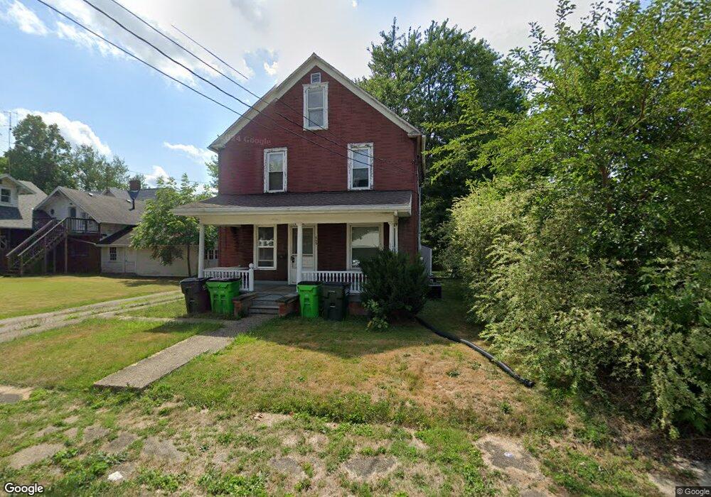
649 Scranton Ave Alliance, OH 44601
Estimated Value: $50,000 - $107,000
2
Beds
2
Baths
1,422
Sq Ft
$59/Sq Ft
Est. Value
About This Home
This home is located at 649 Scranton Ave, Alliance, OH 44601 and is currently estimated at $83,389, approximately $58 per square foot. 649 Scranton Ave is a home located in Stark County with nearby schools including Alliance Early Learning School, Alliance Intermediate School at Northside, and Alliance Middle School.
Ownership History
Date
Name
Owned For
Owner Type
Purchase Details
Closed on
Jun 8, 2020
Sold by
Fla Properties Llc
Bought by
Gates Michael S and Gates Heather M
Current Estimated Value
Purchase Details
Closed on
Apr 8, 2015
Sold by
Armour Fonda L
Bought by
Fla Properties
Purchase Details
Closed on
Aug 7, 1992
Create a Home Valuation Report for This Property
The Home Valuation Report is an in-depth analysis detailing your home's value as well as a comparison with similar homes in the area
Home Values in the Area
Average Home Value in this Area
Purchase History
| Date | Buyer | Sale Price | Title Company |
|---|---|---|---|
| Gates Michael S | $5,800 | Heritage Union Title Co Ltd | |
| Fla Properties | -- | None Available | |
| -- | $20,000 | -- |
Source: Public Records
Tax History Compared to Growth
Tax History
| Year | Tax Paid | Tax Assessment Tax Assessment Total Assessment is a certain percentage of the fair market value that is determined by local assessors to be the total taxable value of land and additions on the property. | Land | Improvement |
|---|---|---|---|---|
| 2025 | $449 | $10,510 | $6,270 | $4,240 |
| 2024 | $586 | $10,510 | $6,270 | $4,240 |
| 2023 | $867 | $12,330 | $5,850 | $6,480 |
| 2022 | $511 | $12,330 | $5,850 | $6,480 |
| 2021 | $512 | $12,330 | $5,850 | $6,480 |
| 2020 | $475 | $10,680 | $5,080 | $5,600 |
| 2019 | $469 | $10,680 | $5,080 | $5,600 |
| 2018 | $471 | $10,680 | $5,080 | $5,600 |
| 2017 | $401 | $8,930 | $4,130 | $4,800 |
| 2016 | $404 | $8,930 | $4,130 | $4,800 |
| 2015 | $408 | $8,930 | $4,130 | $4,800 |
| 2014 | $604 | $12,600 | $4,200 | $8,400 |
| 2013 | $301 | $12,600 | $4,200 | $8,400 |
Source: Public Records
Map
Nearby Homes
- 140 W Summit St
- 427 S Union Ave
- 807 S Union Ave
- 132 S Haines Ave
- 645 W Summit St
- 163 W Market St
- 345 W Market St
- 725 W Summit St
- 432 S Linden Ave
- 356 E Broadway St
- 734 Parkway Blvd
- 452 E Summit St
- 329 1/2 W Main St
- V/L S Fredeom Ave
- 896 Parkway Blvd
- 361 E Main St
- 738 Kingsway St
- 1005 S Freedom Ave
- 442 S Liberty Ave
- 142 S Seneca Ave
- 109 W Summit St
- 123 W Summit St
- 652 Scranton Ave
- 135 W Summit St
- 654 Keplinger Ave
- 634 Scranton Ave
- 646 Keplinger Ave
- 638 Keplinger Ave
- 143 W Summit St
- 77 W Summit St
- 632 Scranton Ave
- 641 Scranton Ave
- 116 W Cambridge St
- 120 W Cambridge St
- 151 W Summit St
- 134 W Cambridge St
- 102 W Cambridge St
- 102 104 W Cambridge
- 144 W Cambridge St
- 106 W Summit St