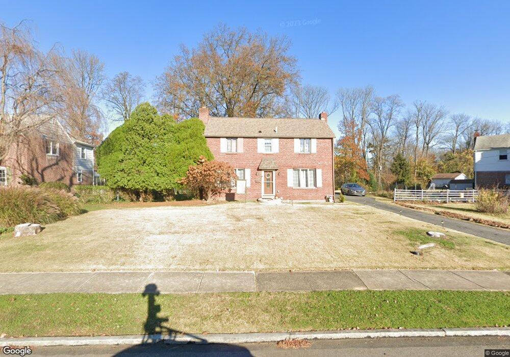
649 Sherman Rd Springfield, PA 19064
Estimated Value: $482,094 - $561,000
3
Beds
2
Baths
1,630
Sq Ft
$315/Sq Ft
Est. Value
About This Home
This home is located at 649 Sherman Rd, Springfield, PA 19064 and is currently estimated at $514,024, approximately $315 per square foot. 649 Sherman Rd is a home located in Delaware County with nearby schools including Springfield High School, Holy Cross School, and Sonshine Christian Academy.
Ownership History
Date
Name
Owned For
Owner Type
Purchase Details
Closed on
Aug 9, 2006
Sold by
Pandoli Pasquale and Pandoli Rita
Bought by
Augustine Lisa
Current Estimated Value
Home Financials for this Owner
Home Financials are based on the most recent Mortgage that was taken out on this home.
Original Mortgage
$299,250
Outstanding Balance
$180,055
Interest Rate
6.8%
Mortgage Type
Purchase Money Mortgage
Estimated Equity
$333,969
Create a Home Valuation Report for This Property
The Home Valuation Report is an in-depth analysis detailing your home's value as well as a comparison with similar homes in the area
Home Values in the Area
Average Home Value in this Area
Purchase History
| Date | Buyer | Sale Price | Title Company |
|---|---|---|---|
| Augustine Lisa | $315,000 | Fidelity National Title Insu |
Source: Public Records
Mortgage History
| Date | Status | Borrower | Loan Amount |
|---|---|---|---|
| Open | Augustine Lisa | $299,250 |
Source: Public Records
Tax History Compared to Growth
Tax History
| Year | Tax Paid | Tax Assessment Tax Assessment Total Assessment is a certain percentage of the fair market value that is determined by local assessors to be the total taxable value of land and additions on the property. | Land | Improvement |
|---|---|---|---|---|
| 2025 | $7,910 | $281,430 | $103,220 | $178,210 |
| 2024 | $7,910 | $281,430 | $103,220 | $178,210 |
| 2023 | $7,617 | $281,430 | $103,220 | $178,210 |
| 2022 | $7,452 | $281,430 | $103,220 | $178,210 |
| 2021 | $11,541 | $281,430 | $103,220 | $178,210 |
| 2020 | $6,778 | $149,570 | $49,620 | $99,950 |
| 2019 | $6,619 | $149,570 | $49,620 | $99,950 |
| 2018 | $6,524 | $149,570 | $0 | $0 |
| 2017 | $6,373 | $149,570 | $0 | $0 |
| 2016 | $821 | $149,570 | $0 | $0 |
| 2015 | $821 | $149,570 | $0 | $0 |
| 2014 | $821 | $149,570 | $0 | $0 |
Source: Public Records
Map
Nearby Homes
- 523 Bloomfield Ave
- 522 Alexander Ave
- 632 Dutton Cir
- 637 Hawarden Rd
- 5134 Westley Dr
- 4400 School Ln
- 466 Wilde Ave
- 521 Blythe Ave
- 320 Gramercy Dr
- 417 Wilde Ave
- 399 N Sycamore Ave
- 449 Hawarden Rd
- 4130 Rosemont Ave
- 72 Colonial Park Dr
- 4129 Garrett Rd
- 301 N Norwinden Dr
- 5107 Whitehall Dr
- 230 Westpark Ln
- 4812 Woodland Ave
- 324 Valley View Rd