Estimated Value: $373,000 - $460,000
3
Beds
2
Baths
1,800
Sq Ft
$231/Sq Ft
Est. Value
About This Home
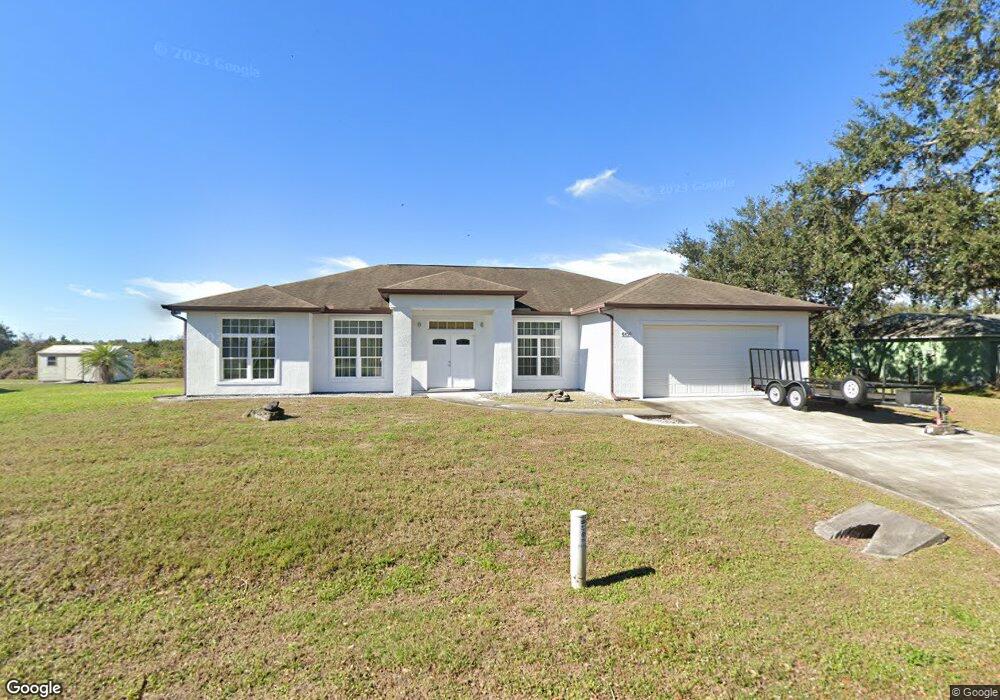
This home is located at 6490 Addie Ave, Cocoa, FL 32927 and is currently estimated at $415,154, approximately $230 per square foot. 6490 Addie Ave is a home located in Brevard County with nearby schools including Enterprise Elementary School, Space Coast Junior/Senior High School, and East Atlantic Prep of Brevard County.
Ownership History
Date
Name
Owned For
Owner Type
Purchase Details
Closed on
Jun 30, 2023
Sold by
Lovegrove Richard Anthony and Lovegrove Josephine Yvonne
Bought by
Lovegrove Torry and Patterson Tabatha
Current Estimated Value
Home Financials for this Owner
Home Financials are based on the most recent Mortgage that was taken out on this home.
Original Mortgage
$356,250
Outstanding Balance
$345,579
Interest Rate
6.39%
Mortgage Type
New Conventional
Estimated Equity
$69,575
Purchase Details
Closed on
Jun 15, 2007
Sold by
Community Educators Cu
Bought by
Lovegrove Richard Anthony and Lovegrove Josephine Yvonne
Purchase Details
Closed on
Jan 24, 2007
Sold by
Newman Patrick R and Board County Commissioners Bre
Bought by
Community Educators Cu
Purchase Details
Closed on
Mar 19, 2002
Sold by
Sanderlin Eugene A
Bought by
Newman Patrick
Home Financials for this Owner
Home Financials are based on the most recent Mortgage that was taken out on this home.
Original Mortgage
$112,800
Interest Rate
6.85%
Create a Home Valuation Report for This Property
The Home Valuation Report is an in-depth analysis detailing your home's value as well as a comparison with similar homes in the area
Home Values in the Area
Average Home Value in this Area
Purchase History
| Date | Buyer | Sale Price | Title Company |
|---|---|---|---|
| Lovegrove Torry | $375,000 | None Listed On Document | |
| Lovegrove Richard Anthony | $80,000 | Landmark Title Agency Inc | |
| Community Educators Cu | $30,600 | None Available | |
| Newman Patrick | $141,000 | -- |
Source: Public Records
Mortgage History
| Date | Status | Borrower | Loan Amount |
|---|---|---|---|
| Open | Lovegrove Torry | $356,250 | |
| Previous Owner | Newman Patrick | $112,800 |
Source: Public Records
Tax History
| Year | Tax Paid | Tax Assessment Tax Assessment Total Assessment is a certain percentage of the fair market value that is determined by local assessors to be the total taxable value of land and additions on the property. | Land | Improvement |
|---|---|---|---|---|
| 2025 | $3,946 | $299,710 | -- | -- |
| 2024 | $5,318 | $291,270 | -- | -- |
| 2023 | $5,318 | $372,350 | $0 | $0 |
| 2022 | $4,718 | $335,460 | $0 | $0 |
| 2021 | $4,471 | $280,930 | $63,000 | $217,930 |
| 2020 | $4,186 | $259,770 | $60,000 | $199,770 |
| 2019 | $4,071 | $249,160 | $52,500 | $196,660 |
| 2018 | $3,979 | $248,030 | $54,000 | $194,030 |
| 2017 | $3,860 | $235,480 | $48,000 | $187,480 |
| 2016 | $3,630 | $205,160 | $36,000 | $169,160 |
| 2015 | $3,474 | $168,230 | $30,000 | $138,230 |
| 2014 | $3,149 | $152,940 | $22,000 | $130,940 |
Source: Public Records
Map
Nearby Homes
- 6460 Homestead Ave
- 6545 Addie Ave
- 6470 Bamboo Ave
- 23-35-21-JX-B-2 Aruin St
- 6574 Bamboo Ave
- 0 Aruin St Unit 1222557
- 6135 Allmont St
- 6105 Banyan St
- 6665 Addie Ave
- 6115 Allmont St
- 5715 Fairbridge St
- 6085 Edison St
- 6200 Edison St
- 5680 Banos Ave
- 5720 Flint Rd
- 6481 La Brea Ave
- 6220 Golfview Ave
- 6150 Baltimore Ave
- 6581 Bancroft Ave
- 5601 Banos Ave
- 6500 Addie Ave
- 6470 Addie Ave
- 6485 Addie Ave
- 6495 Addie
- 6510 Addie Ave
- 6460 Addie Ave
- 6475 Addie Ave
- 6505 Addie Ave
- 6465 Addie Ave
- 6515 Addie Ave
- 6520 Addie Ave
- 6450 Addie Ave
- 6470 Homestead Ave
- 6480 Homestead Ave
- 6490 Homestead Ave
- 6525 Addie Ave
- 6530 Addie Ave
- 6500 Homestead Ave
- 6455 Addie Ave
- 6445 Addie Ave
Your Personal Tour Guide
Ask me questions while you tour the home.